The island is situated just 320 km east of Greenland and some 800 km from Scottland, – its nearest European neighbor. By lying on the constantly active geologic border between the Eurasian and North American tectonic plate, volcano eruptions on average occur every four to five years and seismic activity is recorded almost daily.
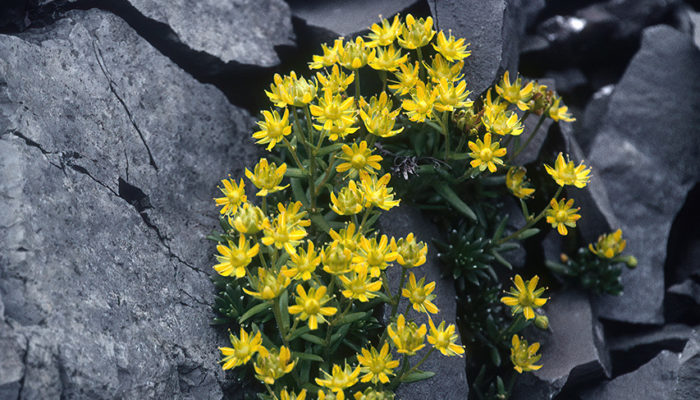
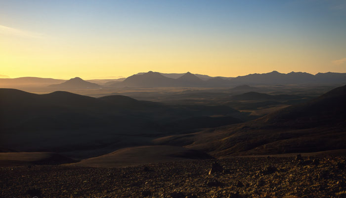
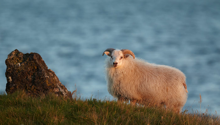
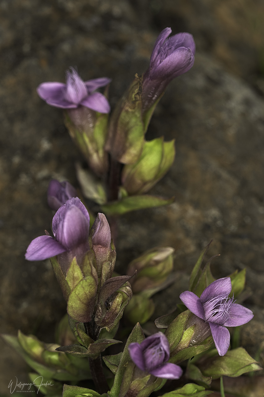
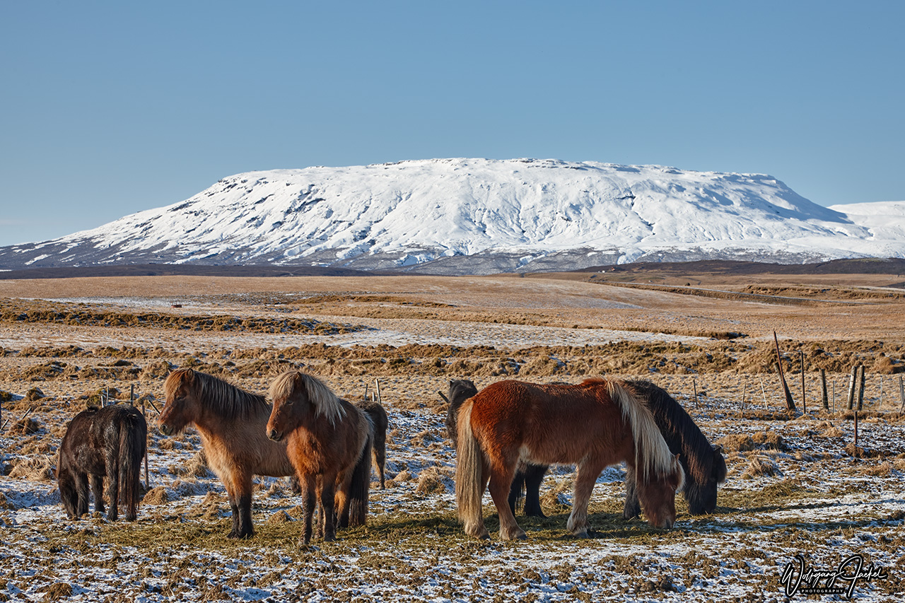
Iceland is defined by 200 volcanoes of different types, lava fields, countless waterfalls, impressive geysers, colorful geothermal areas with hot springs and the still massive glaciers with Vatnajökull being Europe’s largest one. Nevertheless, only around 10% of Iceland still is covered by glaciers; so the name of the country may not be that appropriate anymore and the offshore Gulf Stream provides a surprisingly mild climate for what is one of the northernmost inhabited places on the planet. Numerous cultural and historical traces refer to the Viking age of exploration 1000 years ago, including the reknown Icelandic Sagas. Beyond that, the widespread belief in the wee folk and elves is part of the daily life.
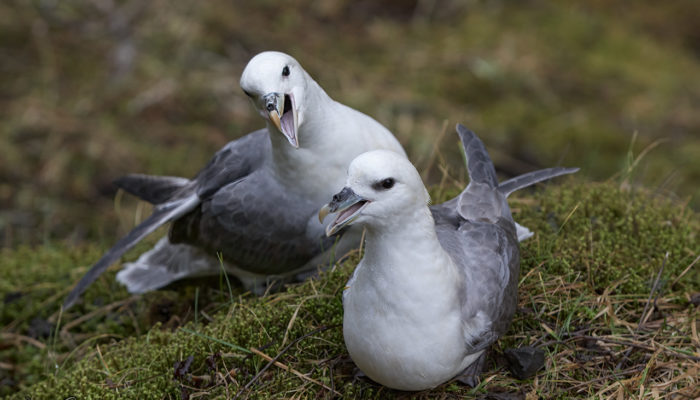
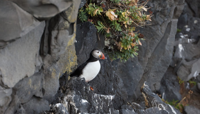
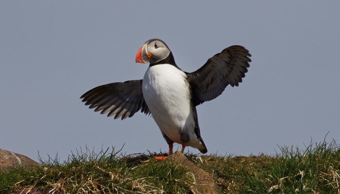
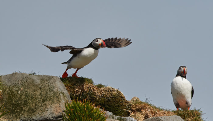
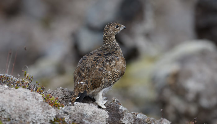
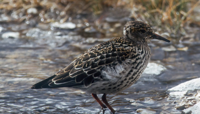
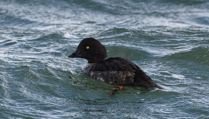
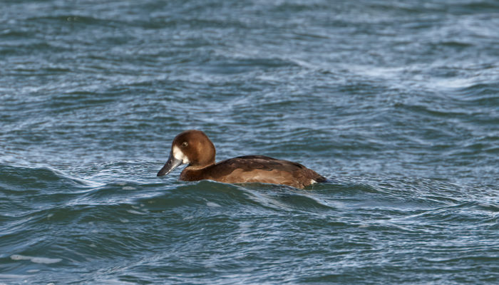
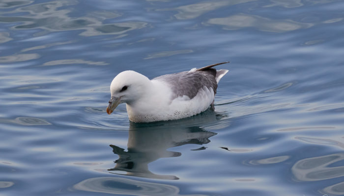
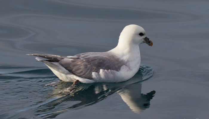
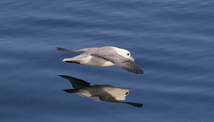
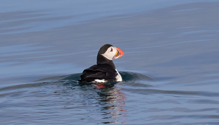
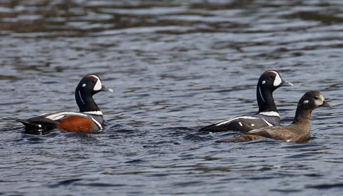
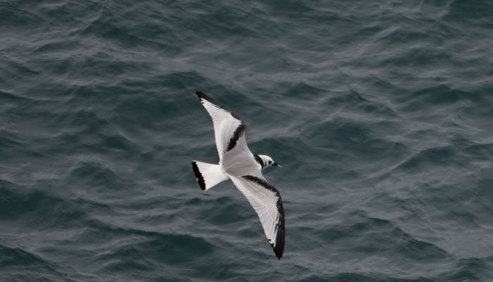
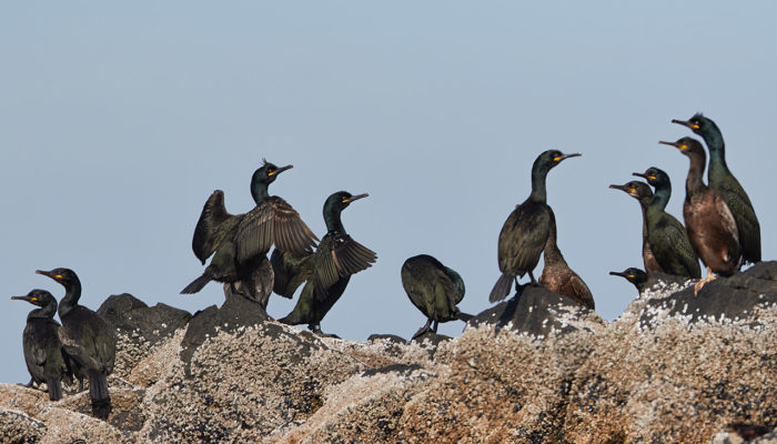
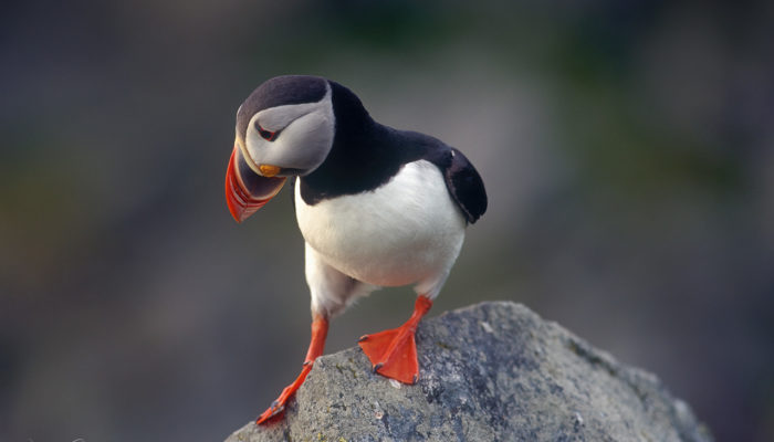
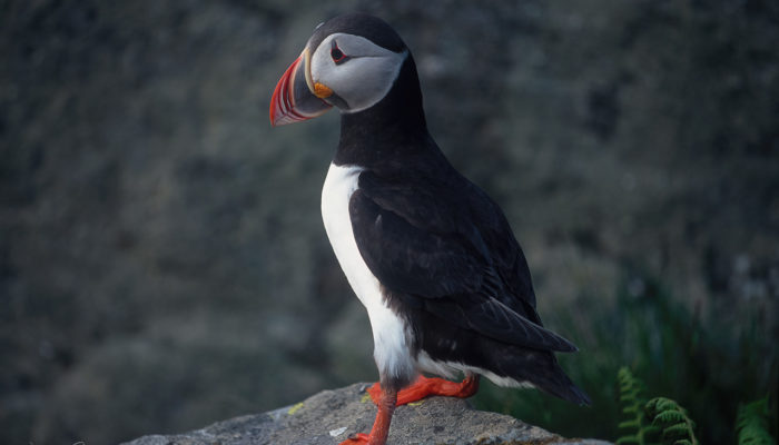
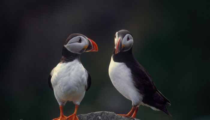
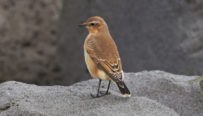
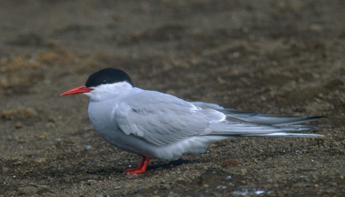
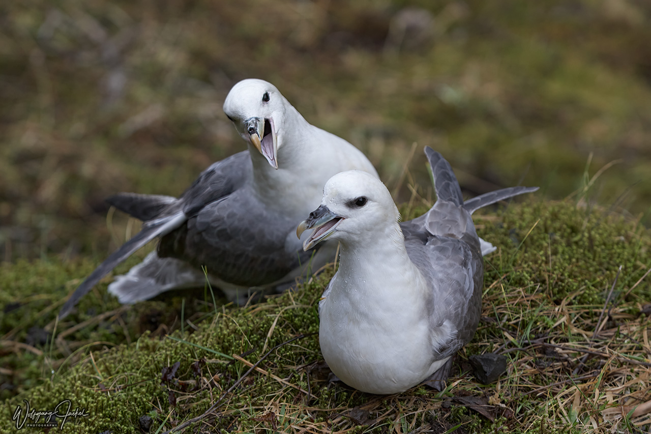
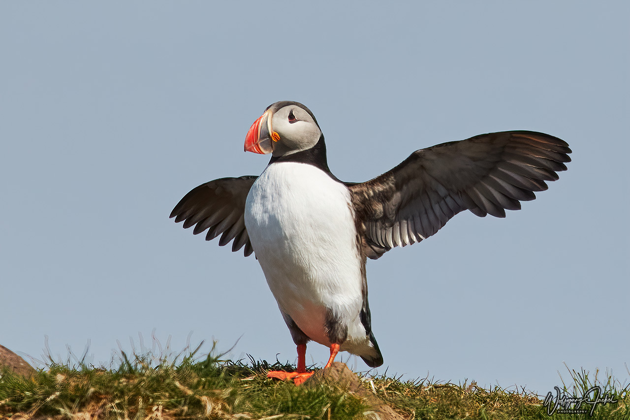
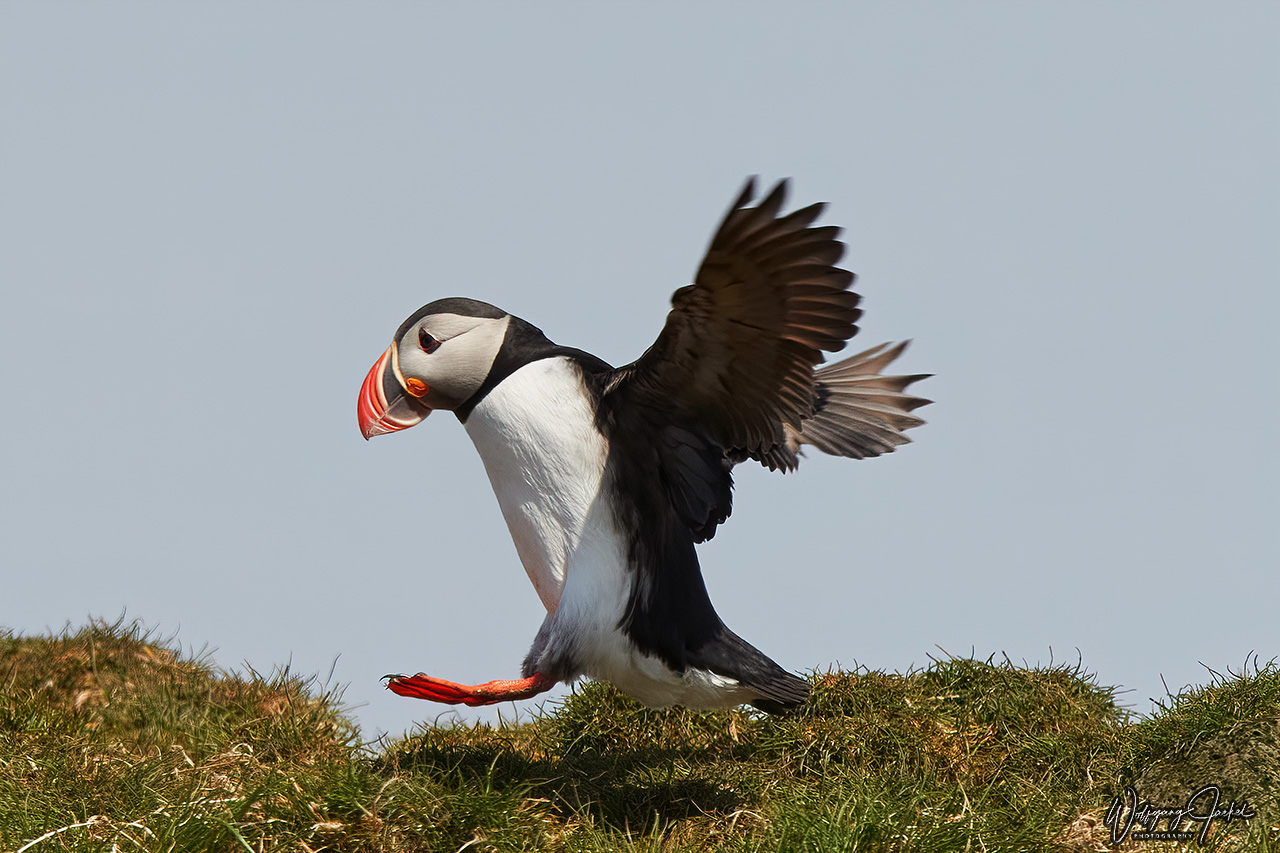
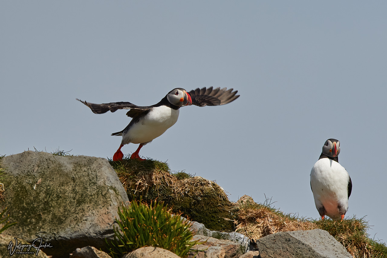
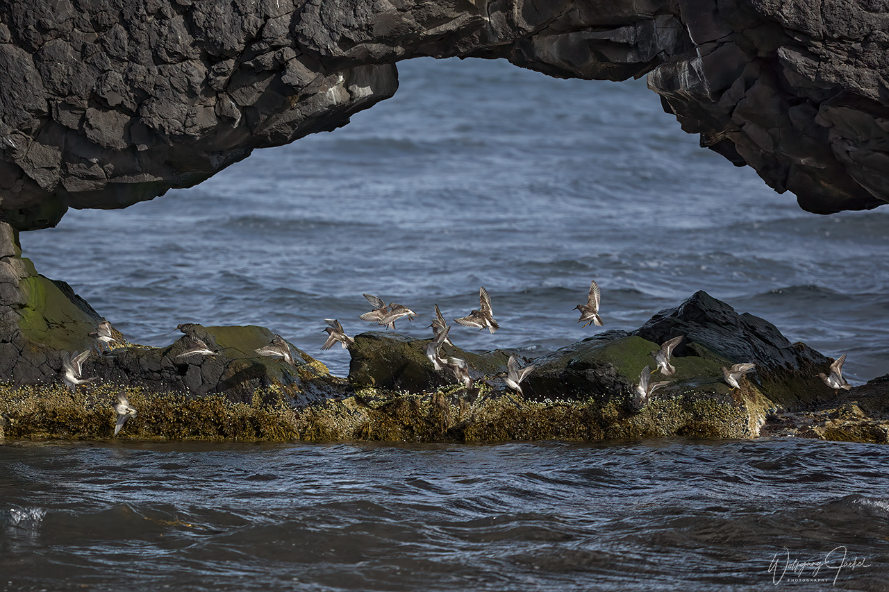
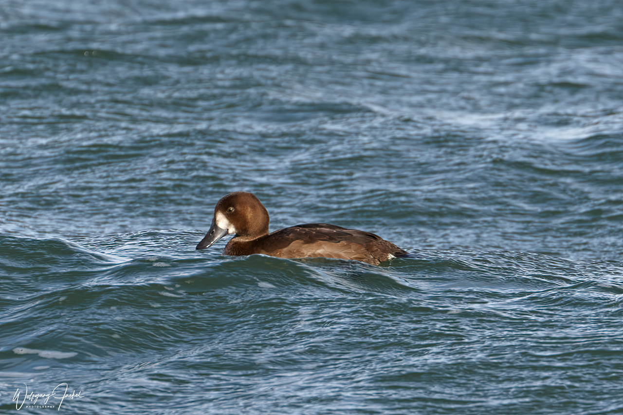
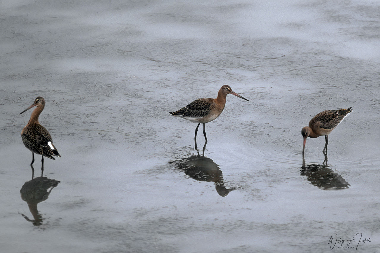
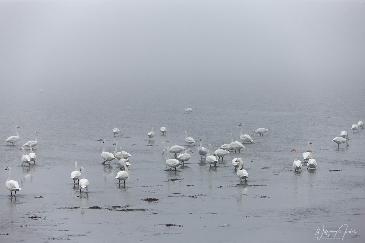
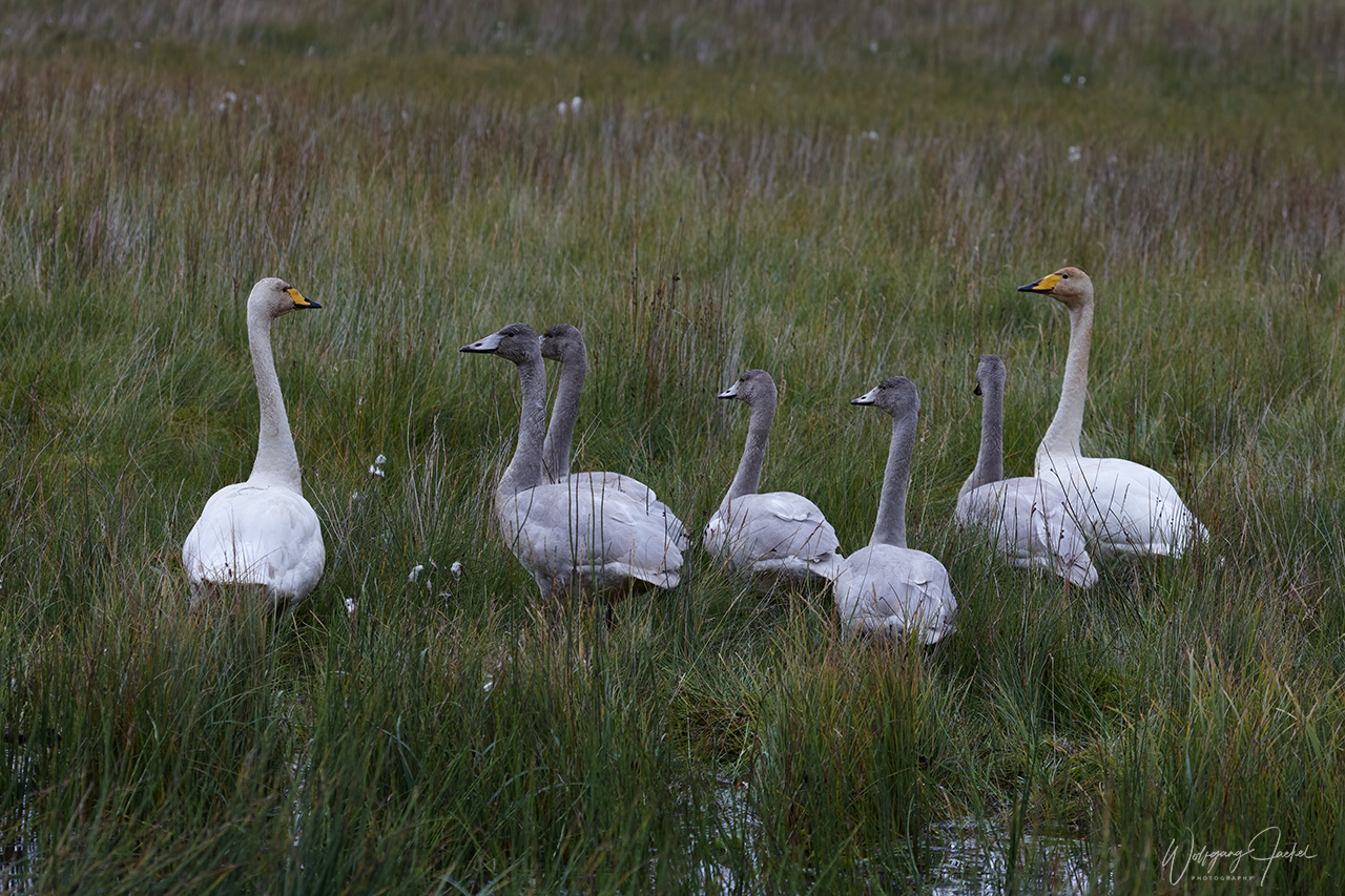
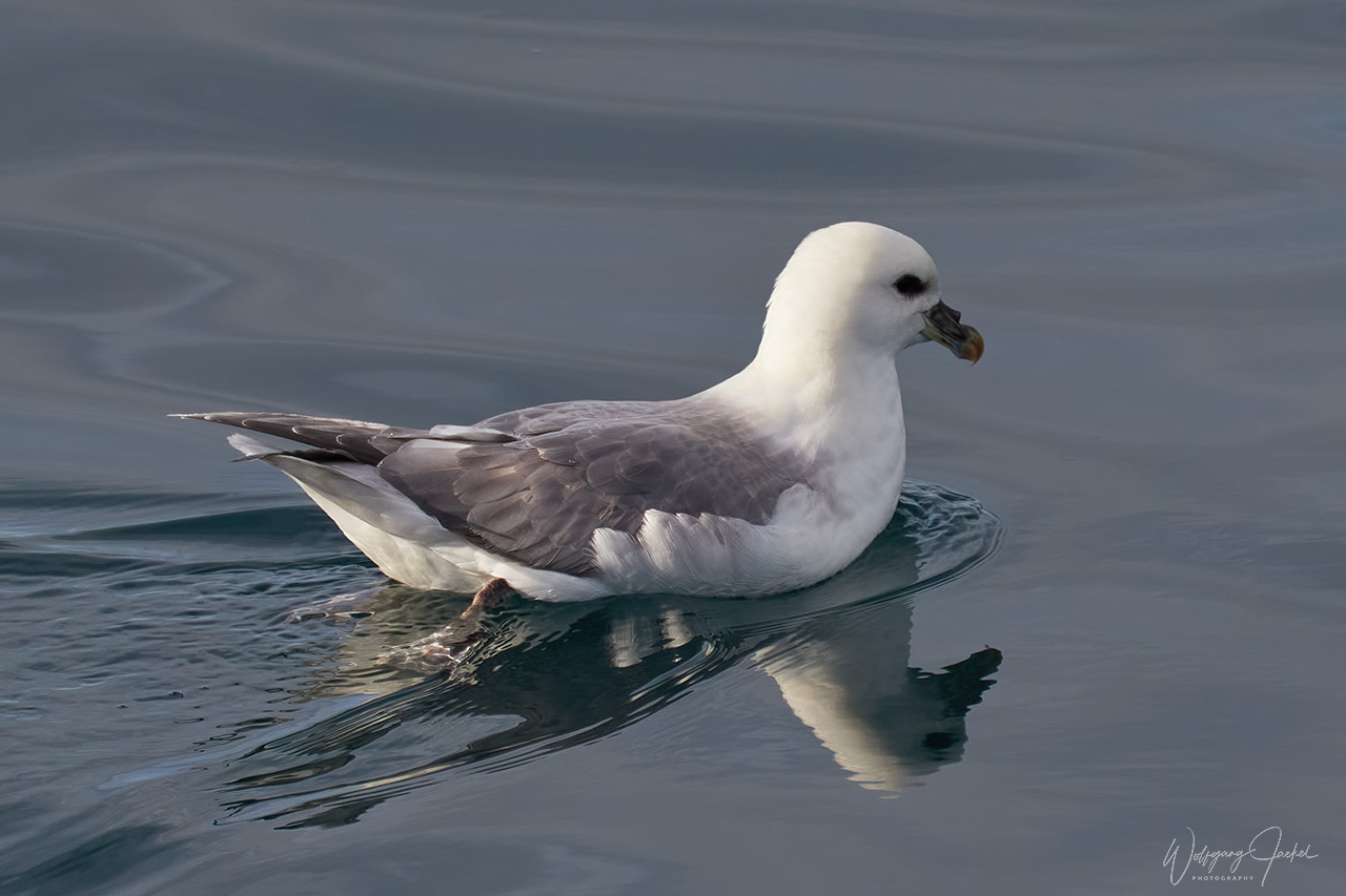
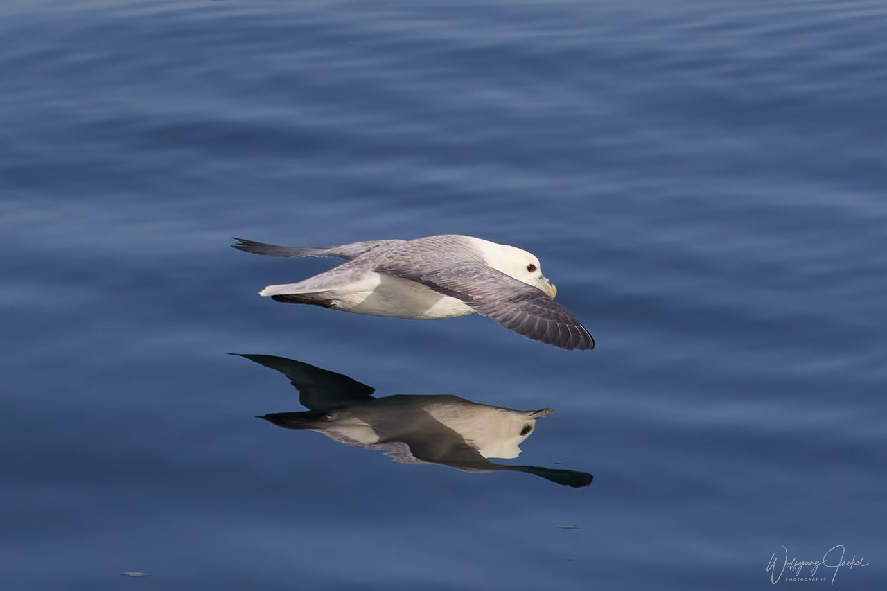
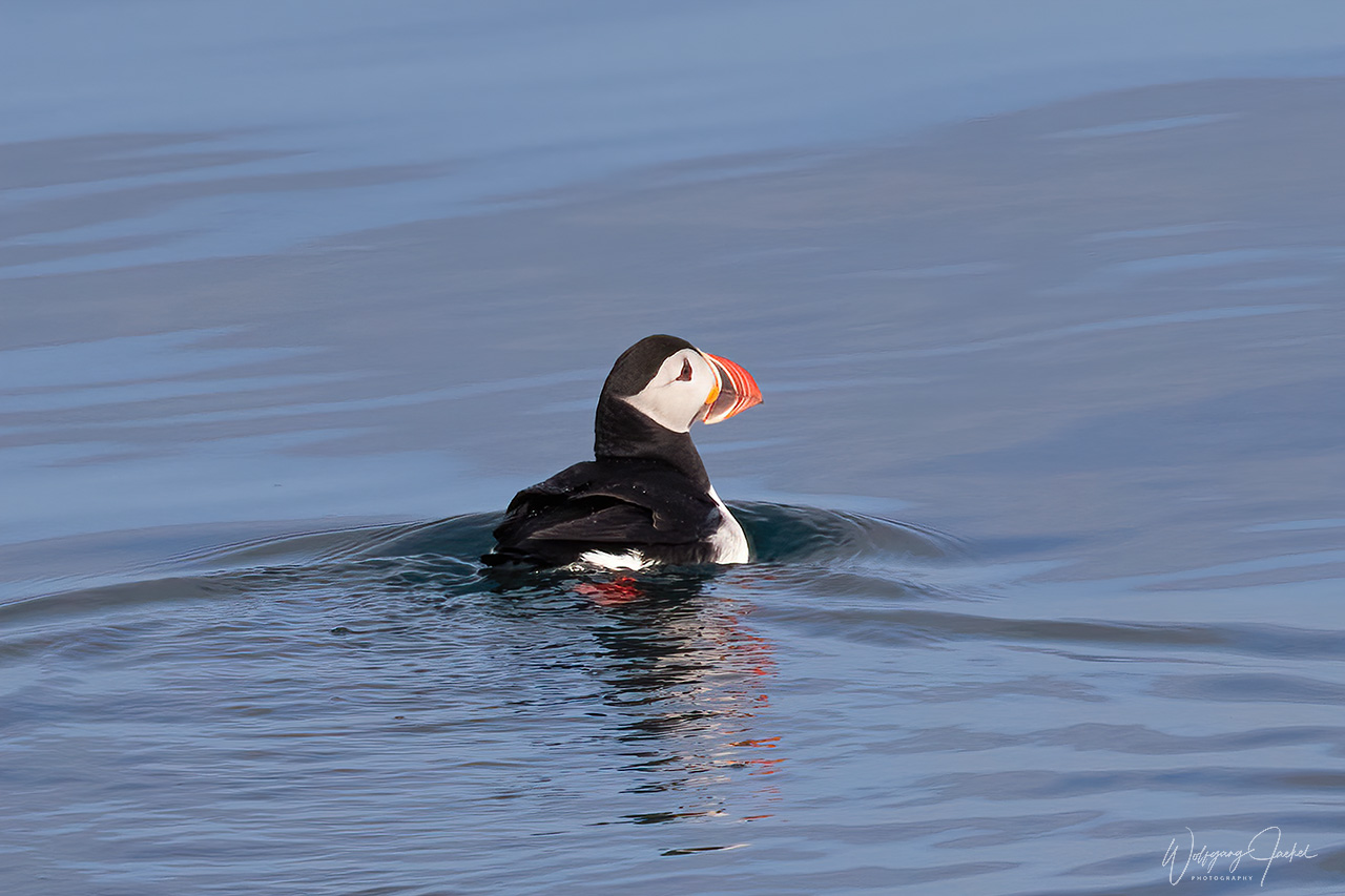
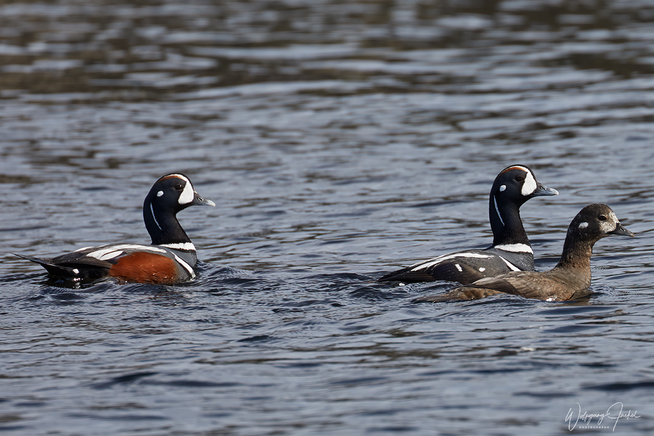
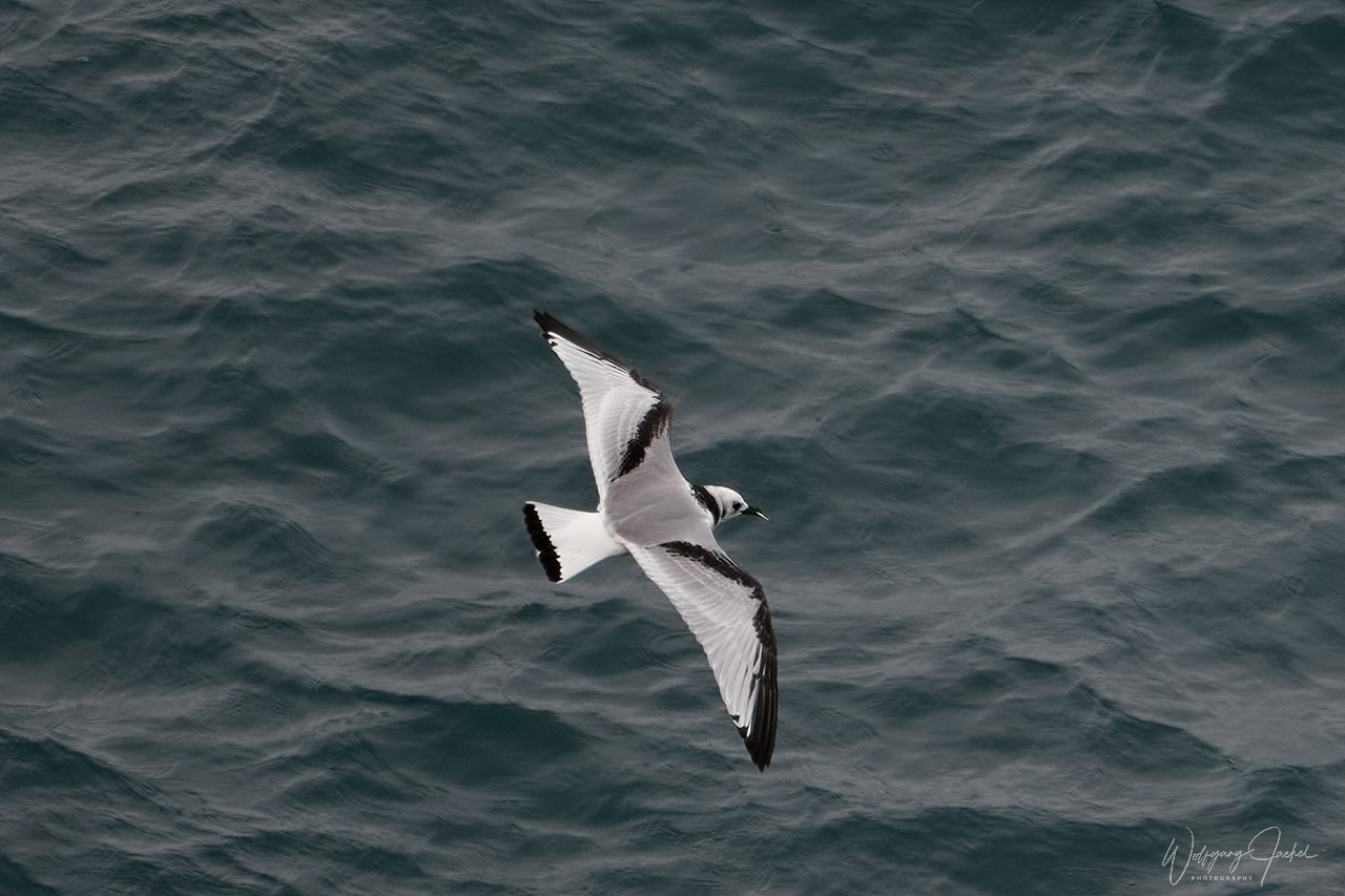
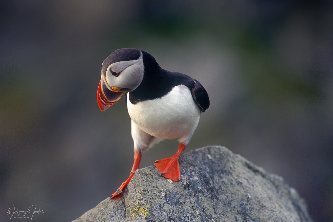
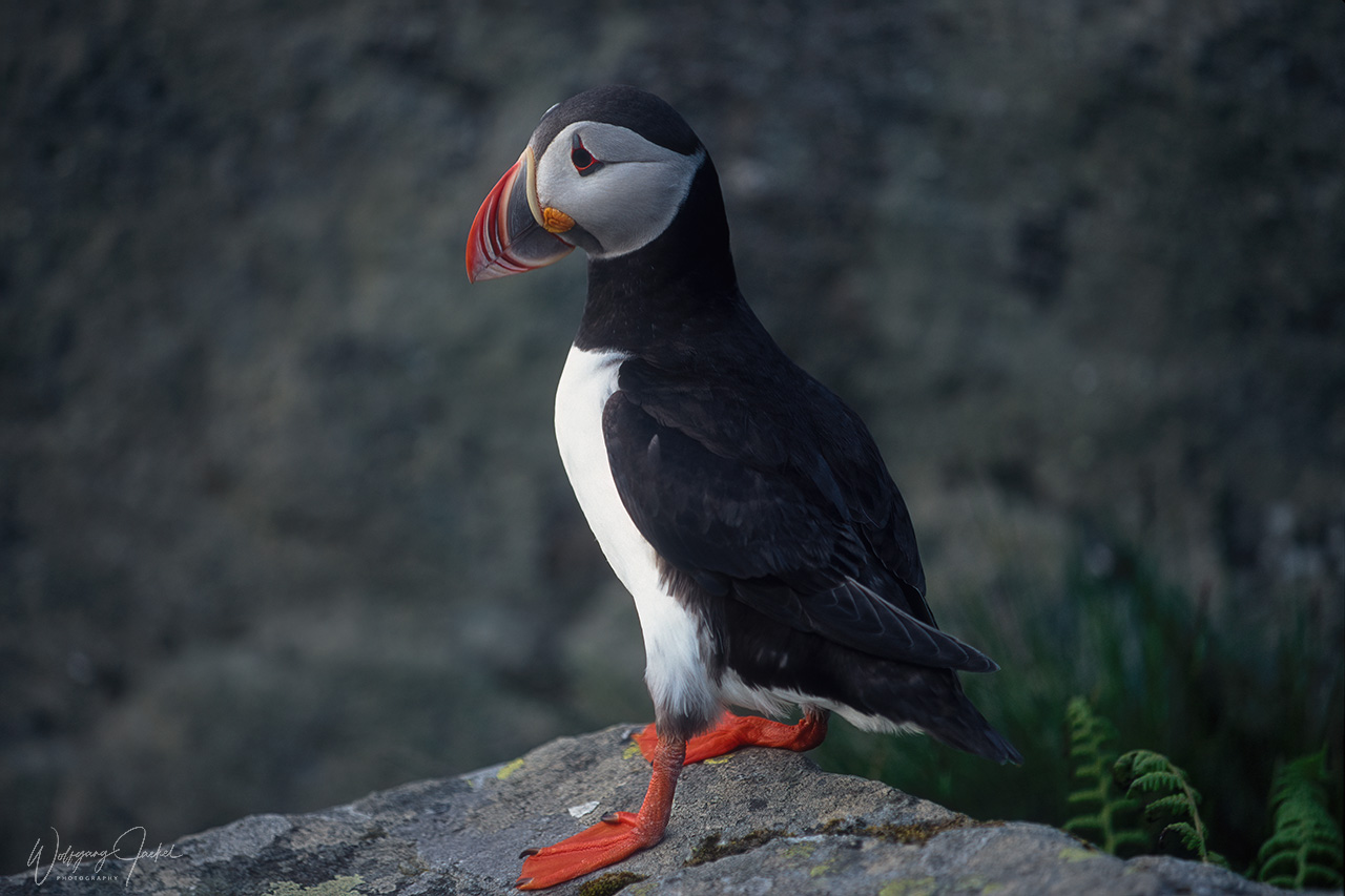
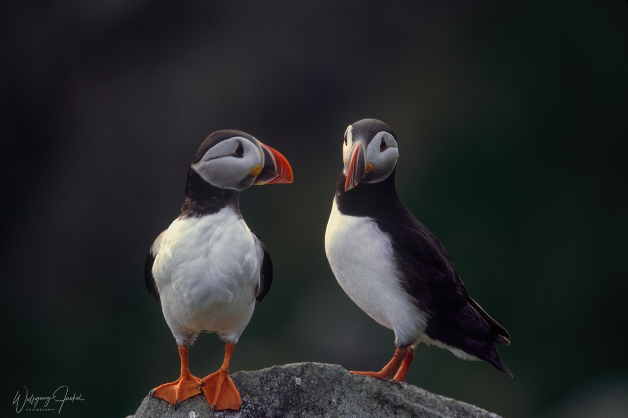
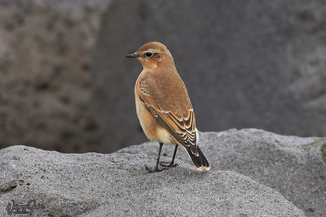
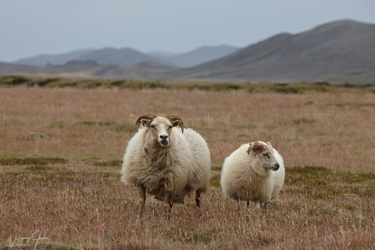
Birders also come to Iceland for visiting the large puffin colonies, ducks at Mývatn and other birds. Many visitors also plan whale watching tours. Over the years an increasing number of tourists has been attracted to Iceland amounting to 2,3 million in 2018.
Between 2000 and 2017, I had visited the amazing island 7 times including two short stays on the voyage to Greenland. Most trips were focused on the southwestern part and south coast but we also had visited the Snaefellsnes Peninsula and North Iceland 3 respectively 2 times with the East Fjords included on one of the trips (see itineraries and descriptions below).
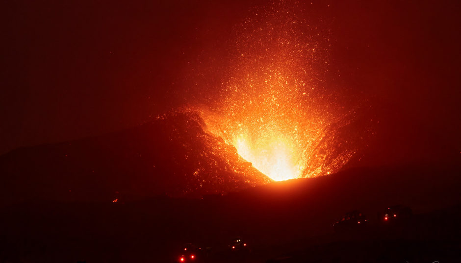
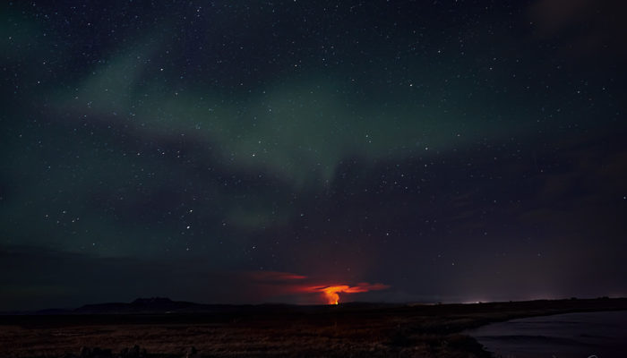
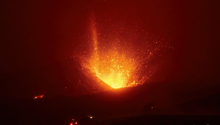
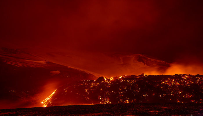
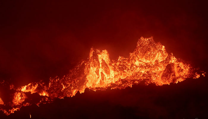
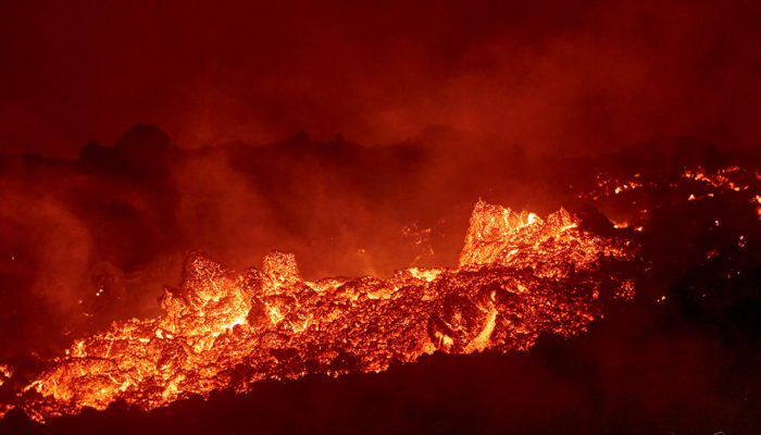
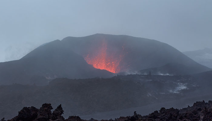
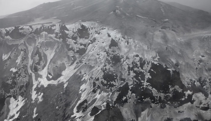
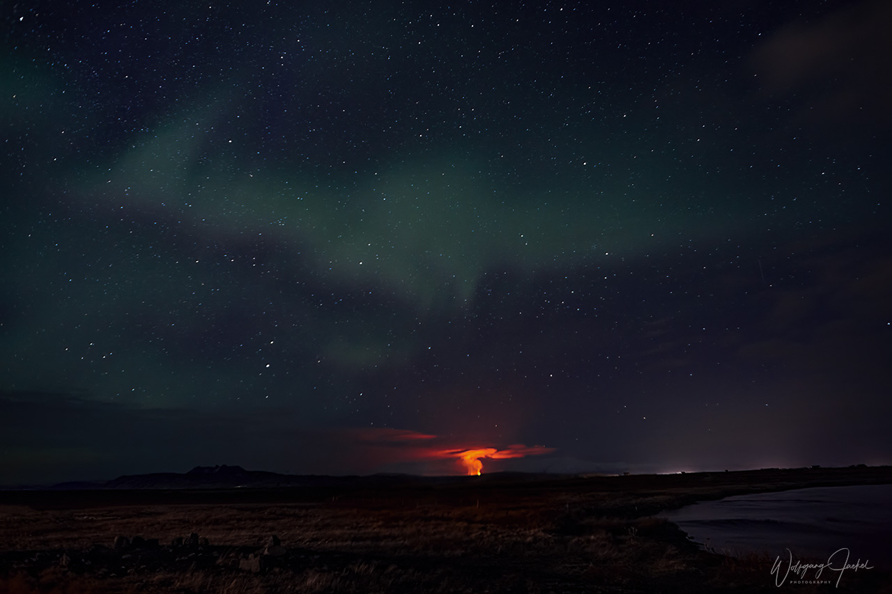
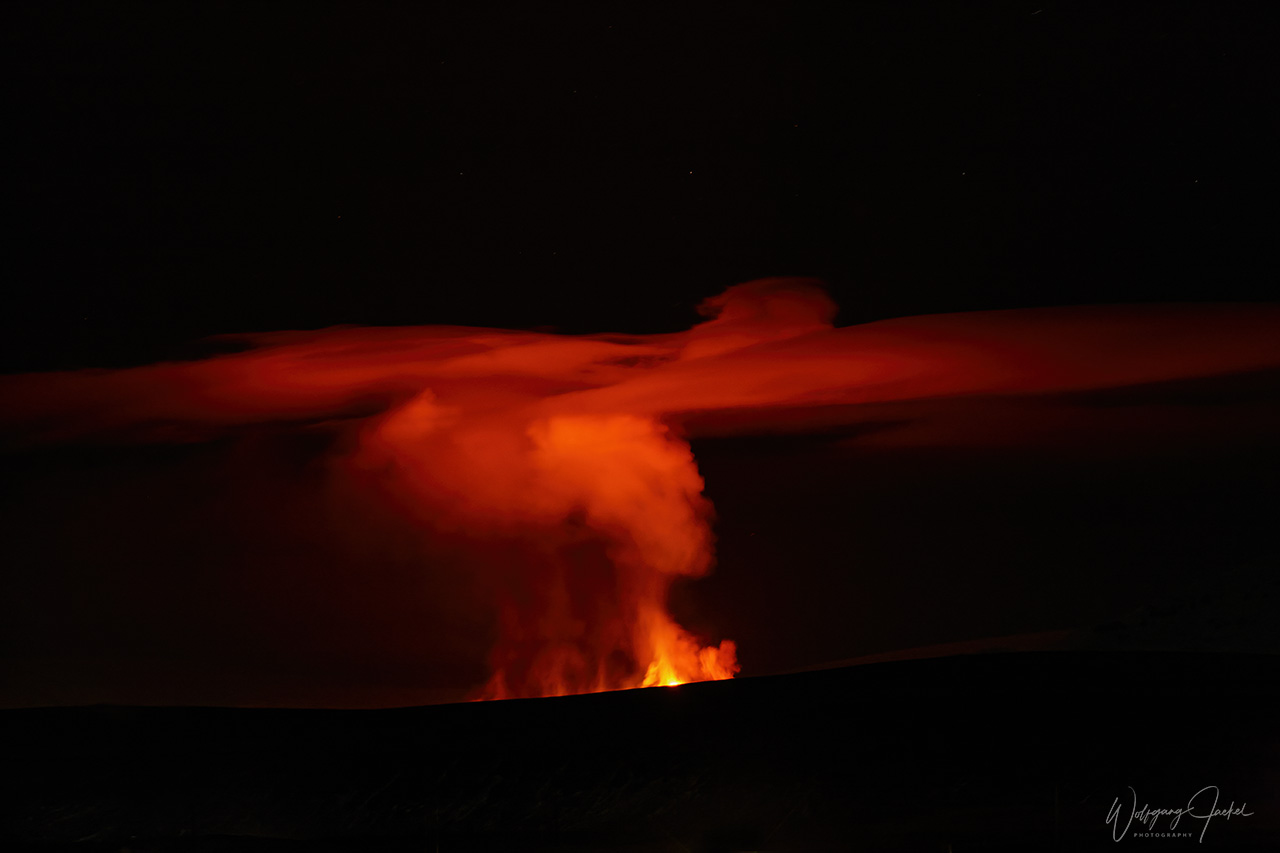
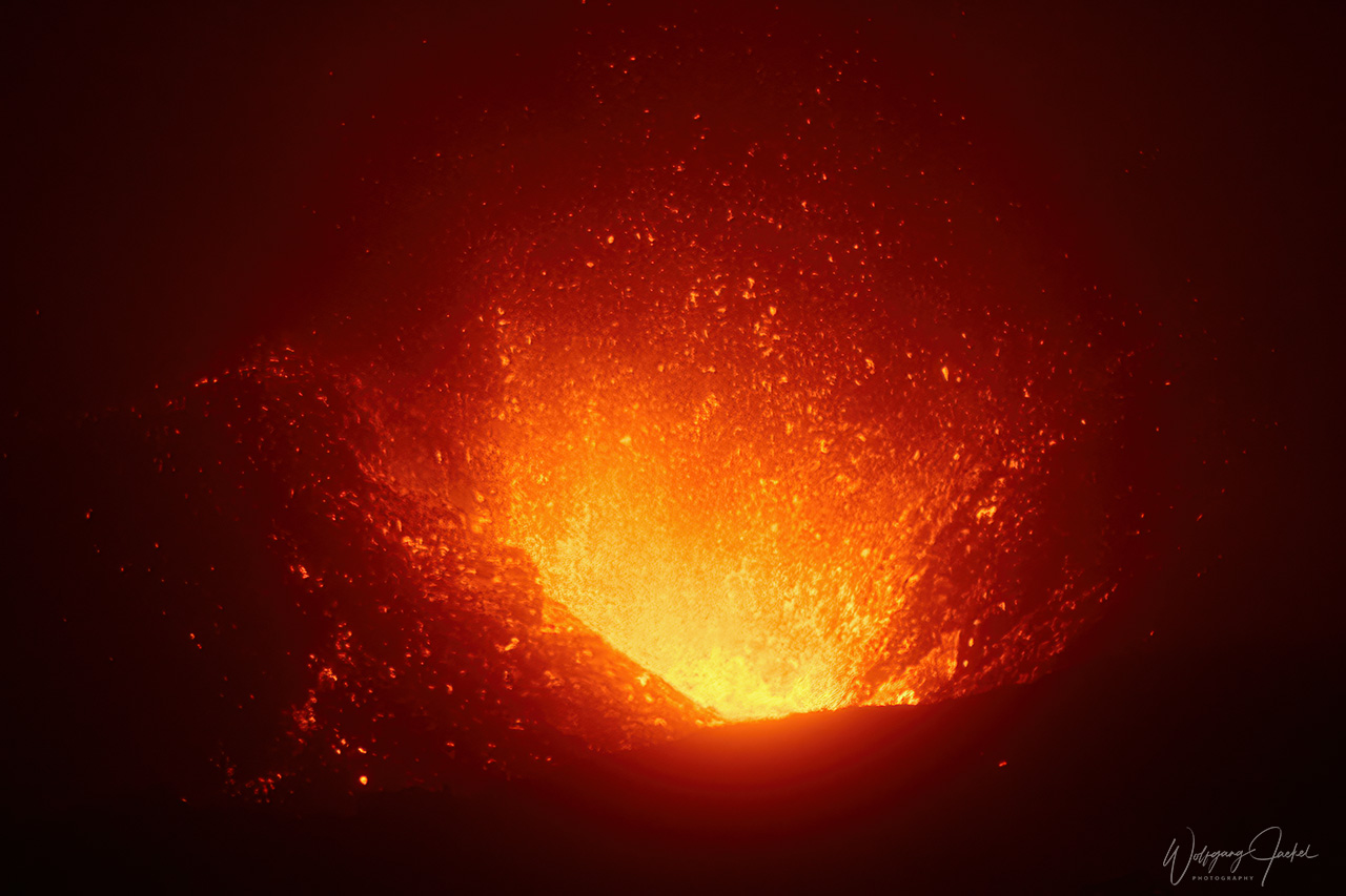
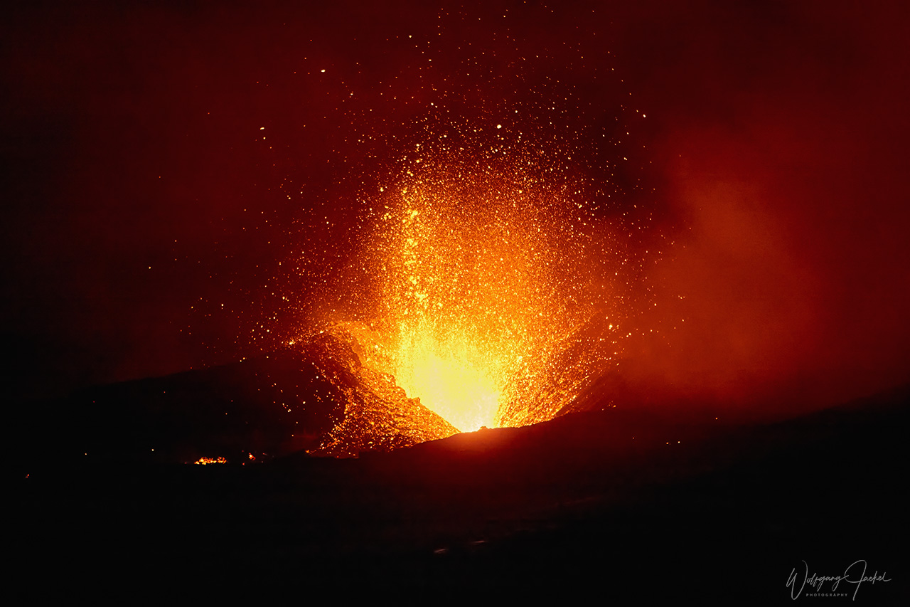
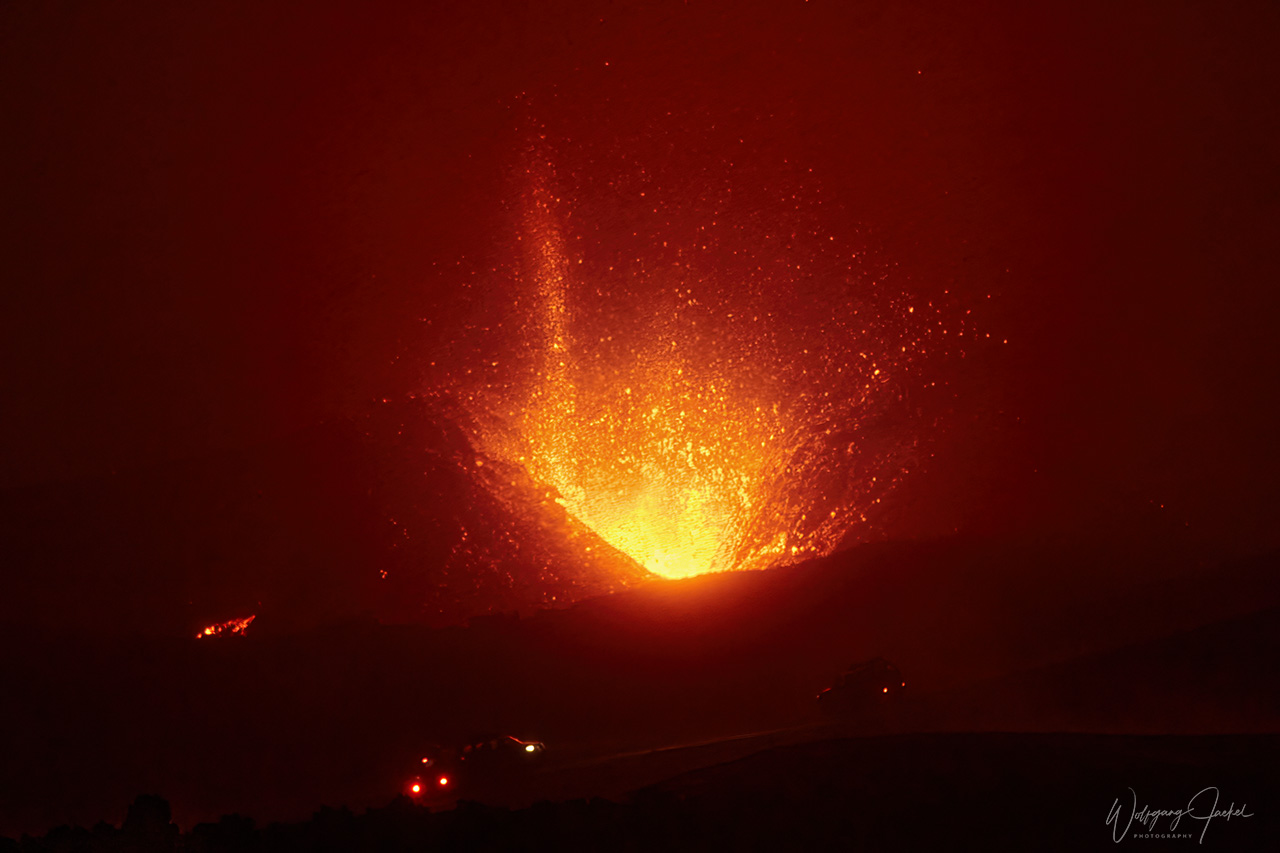
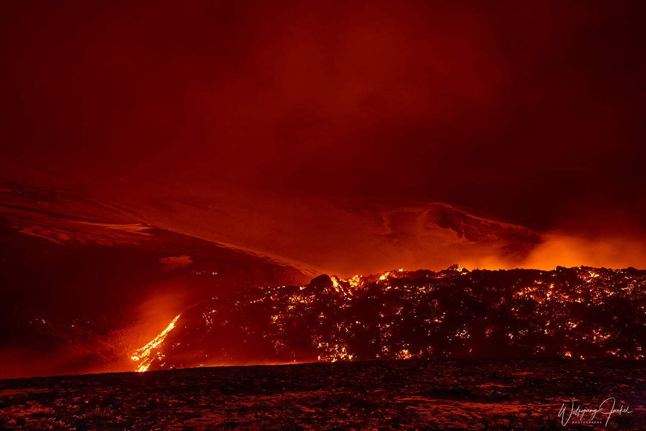
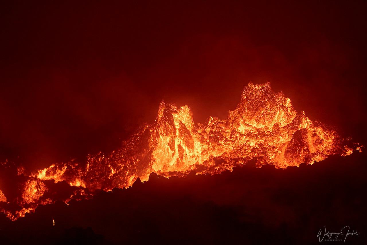
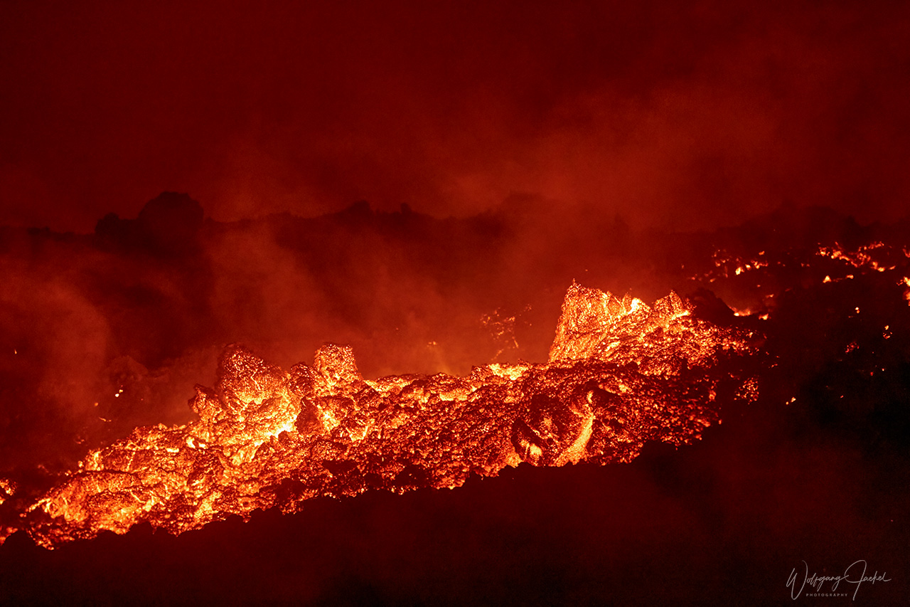
Particularily the spontaneous last-minute trip to the Fimmvörðuháls volcano eruption which had begun on March 20, 2010 was an unforgettable highlight and lifetime experience, including the guided nocturnal Super-Jeep drive over the glacier right up to the volcano fire and glowing lava streams in the glacial environment It was a bit foggy on the glacier, though, preventing first class photographs of the eruption. But nevertheless I’m happy with the images of which a few are shown in the gallery. On the following day we took the last offered helicopter ride to the crater. Though the weather was rainy and the eruption just had faded, the round flight was impressive and complemented the 3days volcano trip. All in all we obviously had been a bit late at the location with the eruptive period at Fimmvörðuháls just coming to the end on the day of our departure. But we are extremely grateful that we still could closely enjoy the unique spectacle.
Back home again it became evident that the recently ended activity of Fimmvörðuháls just preceded the violent and explosive eruption of the nearby Eyjafjallajokull volcano in April 2020 occurring beneath glacial ice. It had caused air travel disruptions and the largest air-traffic shut-down since World War II because the volcanic ash clouds had covered large parts of western and northern Europe.
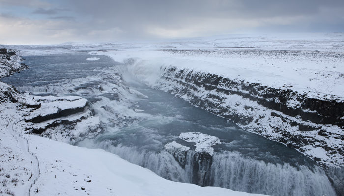
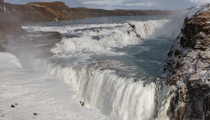
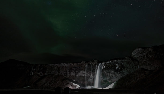
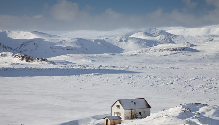
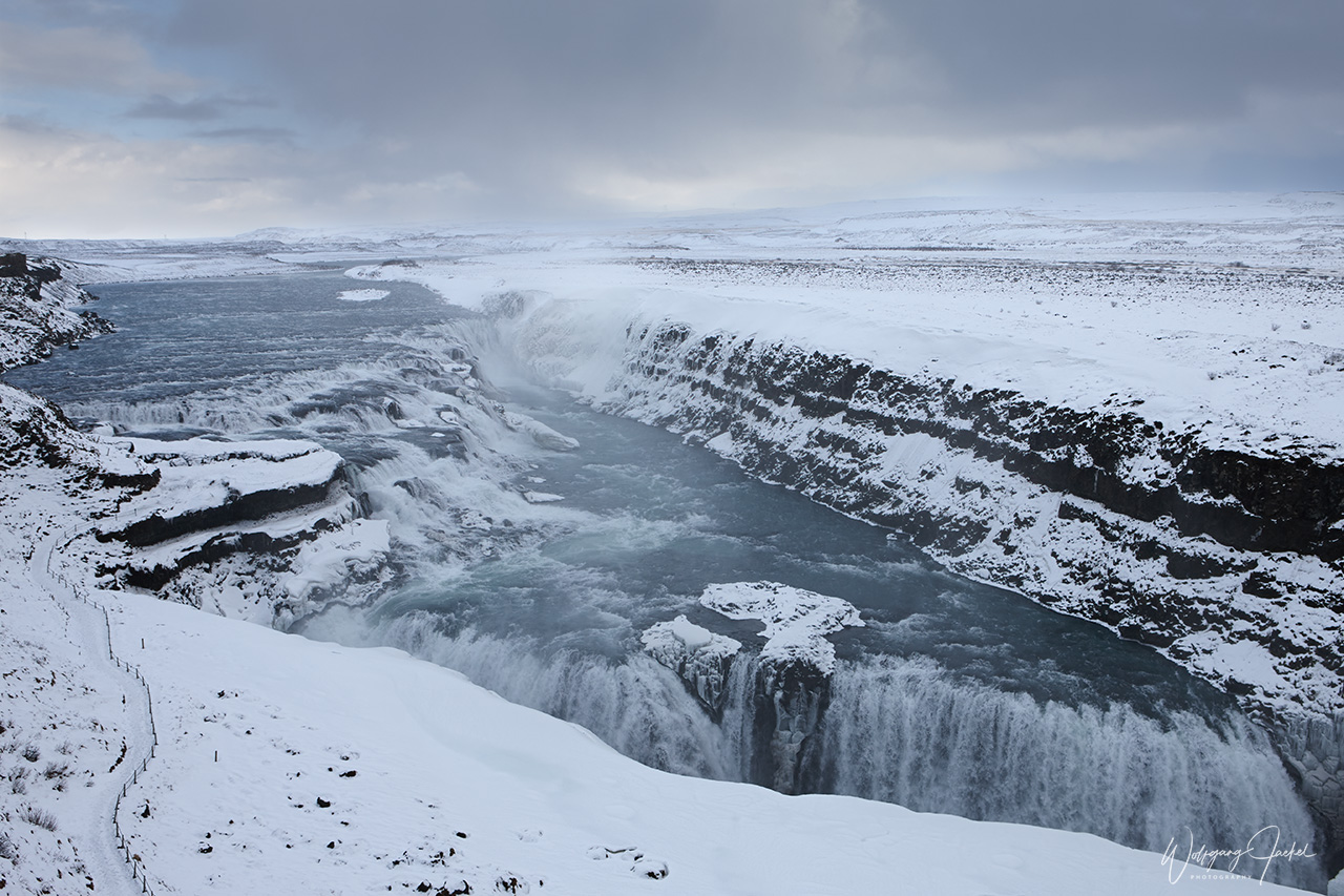
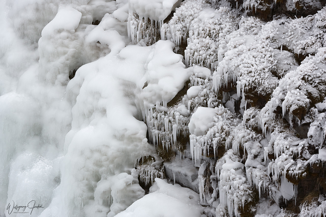
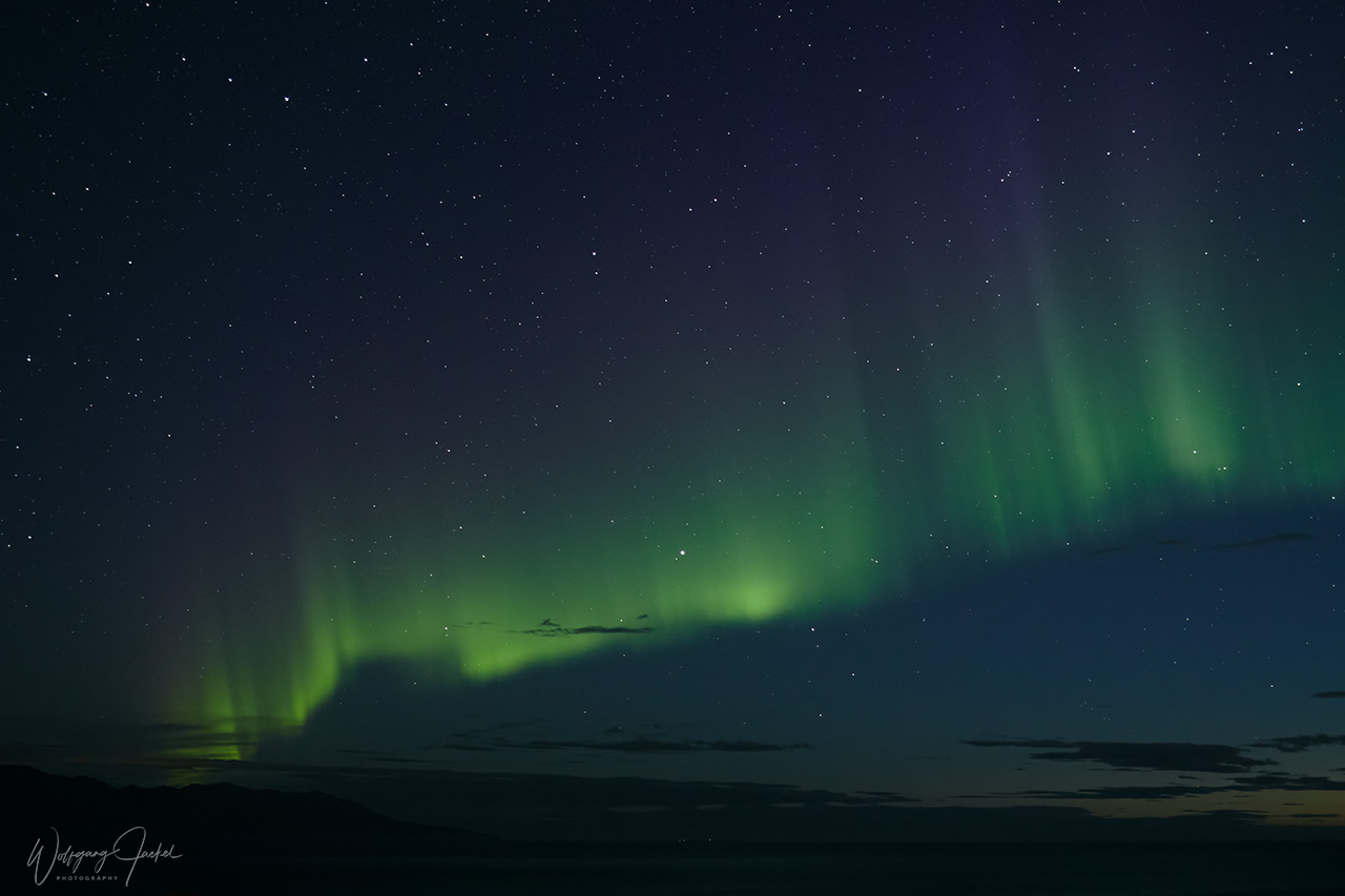
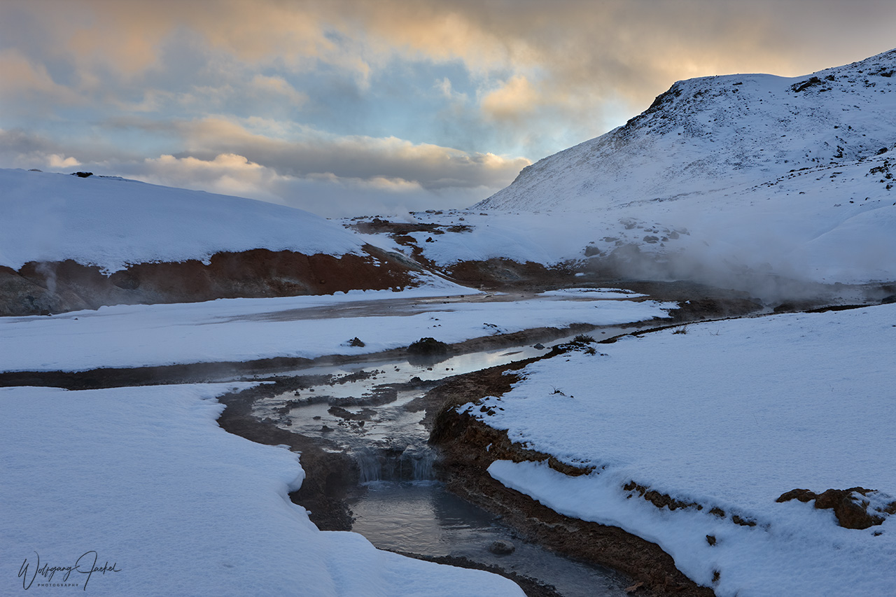
Aside from this short trip, the multiple visits to iceland over the past 2 decades have taken place both in winter and in summer with the winter season offering entirely different landscapes with partly frozen waterfalls and the dramatic scenery wrapped in snow and ice. And there’s an additional bonus for travelling later in year and winter:Though the main part of Iceland is located a few degrees south of the Arctic Circle and only the small Island of Grimsey is crossed by 66°N, the country lies well within the auroral oval, also called aurora belt, thus making Iceland a known and favorite place to see the Northern Lights in clear nights. Given the dramatic scenery, the aurora displays can make up for fantastic views if you’re lucky with the weather and often changing cloud covering.
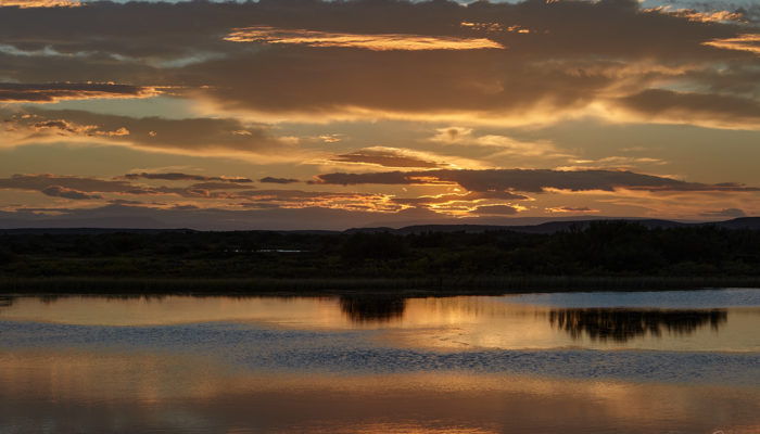
Meanwhile, in midsummer the sun doesn’t completely set providing the favorite “golden” light for photography all through the night. On the other hand, this is the time of year most visitors come to Iceland. And frankly, during my last stay in 2017, I was pretty shocked by the increased mass of tourists flooding the island and making it almost impossible to photograph any of the known scenic attractions without lots of people, specifically the selfie folks, in front of them. Reviewing my photographs taken 10 or 20 years ago we often had been all alone at the locations or just a few people been around. Anyway, from what I’ve heard during my last stop over in 2017, the Islandic authorities were thinking of rising entrance fees or even limit the number of people accessing the main attractions.
The map below offers an overview of the travel routes and main points visited on the various trips, followed by short descriptions of some major locations. Some additional informations can be gathered from the image descriptions in the gallery. There are several motifs captured at the identical location in winter and summer over different years.
List of the main travel destinations, – not necessarily in order of the itineraries, see also map:
- Reykjanes Peninsula (Keflavik, Grindavik, Garður, Blue Lagoon, Seltun geothermal area, Strandarkirkja
- Reykjavik
- Golden Circle (Gullfoss waterfall, Geysir Geothermal Area, Thingvellir (Þingvellir ) National Park
- Southwest and south coast: Fimmvörðuháls Volcano, Seljalandsfoss, Skógafoss, Dyrhólaey, Núpsstaður, Vík í Mýrdal, Reynisfjara beach
- South Highlands (interior) Landmannalaugar
- Southeast: (Skaftafell Reserve: Svartifoss waterfall, Jökulsárlón glacier lagoon)
- Interior: Kjolur (Kjölur) Route, Hveravellir,
- North and Northeast: Hvítserkur, Glaumbær, Akureyri, Grenjaðarstaður, Goðafoss waterfall, Mývatn, Námaskarð Geothermal area ,Viti Crater in Krafla, Húsavík, Dettifoss
- Eastfjords : Seyðisfjörður
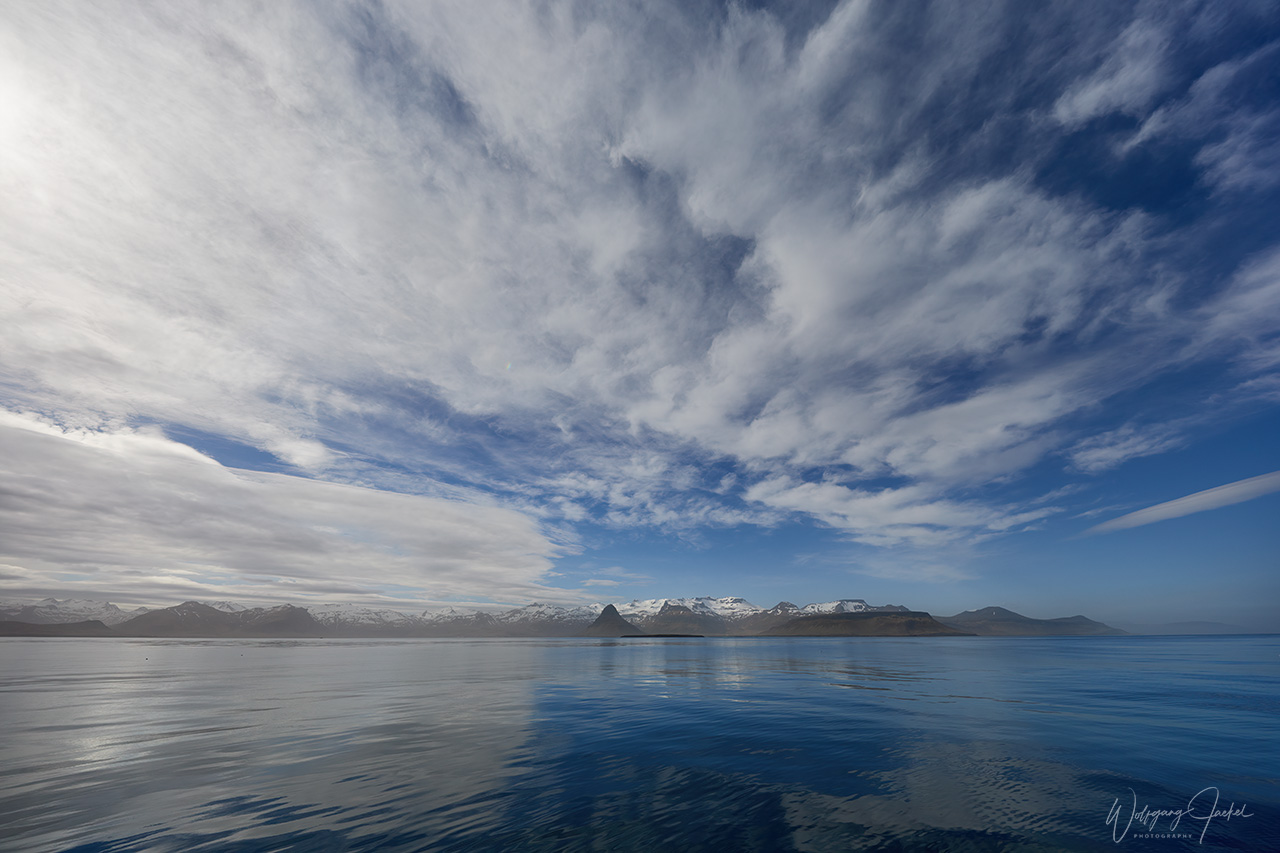
- West: Snæfellsnes Peninsula: (Kirkjufell and Kirkjufellsfoss, Hellissandur, Skarðsvík Beach, Arnarstapi Stykkishólmur)
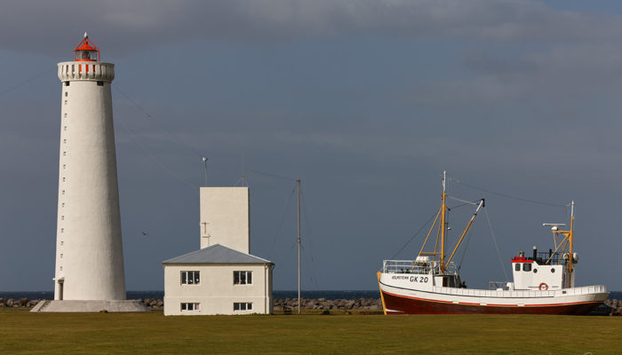
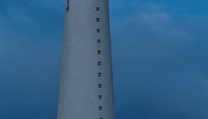
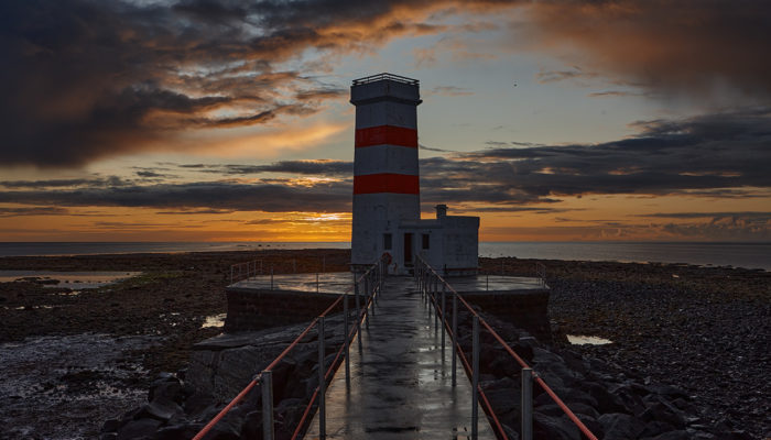
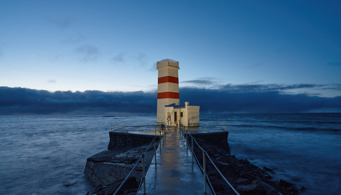
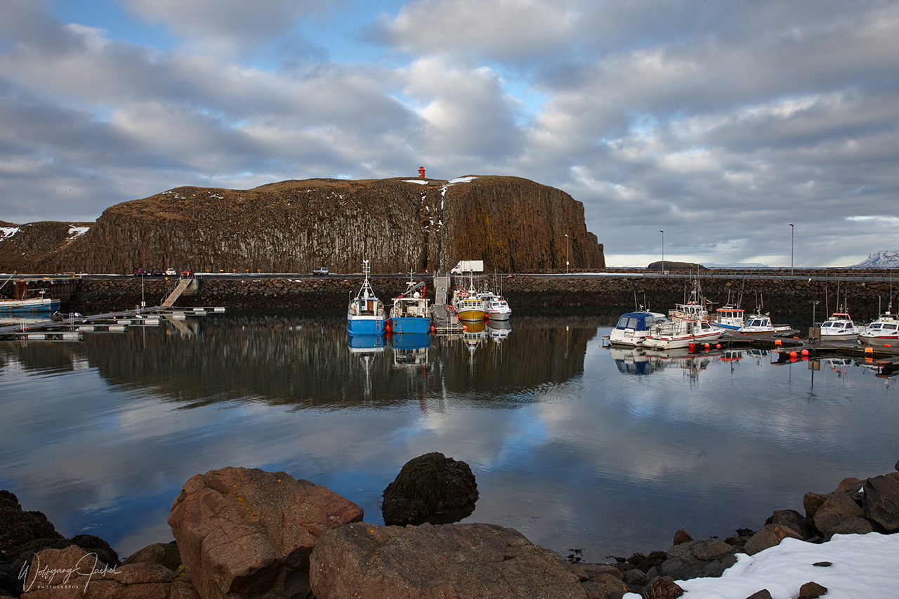
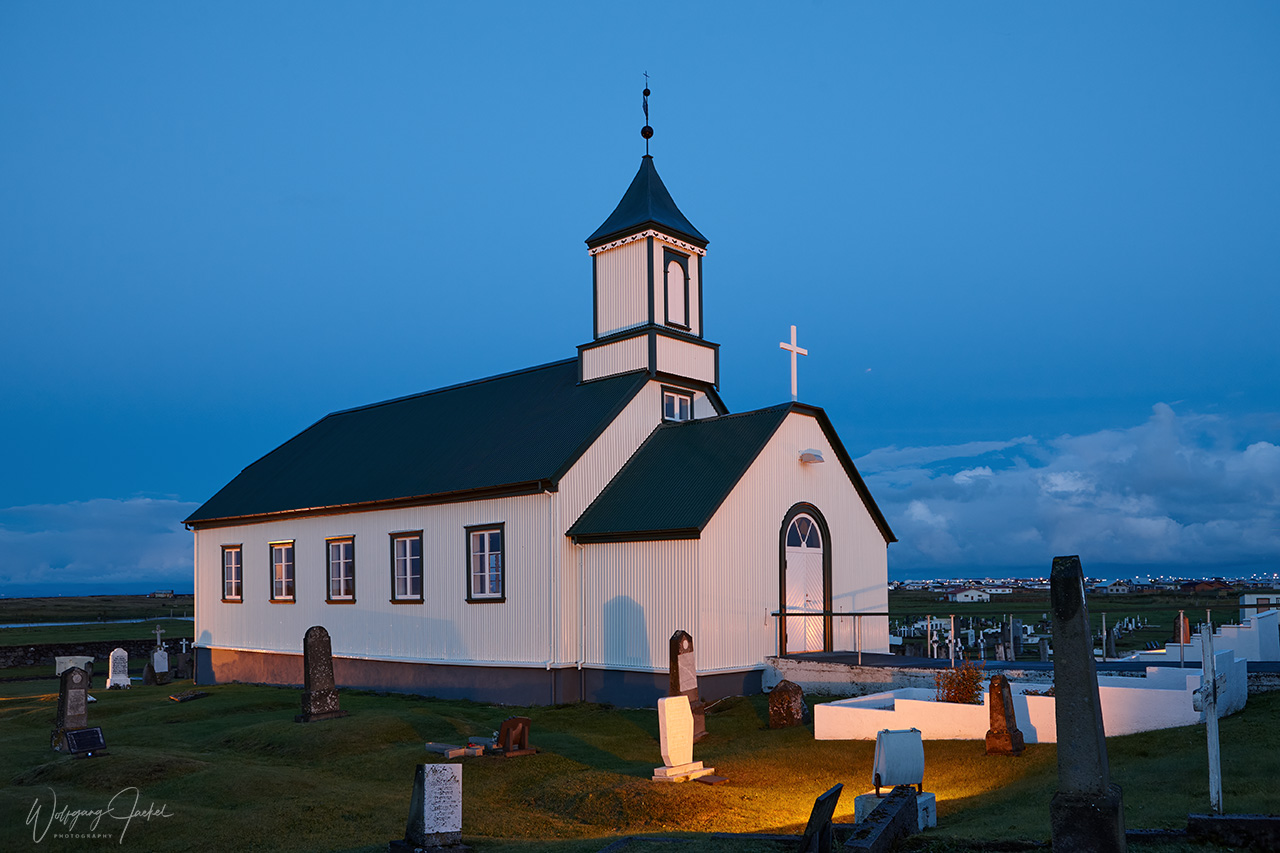
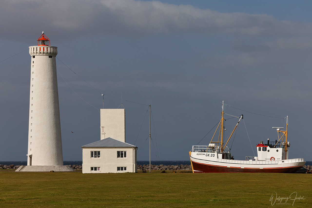
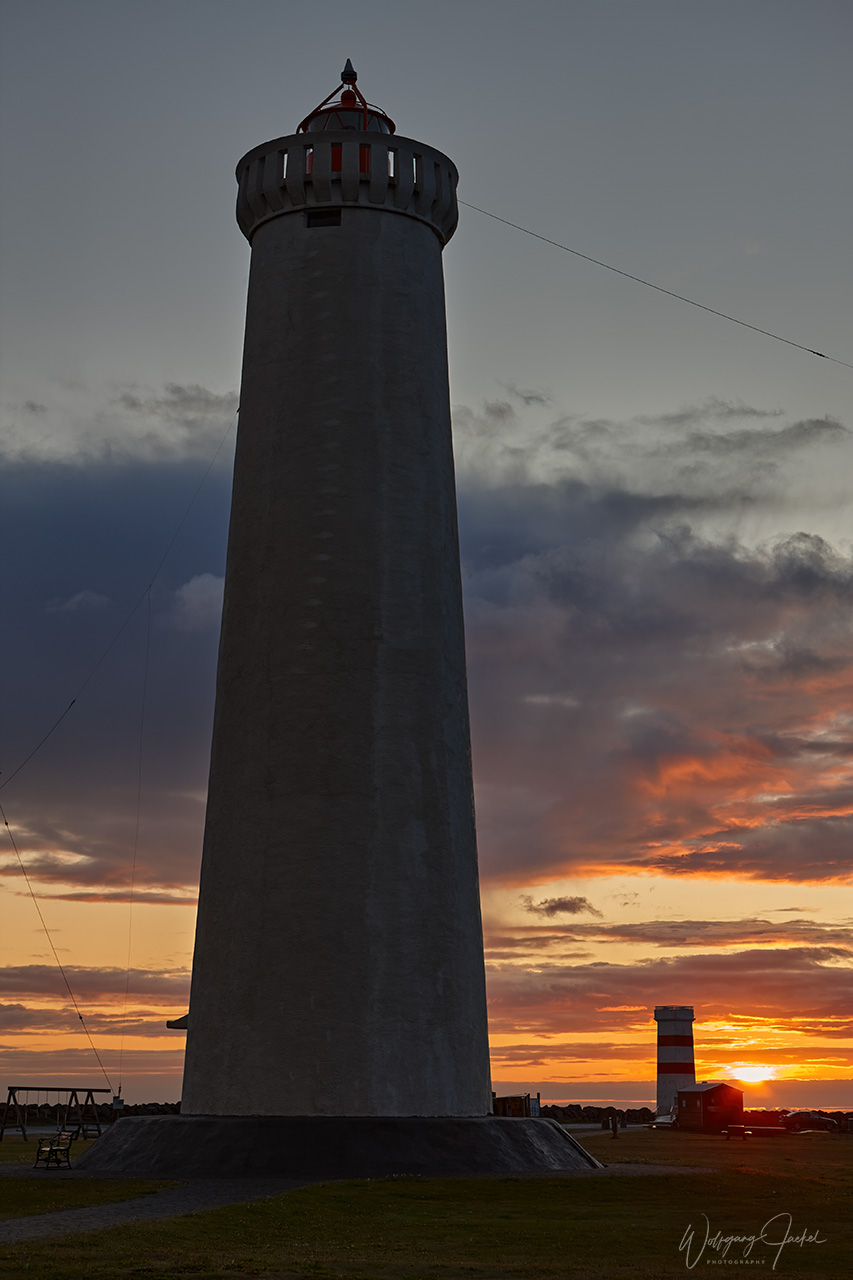
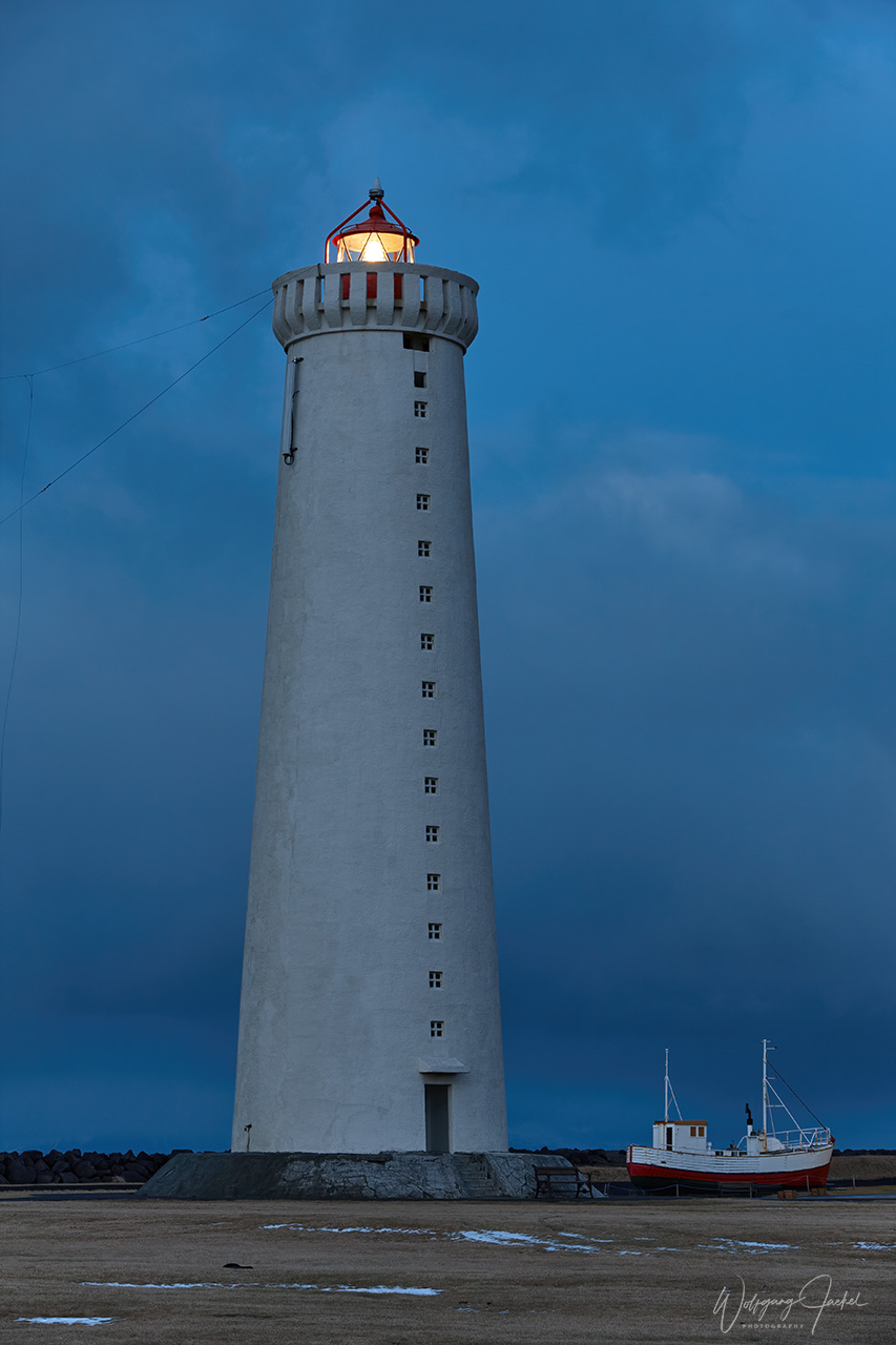
As most Visitors we always arrived and picked up the rental car on Keflavik Int. Airport, located on the Reykjanes Peninsula in the Southwest,- just 47 km from Iceland’s capital. We sometimes had stayed on the peninsula in the first step to explore the beautiful scenery along the coast including the small fishing villages of Grindavik and Garður with the lighthouses nearby offering nice views at sunset.
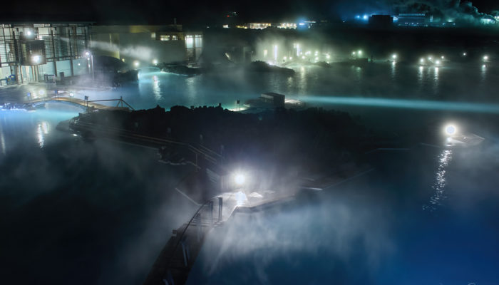
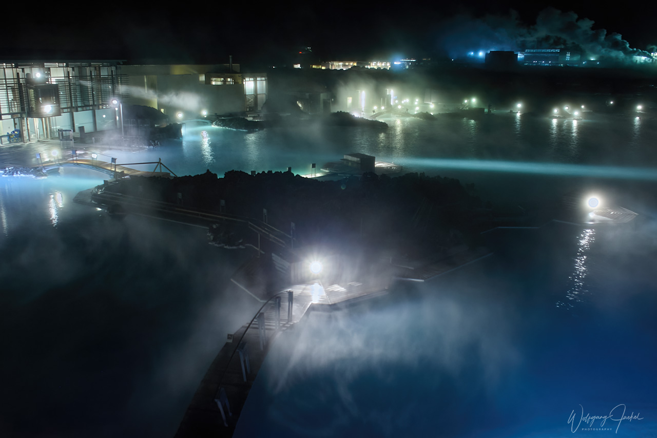
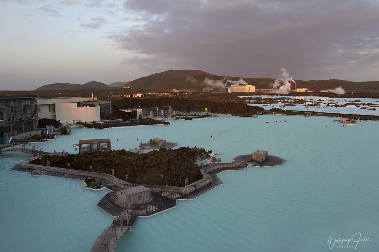
The Blue Lagoon (Bláa lónið), a geothermal spa and outdoor bathing area close to Grindavik in the heart of the volcanic landscape, is one of the main tourist destinations and advertised as one of the 25 wonders of the world. Since it has become completely overcrowded over the years, visitors now need to book a ticket for a time slot.
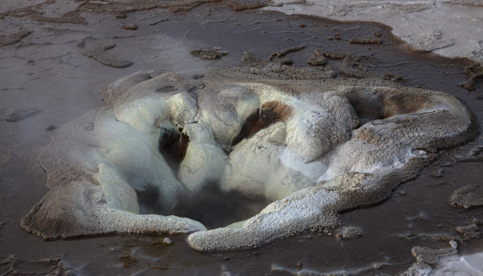
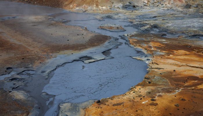
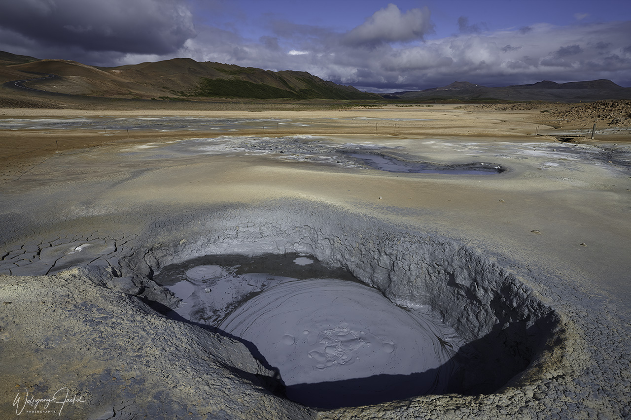
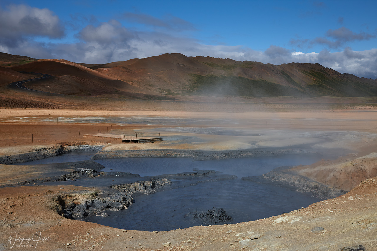
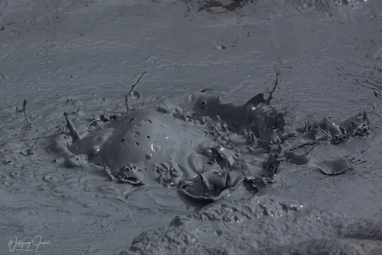
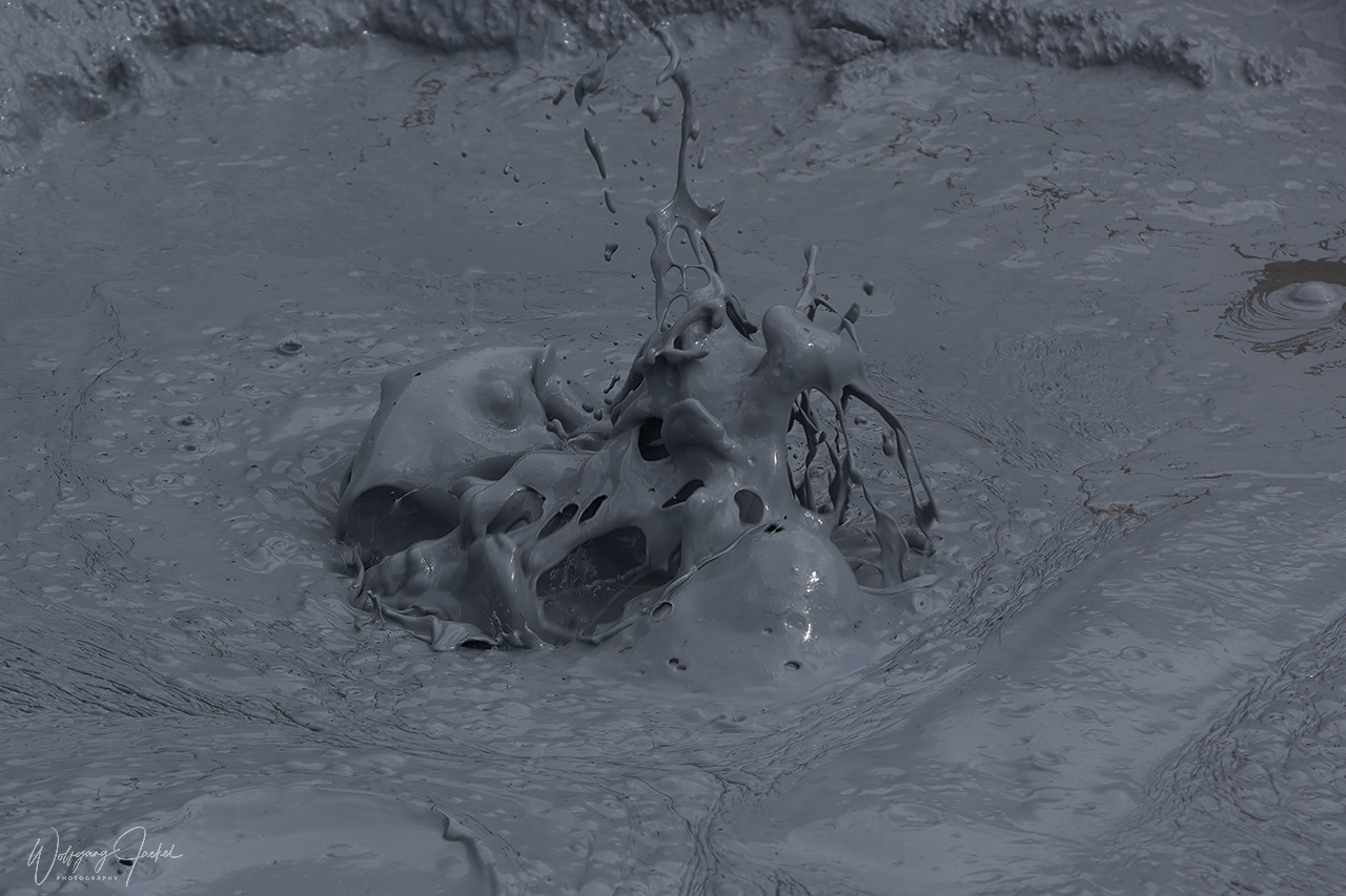
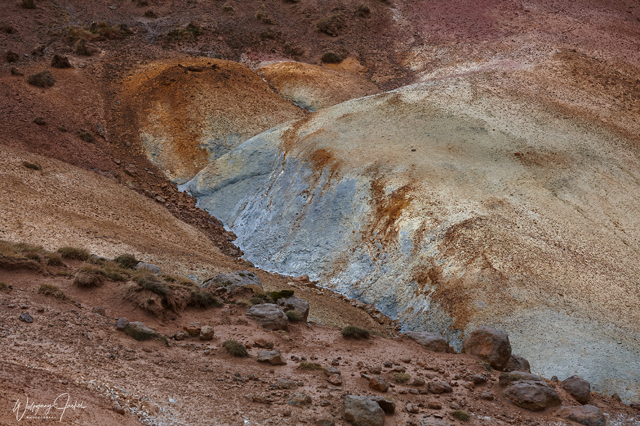
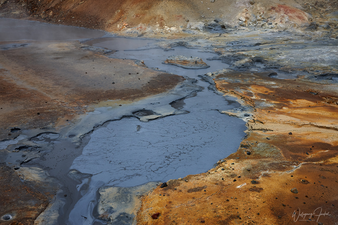
Another attraction on the peninsula is the Seltun geothermal area that resembles a lunar landscape and is dotted with bubbling pools of mud, fumaroles and hot springs The sediments brought up range in color from red, orange and green.
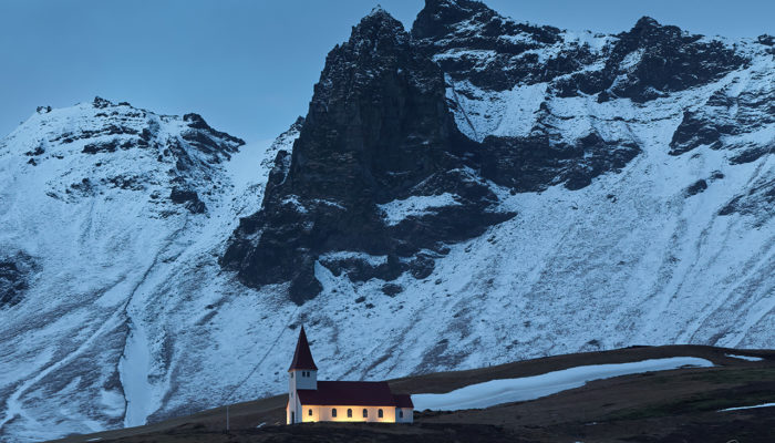
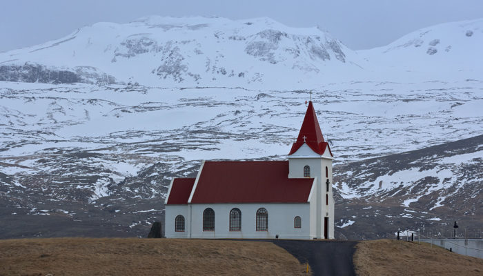
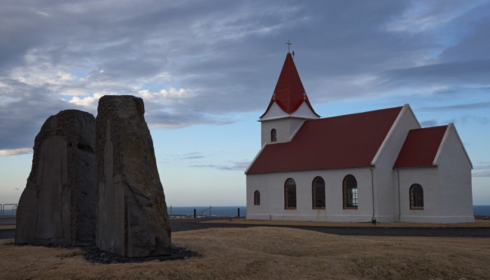
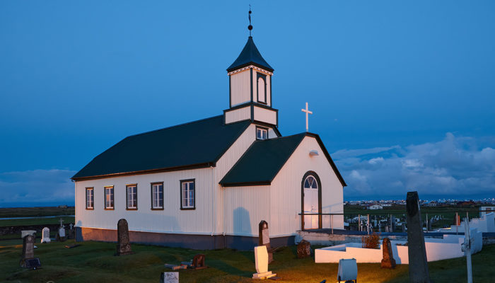
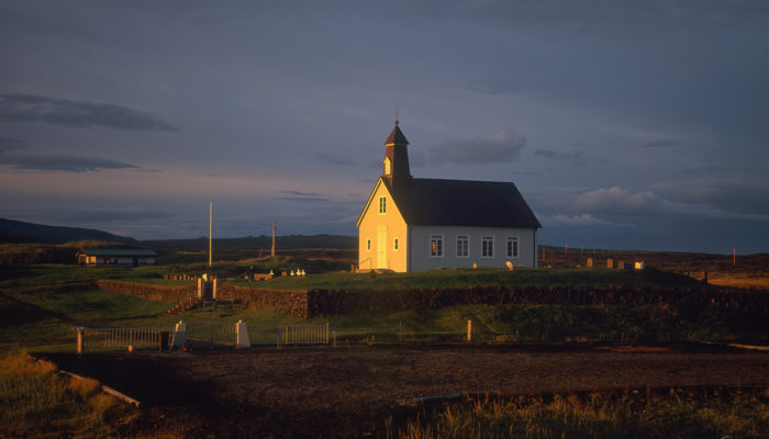
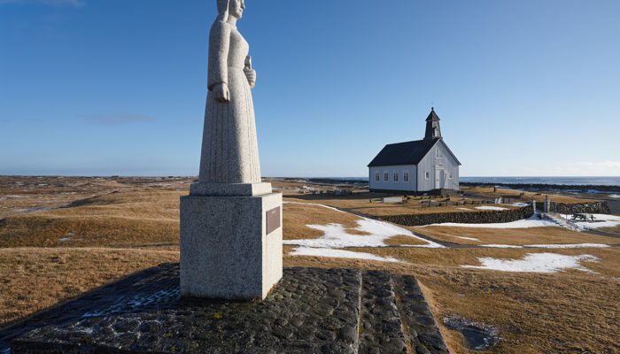
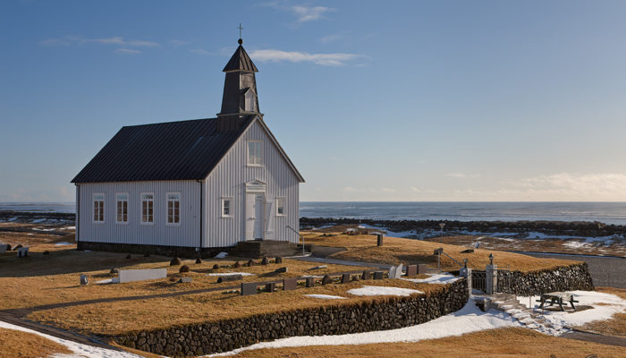
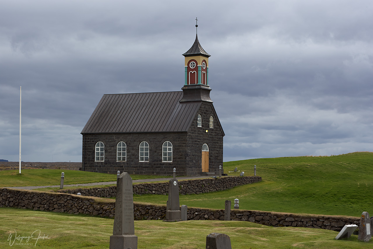
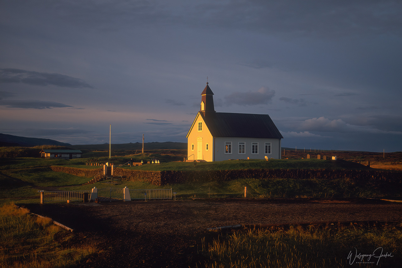
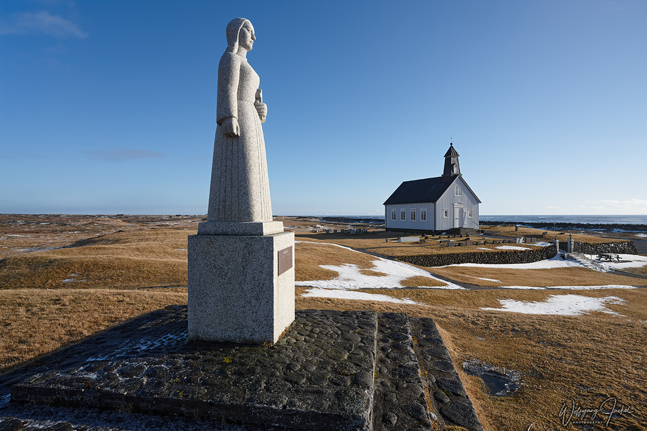
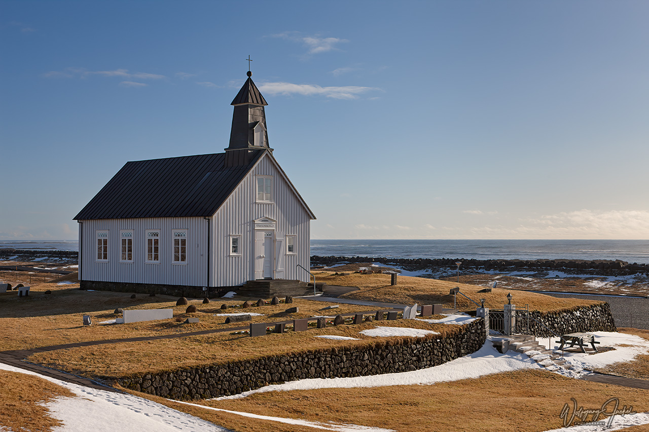
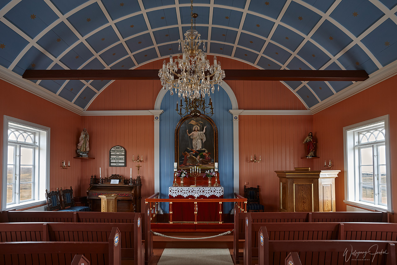
Strandarkirkja, exposed to the North Atlantic ocean, lies on the east shore of the Reykjanes Peninsula. The church is a landmark for travelers at sea established by returning sailors in the 12th century. Also called the “Miracle church”, because many miracles have been attributed to Strandarkirkja, the church has been central in Icelandic seamen’s prayers for centuries. It’s a beautiful motif giving a feeling of remoteness.
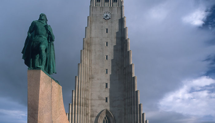
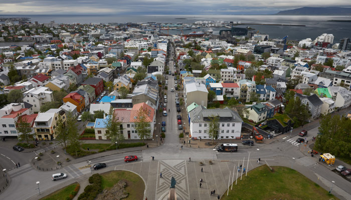
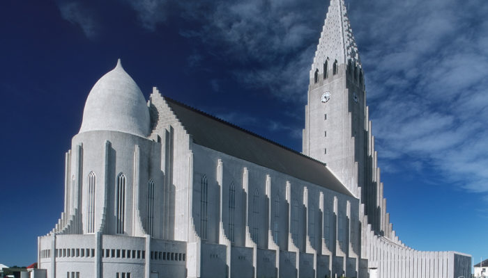
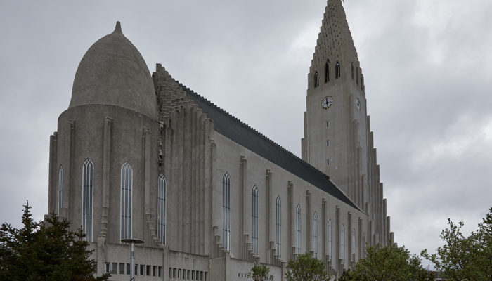
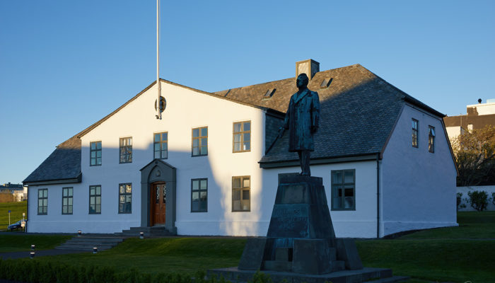
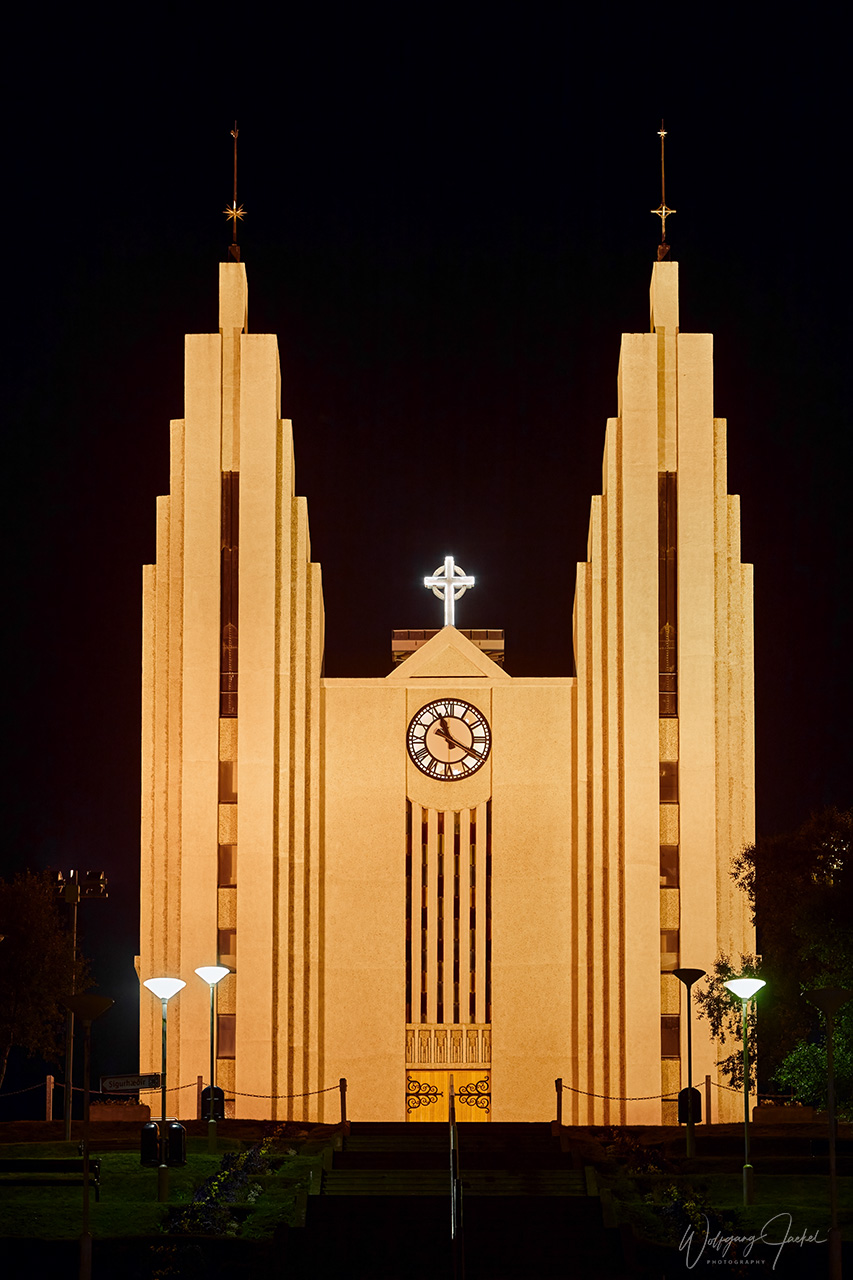
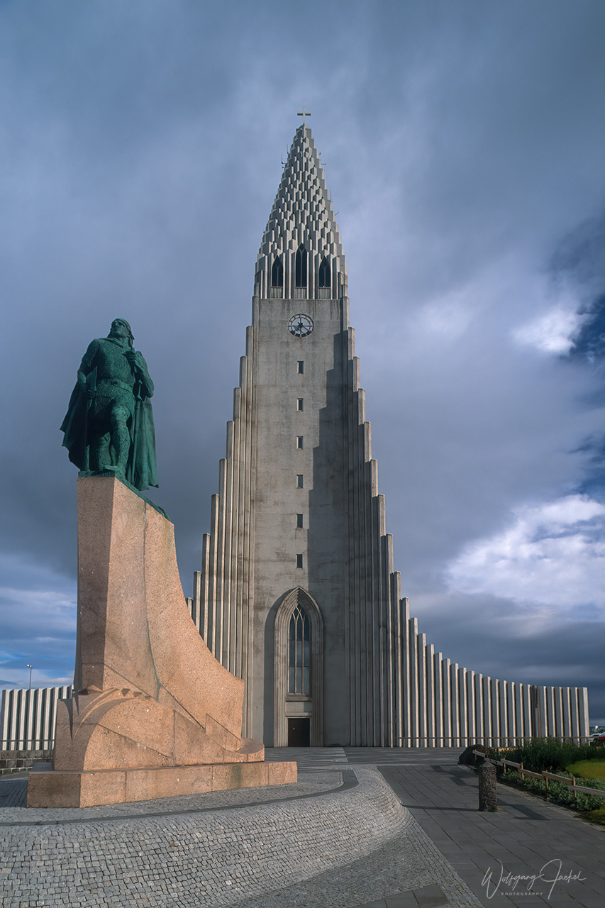
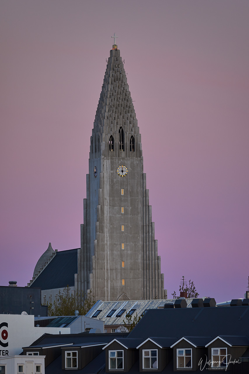
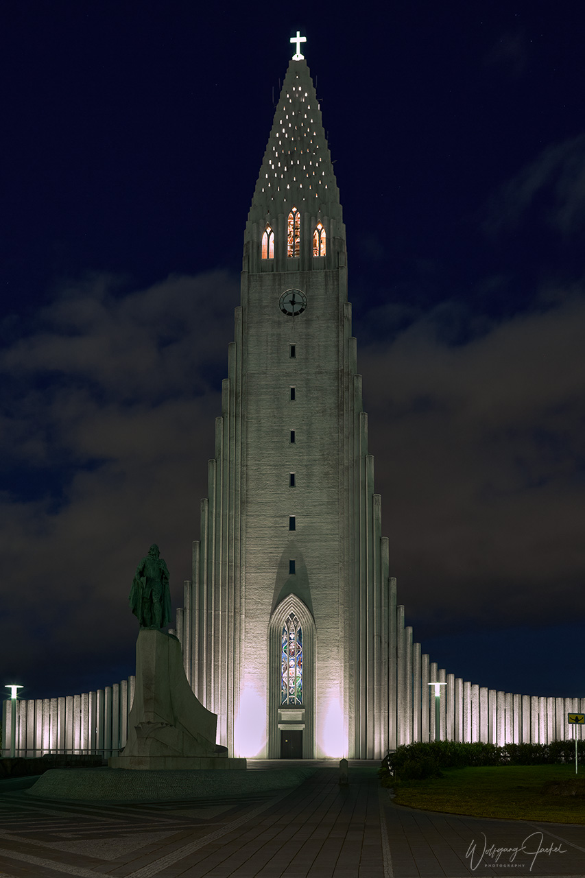
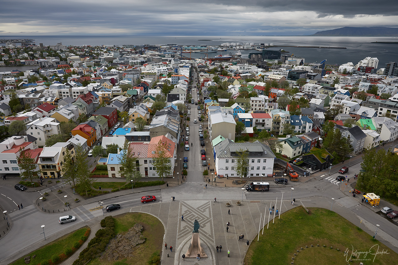
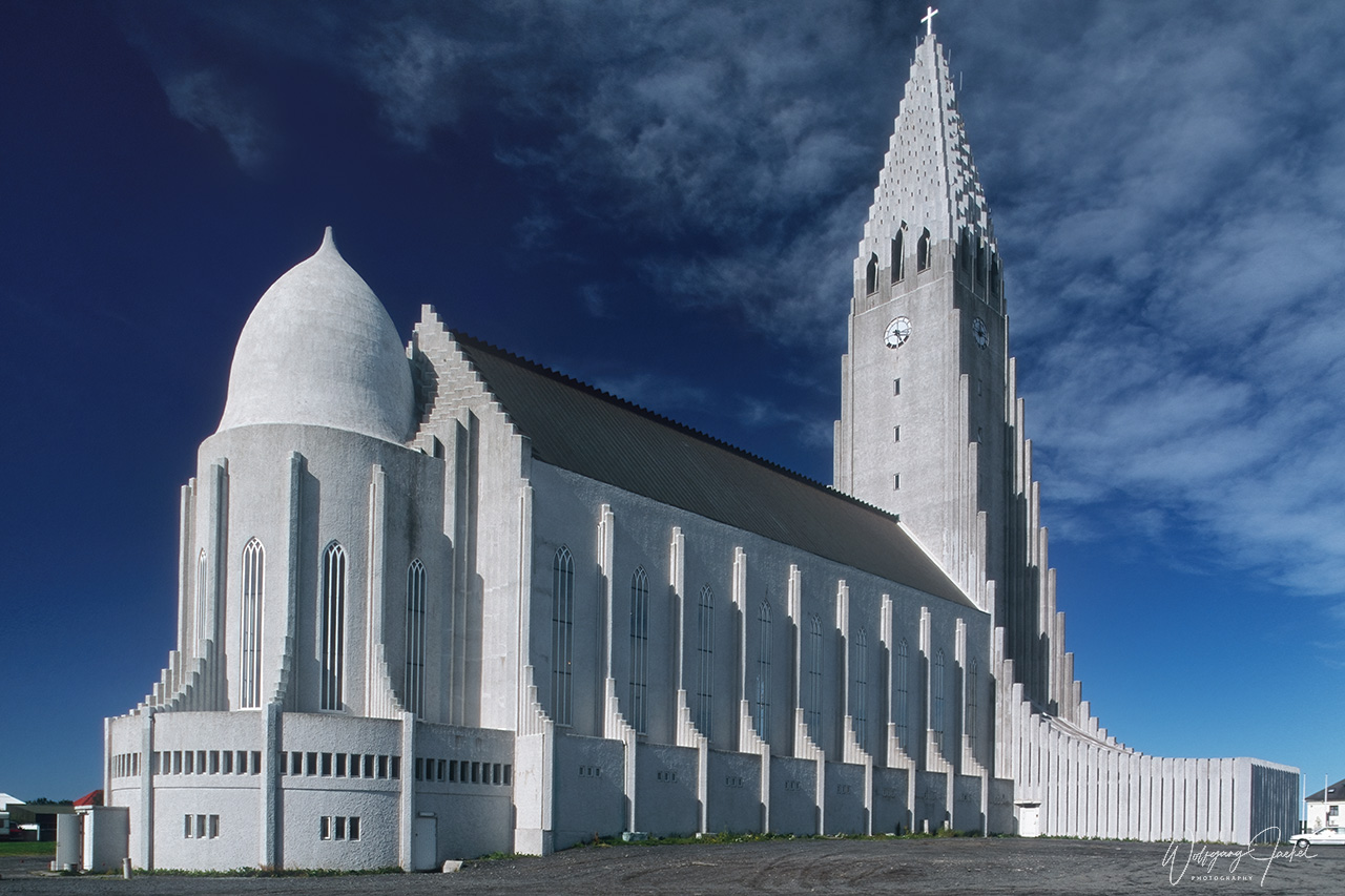
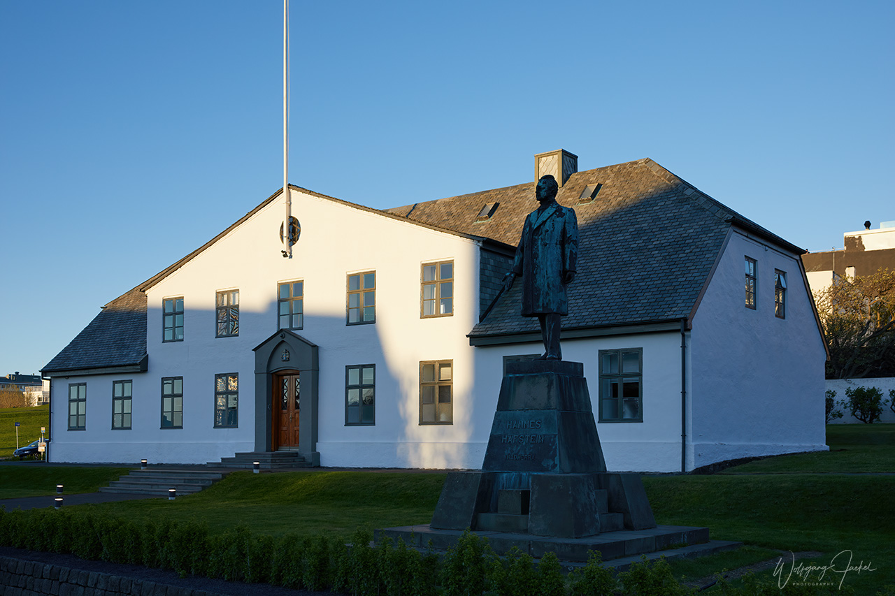
The capital Reykjavik is by far the largest city in Iceland with 36% of the population living there,- that’s to say around 131136 inhabitants as of Jan 1st, 2020. Including the surrounding municipalities the area is home to 233034 people amounting to about 64% of the population. Reykjavik is the center of Iceland’s economic, cultural and governmental activity and a tourist destination, too, of course. The Hallgrímskirkja is the largest church in Iceland (height 74,5m) and the city’s best known landmark. In front there’s the statue of the explorer Leif Eiríksson who was the first European to arrive in America by the year 1000. The sculpture was a gift from the US to Iceland to commemorate the 1000 year anniversary of Alþingi, -the parliament of Iceland.
Many of Iceland’s famous tourist attractions and natural highlights are accessible via short or moderate detours from the Ring Road, also known as Route 1 which was built to connect the settlements on the coast and loops around Iceland in a rough circle. The 1328 kilometres (825 miles) long paved Ring Road is the nation’s main artery. In theory, you can drive around Iceland in about 17 hours – road and weather conditions permitting. Of course, that kind of rush by skipping almost all attractions never was on our schedule. Instead, the vast array of spectacular landscapes and highlights often located in close proximity to each other allow to visit and to photograph i.e. mountain ranges, glaciers, waterfalls, lava fields, coastal views and geothermal areas etc. within just one day.
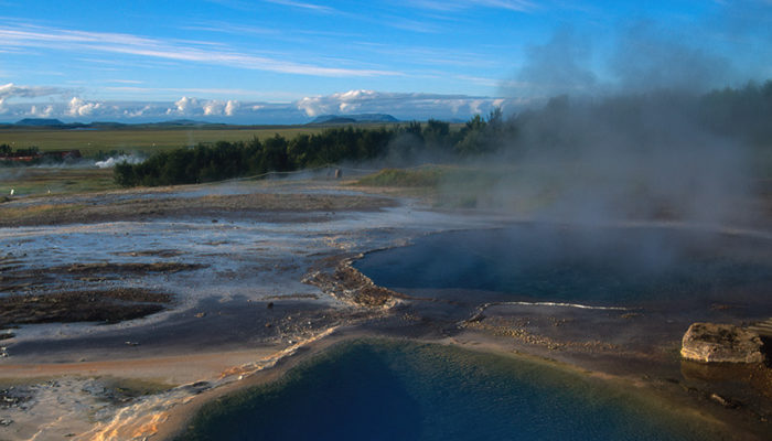
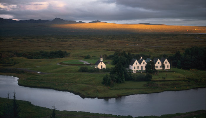
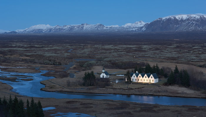
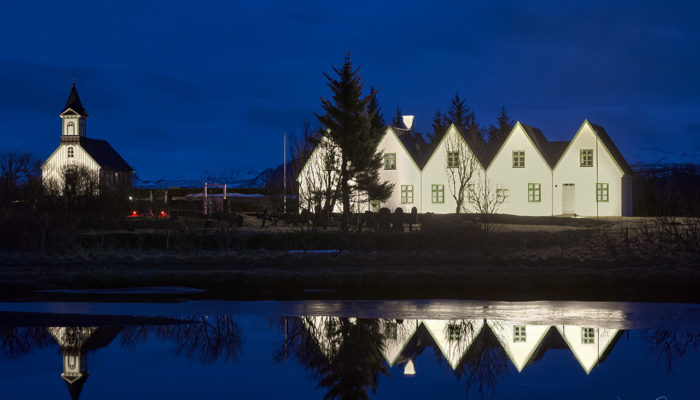
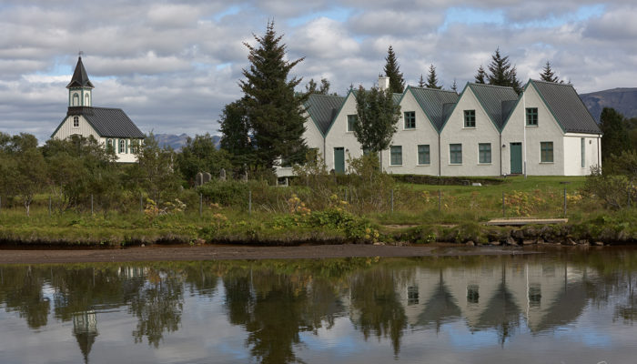
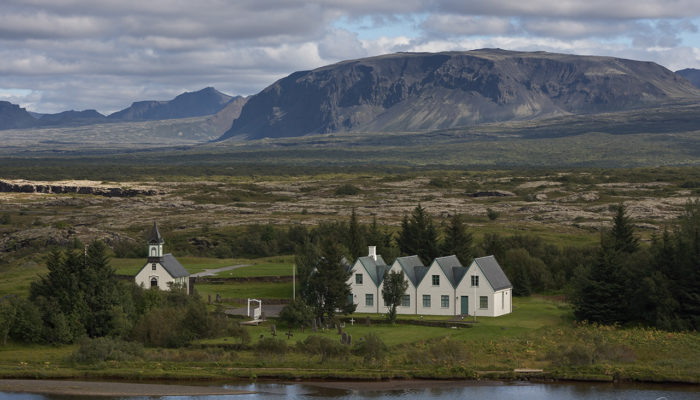
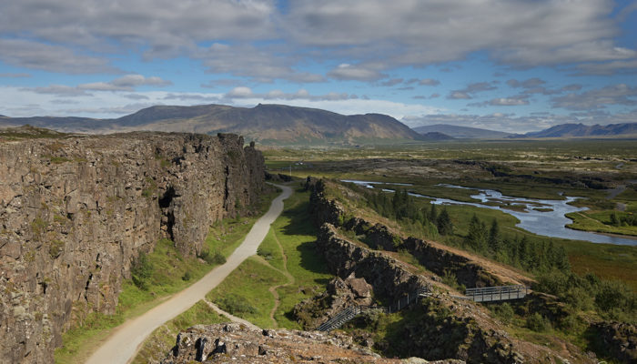
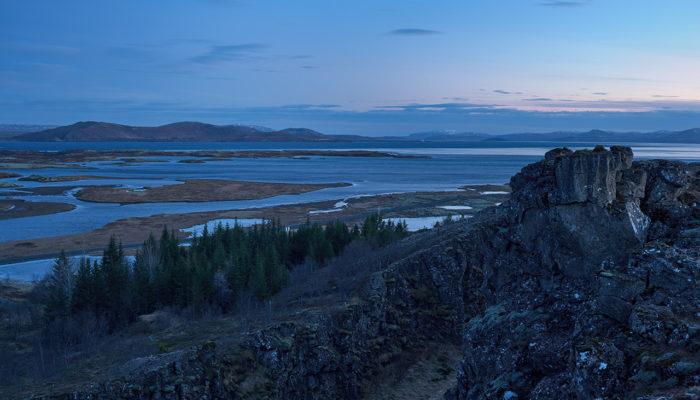
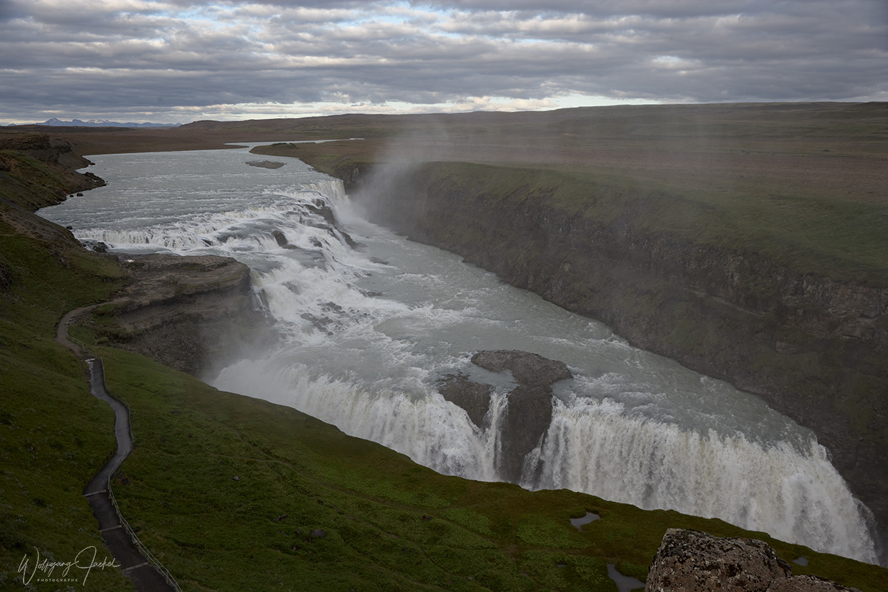
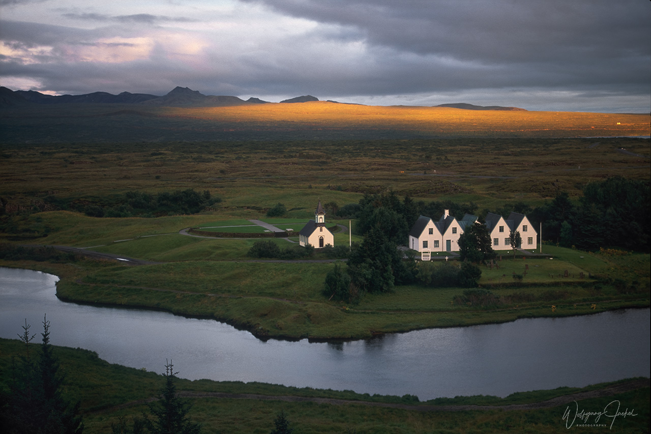
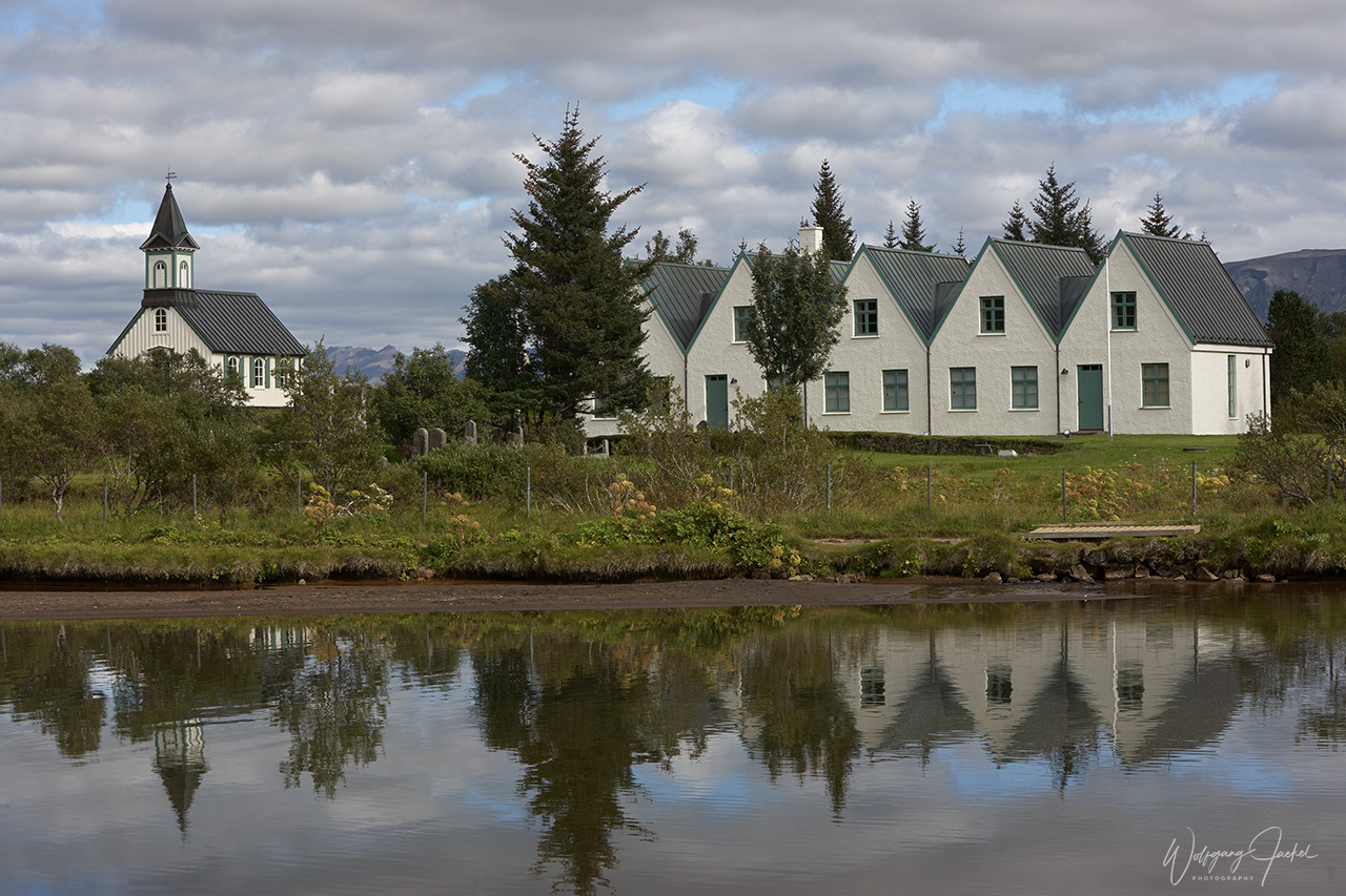
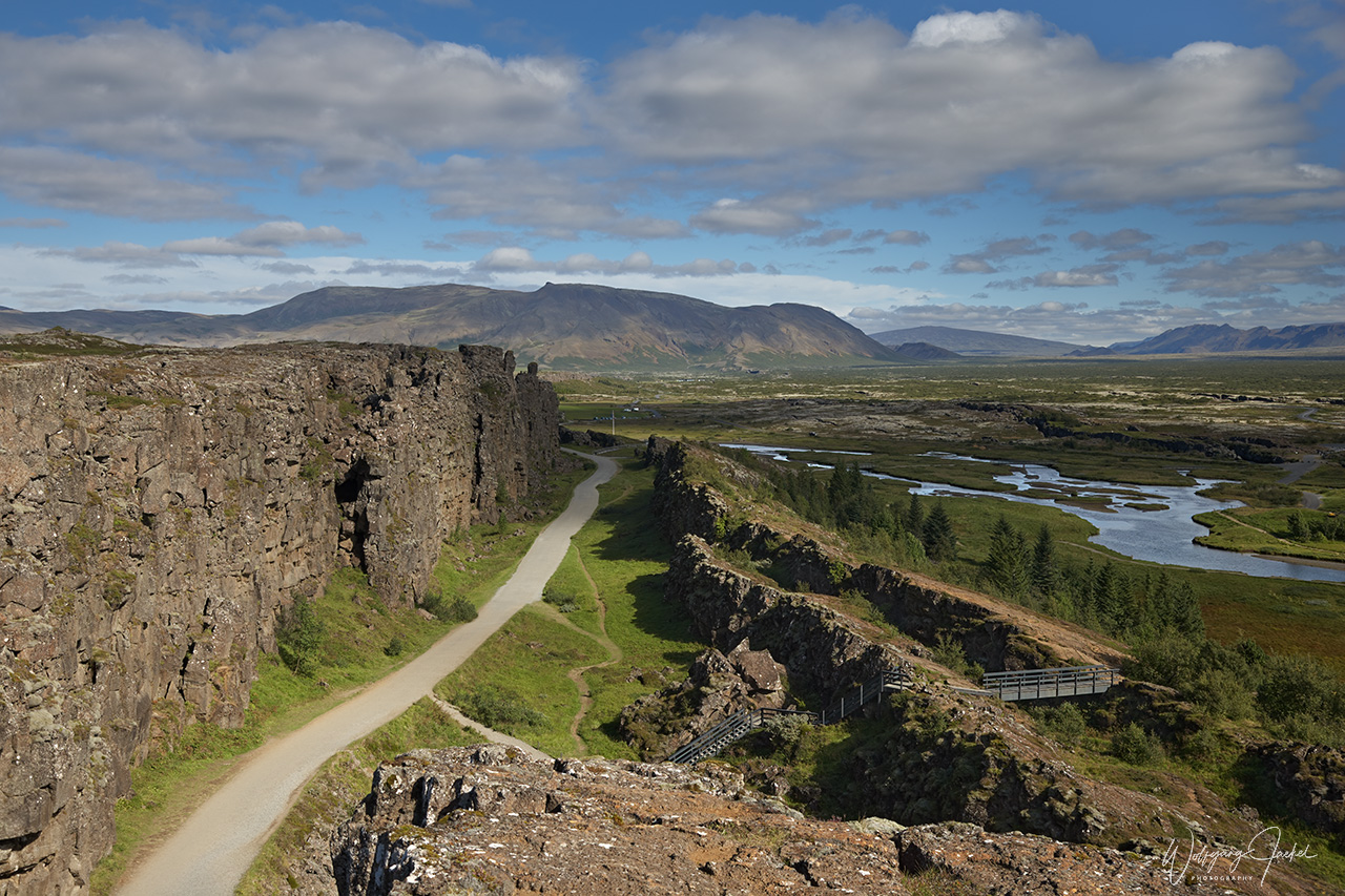
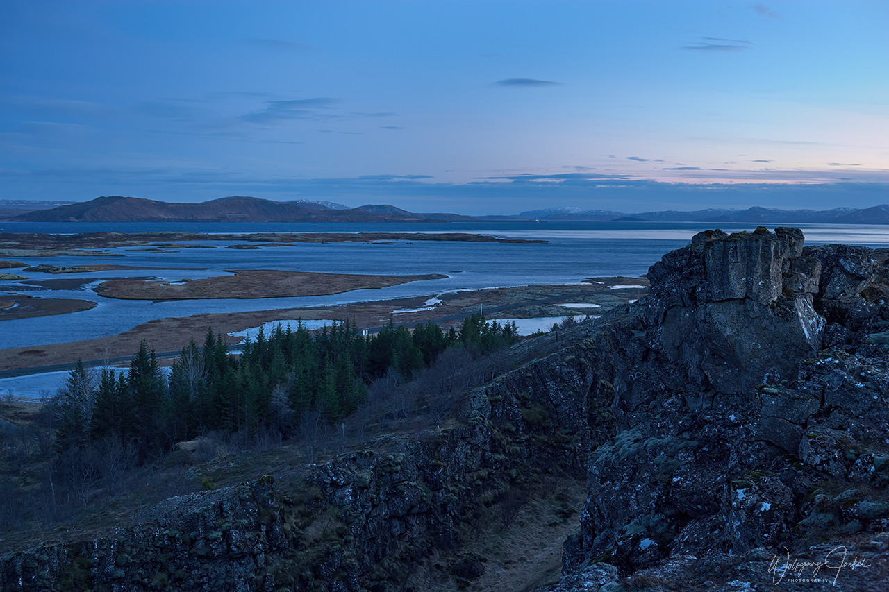
The best known example is the Golden Circle, a 300 km (186 mile) loop from Reykjavík that connects three of Iceland’s most popular spots: the Gullfoss waterfall, the Geysir Geothermal Area, and the Thingvellir (Þingvellir’) National Park, a UNESCO World Heritage site proclaimed in 2004. This is the location of the world’s oldest existing democratic parliament from the 10th to 18th century -, the Alþing (Althingi) that marked the origin of the Icelandic nation. On the site are the Þingvellir Church and the ruins of old stone shelters. Furthermore, the park with its rocky cliffs and fissures is located in the Rift valley caused by the separation of the Eurasian and North American tectonic plate that are moving apart at approximately 2.5 centimetres a year, Looking upon the face of the cliff is to literally look at the edge of North America. If you drive through the park, you will ascend on the other side adjacent to another wall: this is Eurasia. Iceland is the only country where this valley, the Mid Atlantic Ridge, can be seen above sea level.
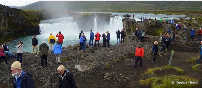
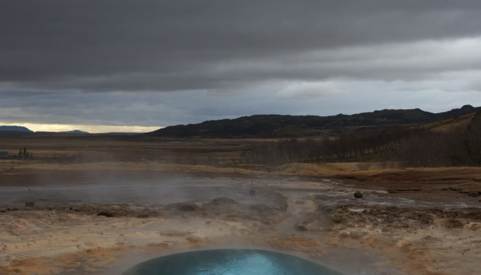
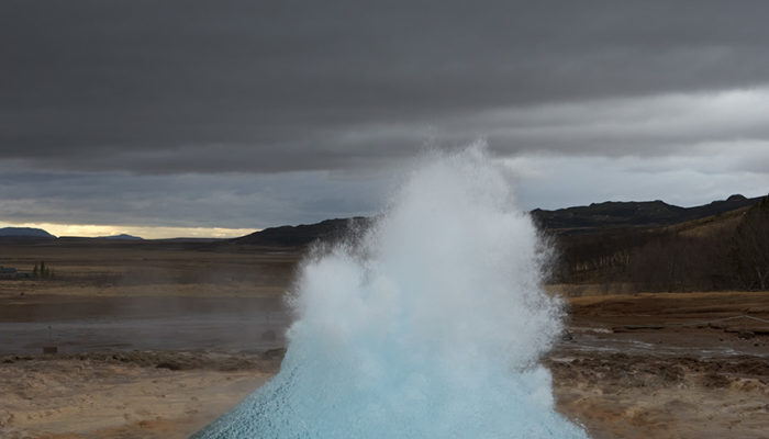
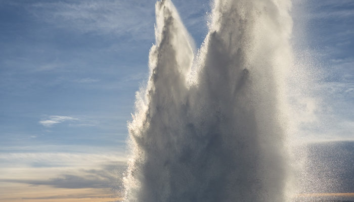
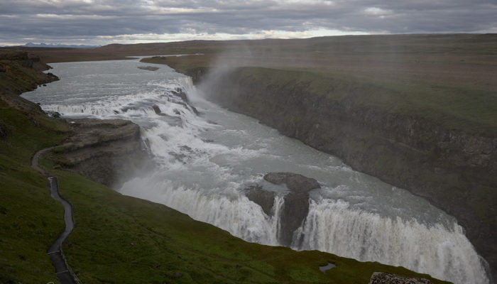
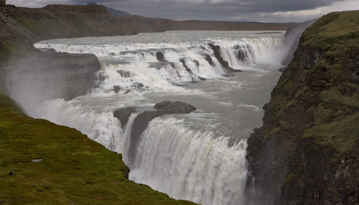
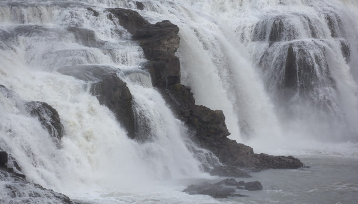
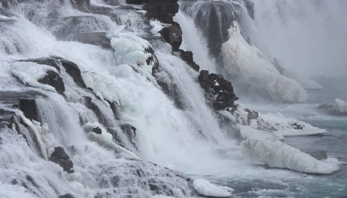
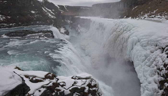
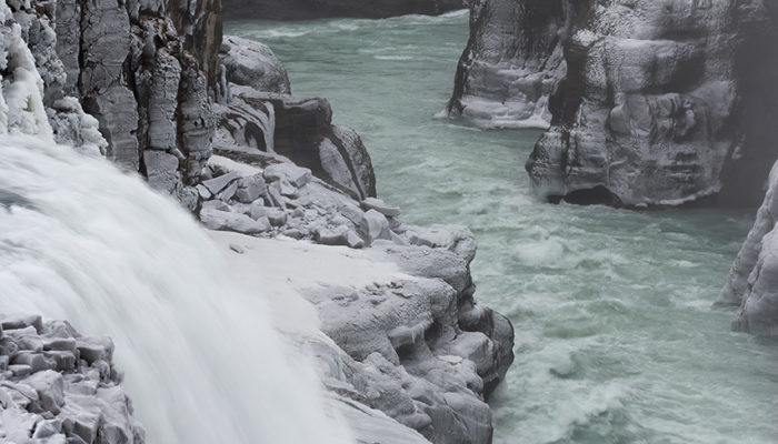
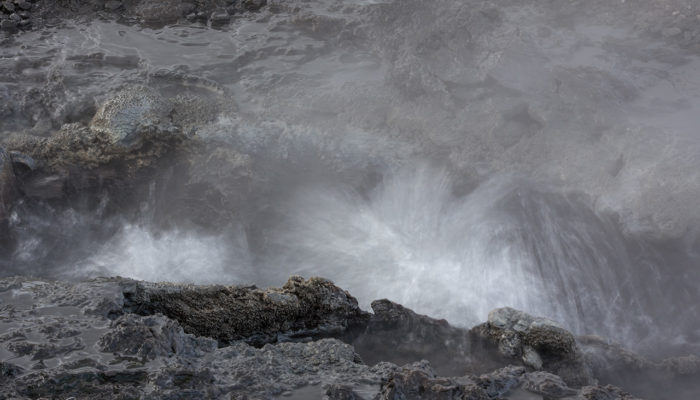
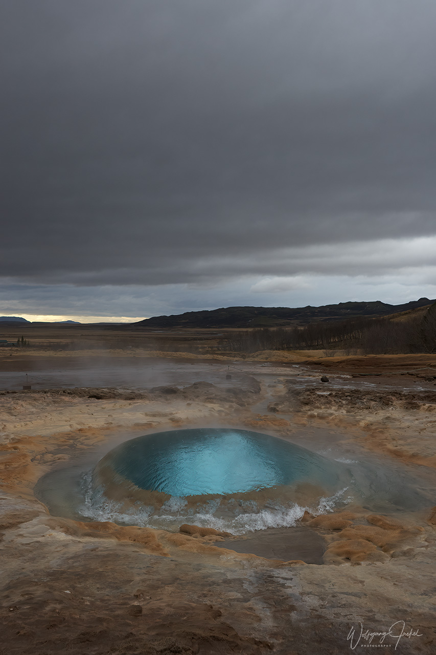
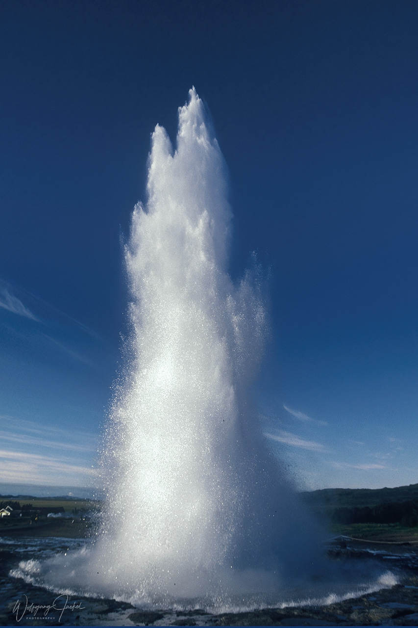
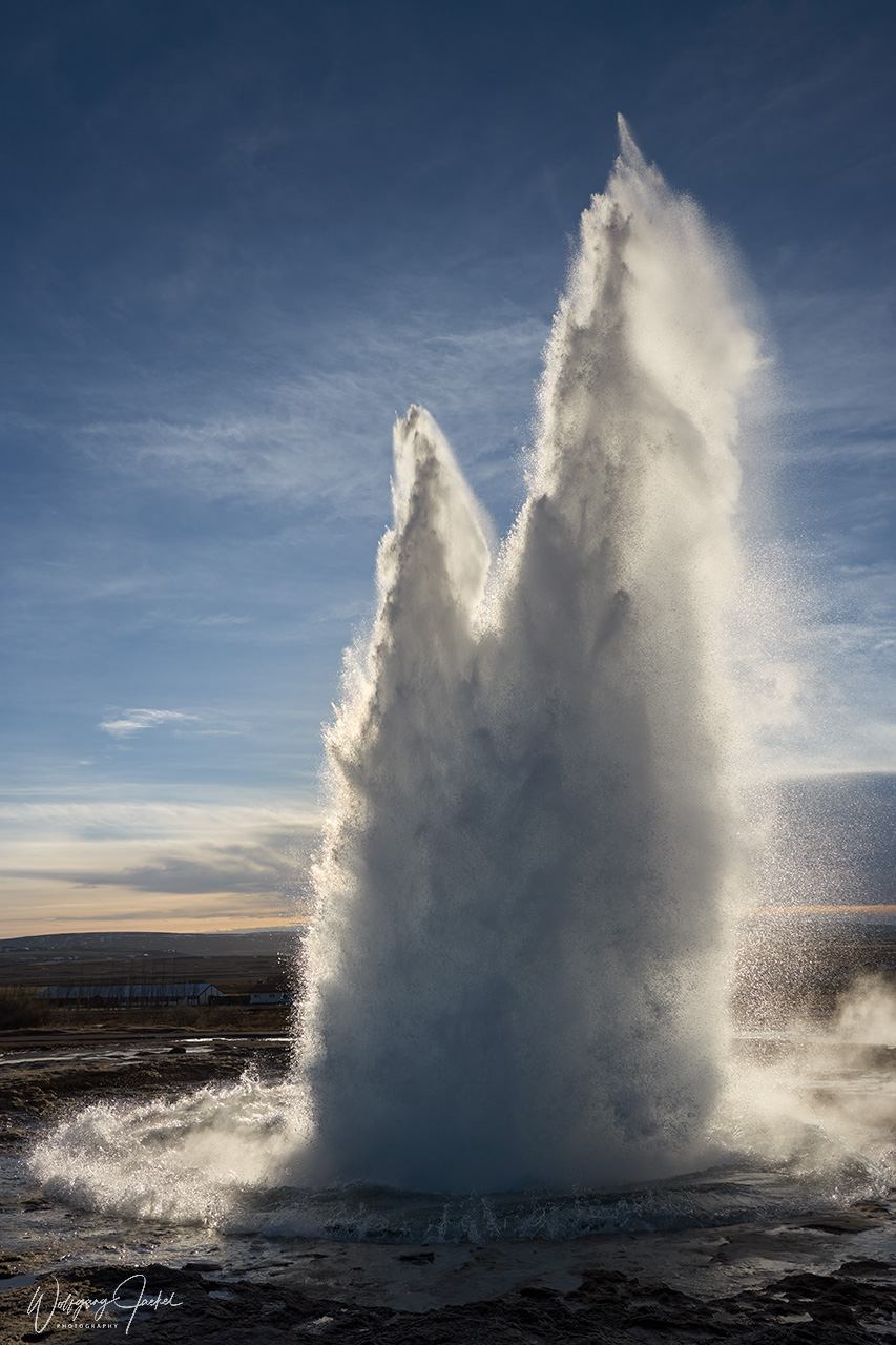
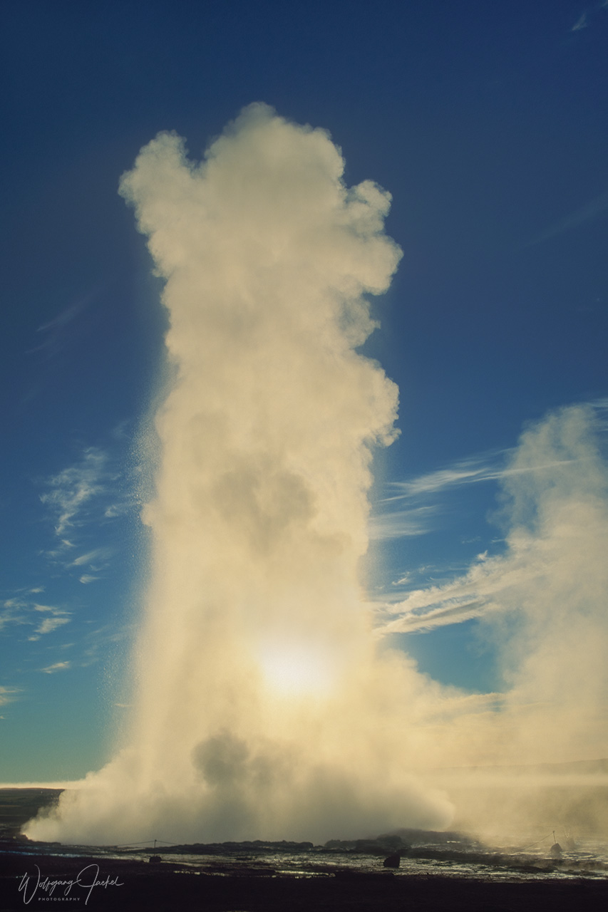
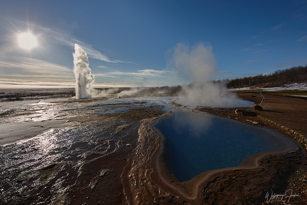
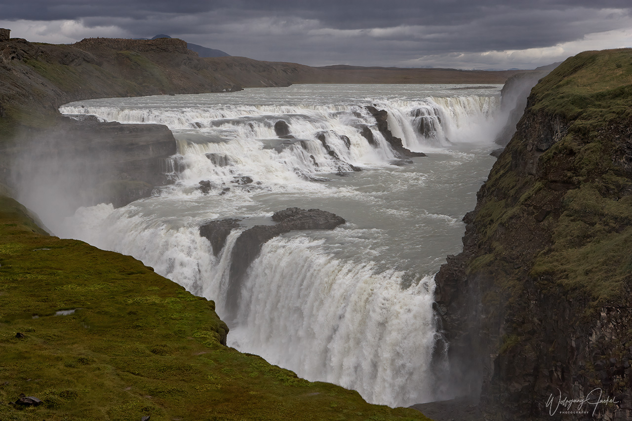
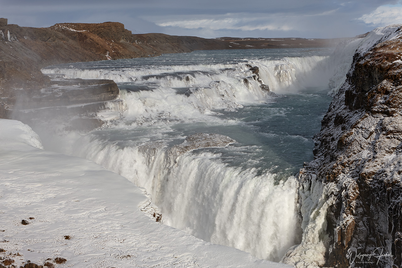
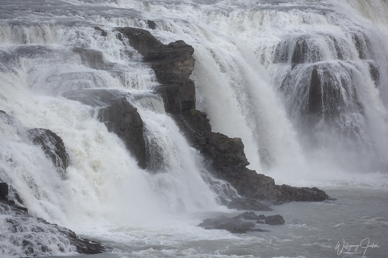
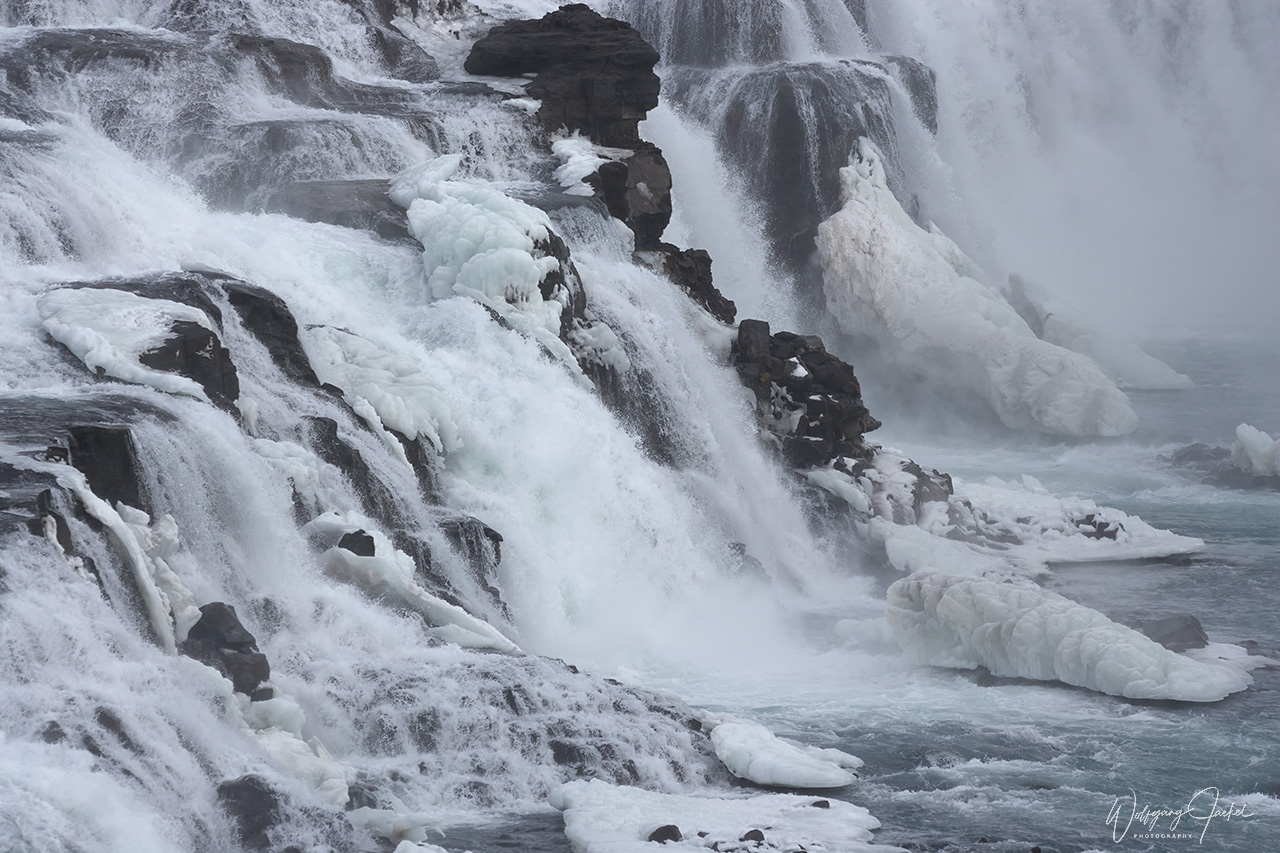
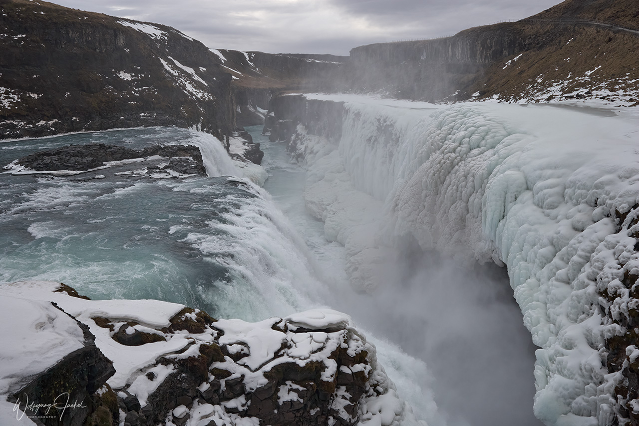
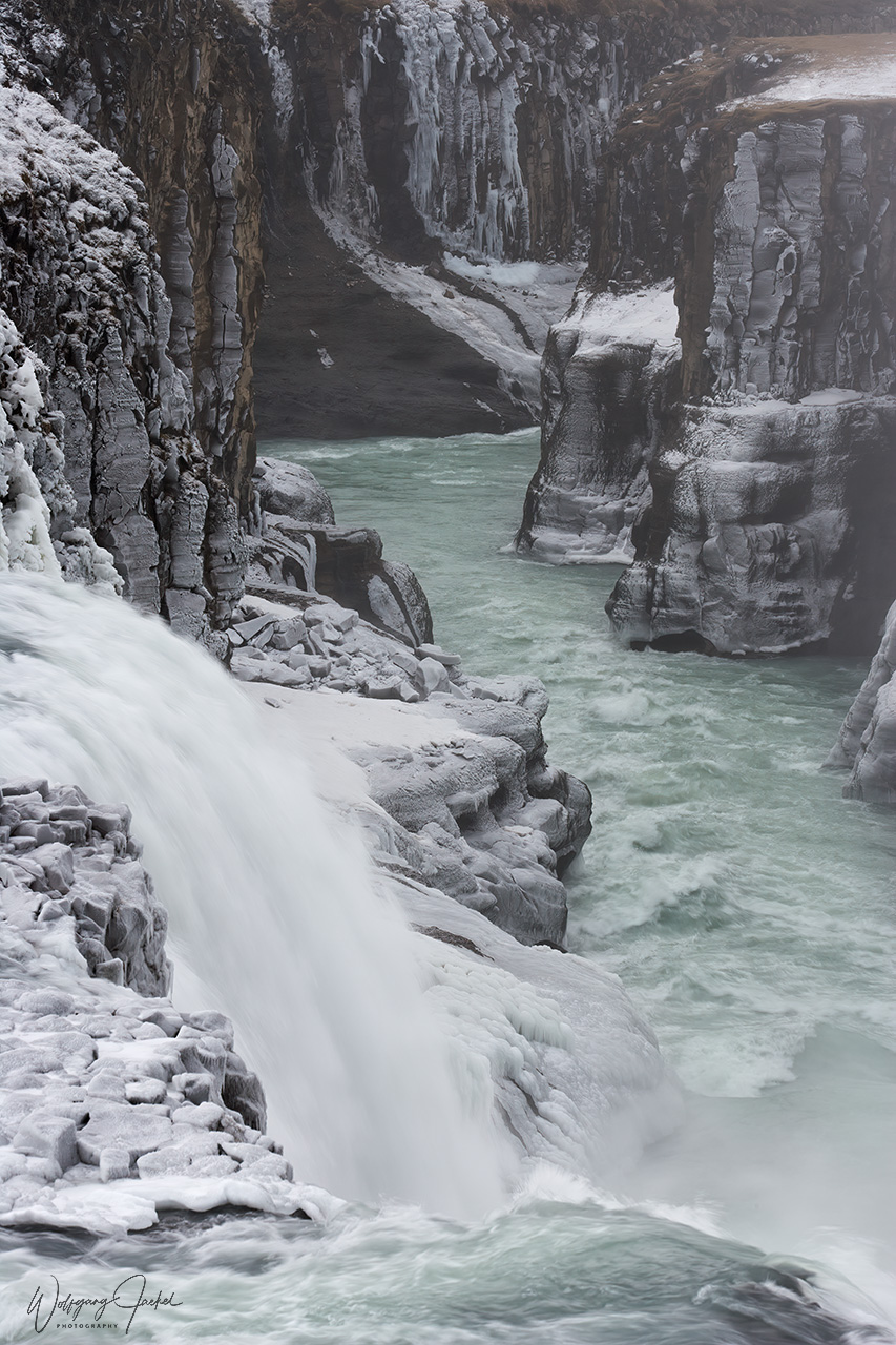
The iconic Gullfoss waterfall is a favorite attraction because of its impressive scale and beauty.The Strokkur Geyser which is located within short driving distance from the Gullfoss, reliably erupts around every 10 minutes with a fountain 20 to 40m high. The much larger Great Geysir close by which gave all others their name and has blasted much higher (around 122m) than Strokkur has been mostly dormant in the past decades
We had visited those three “must-see” attractions many times. But since busloads of tourists are flooding the region nowadays, the scenery has become somewhat less enjoyable for serious photographers.
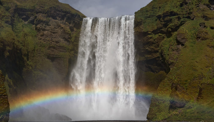
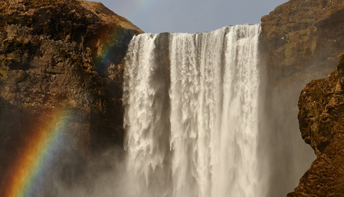
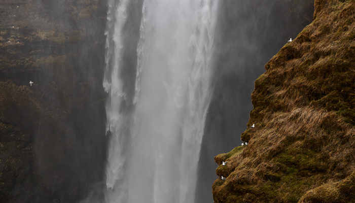
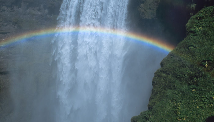
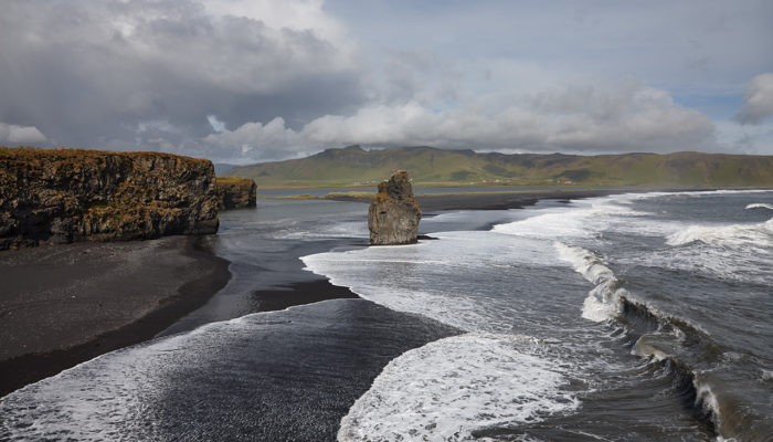
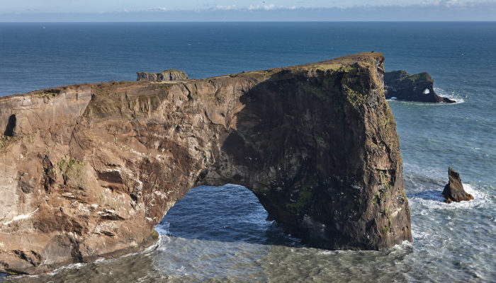
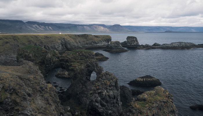
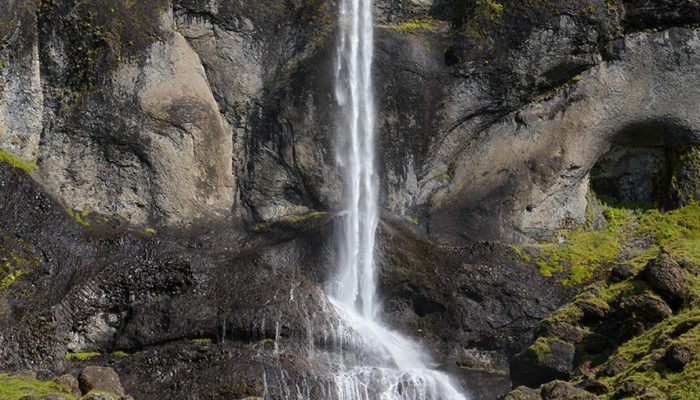
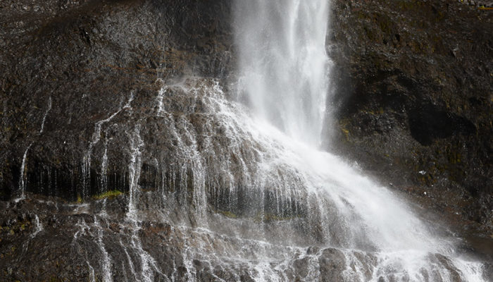
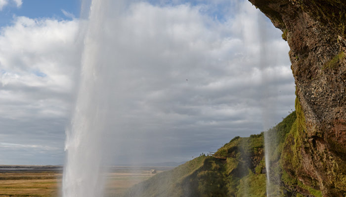
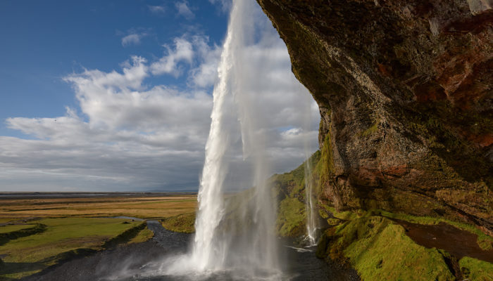
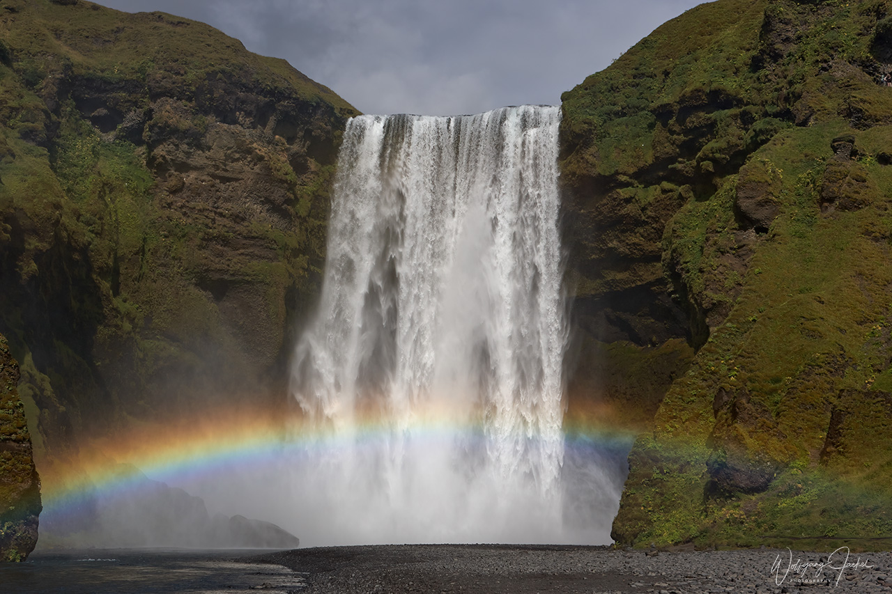
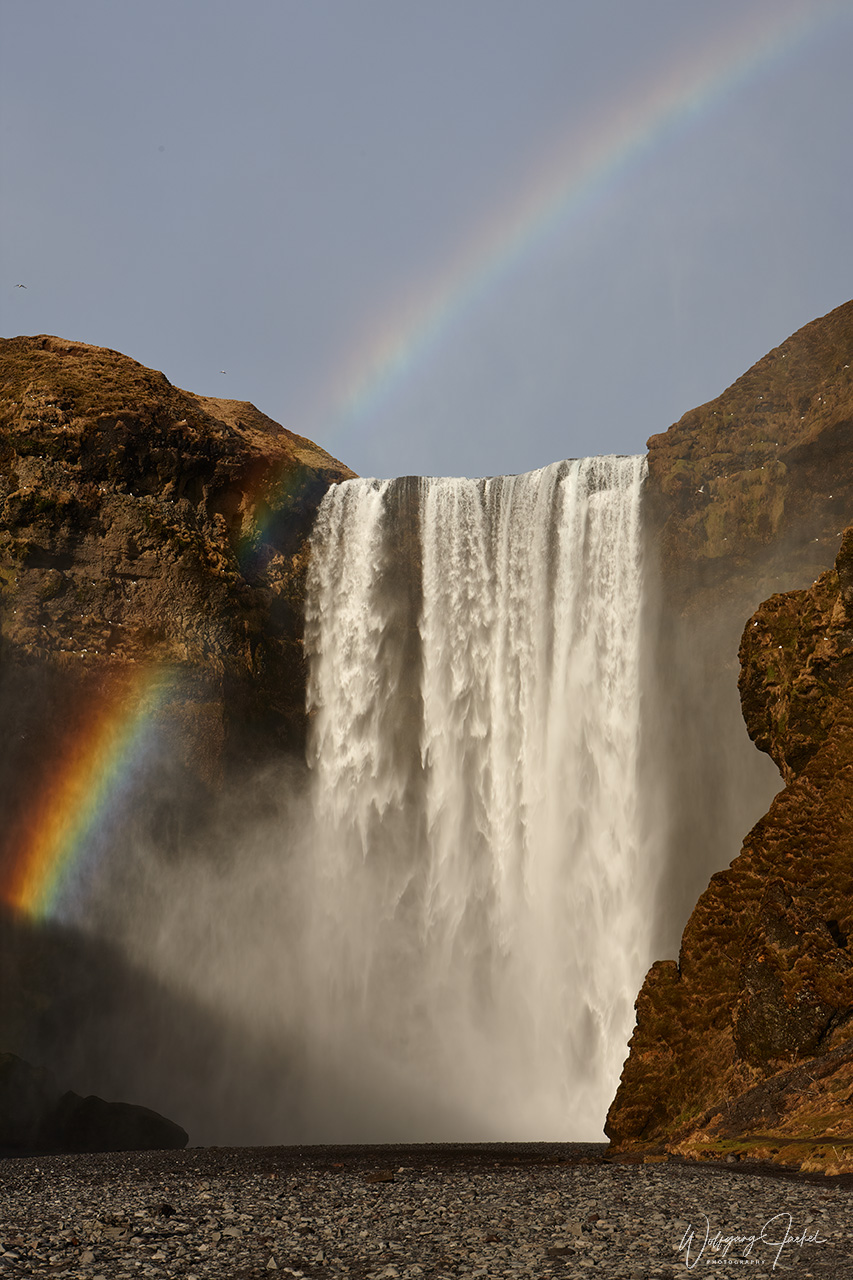
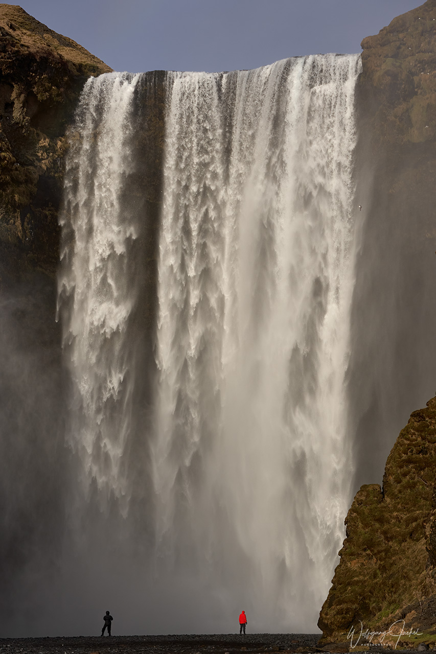
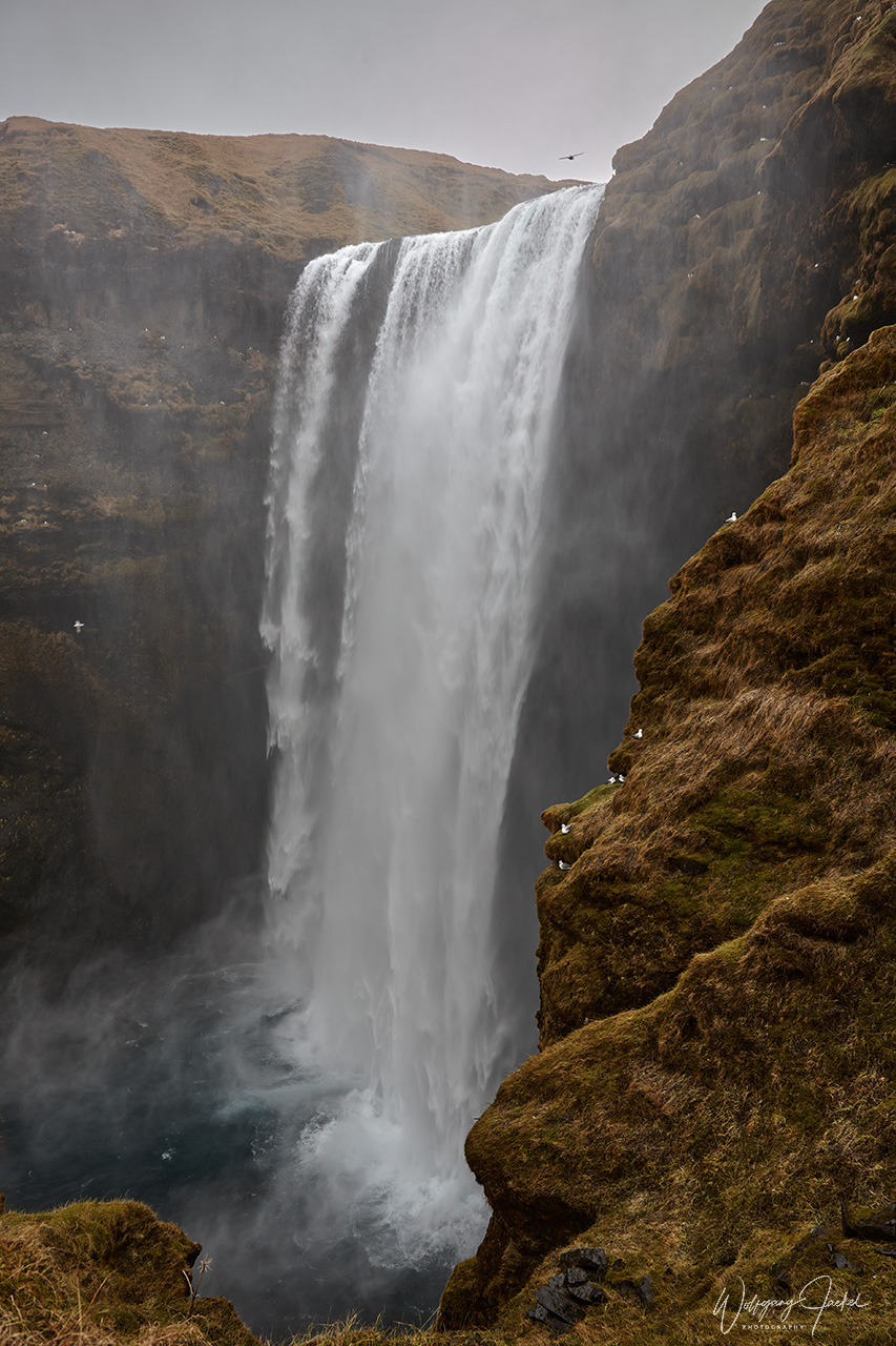
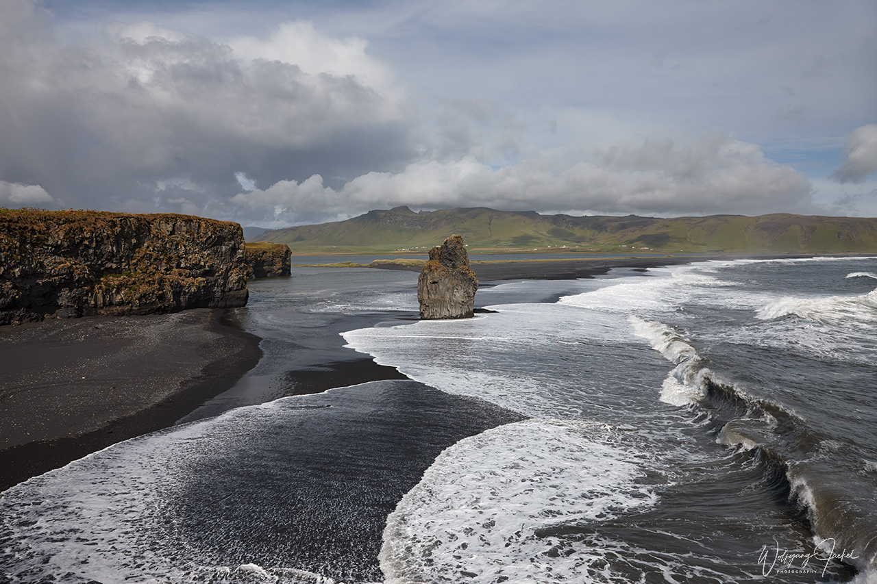
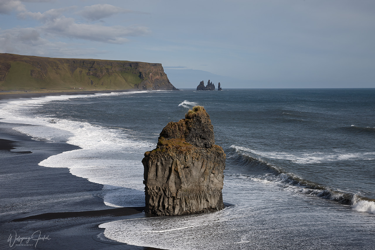
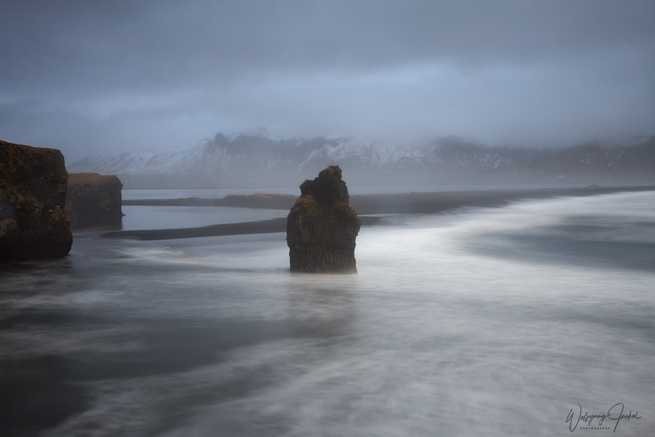
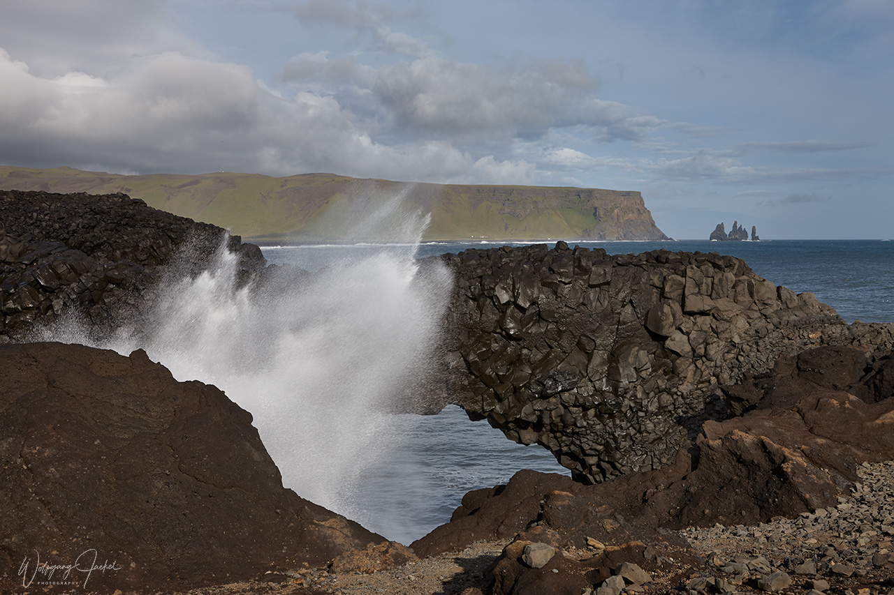
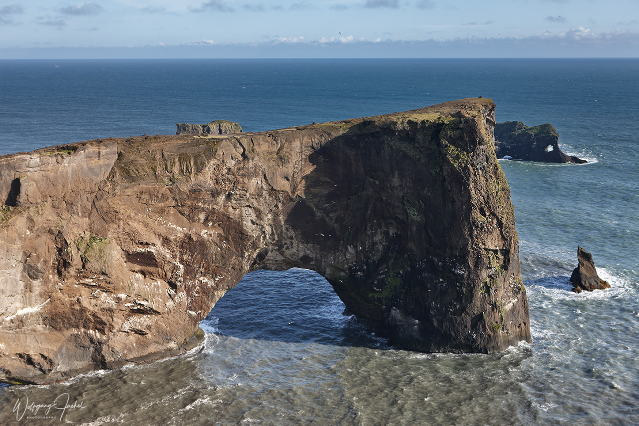
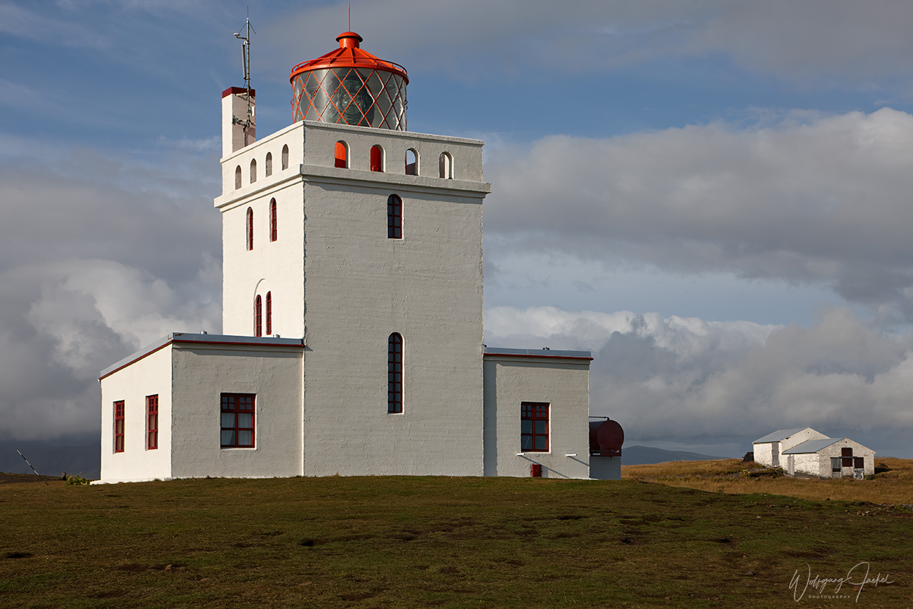
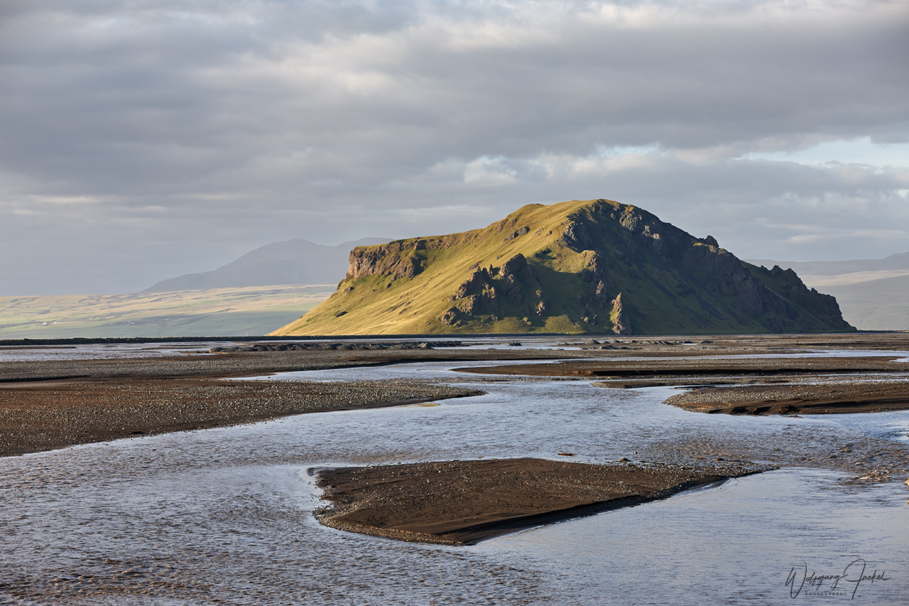
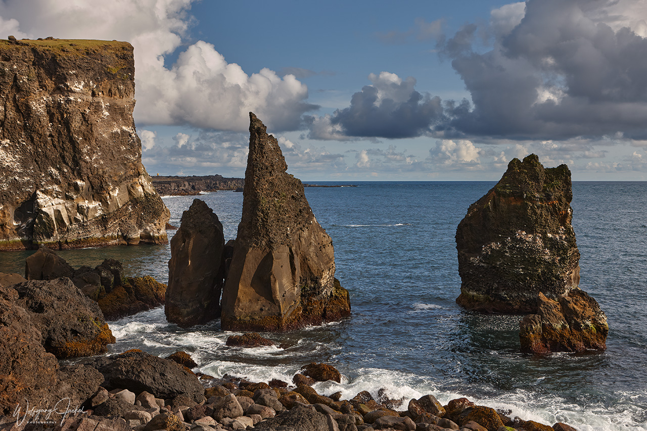
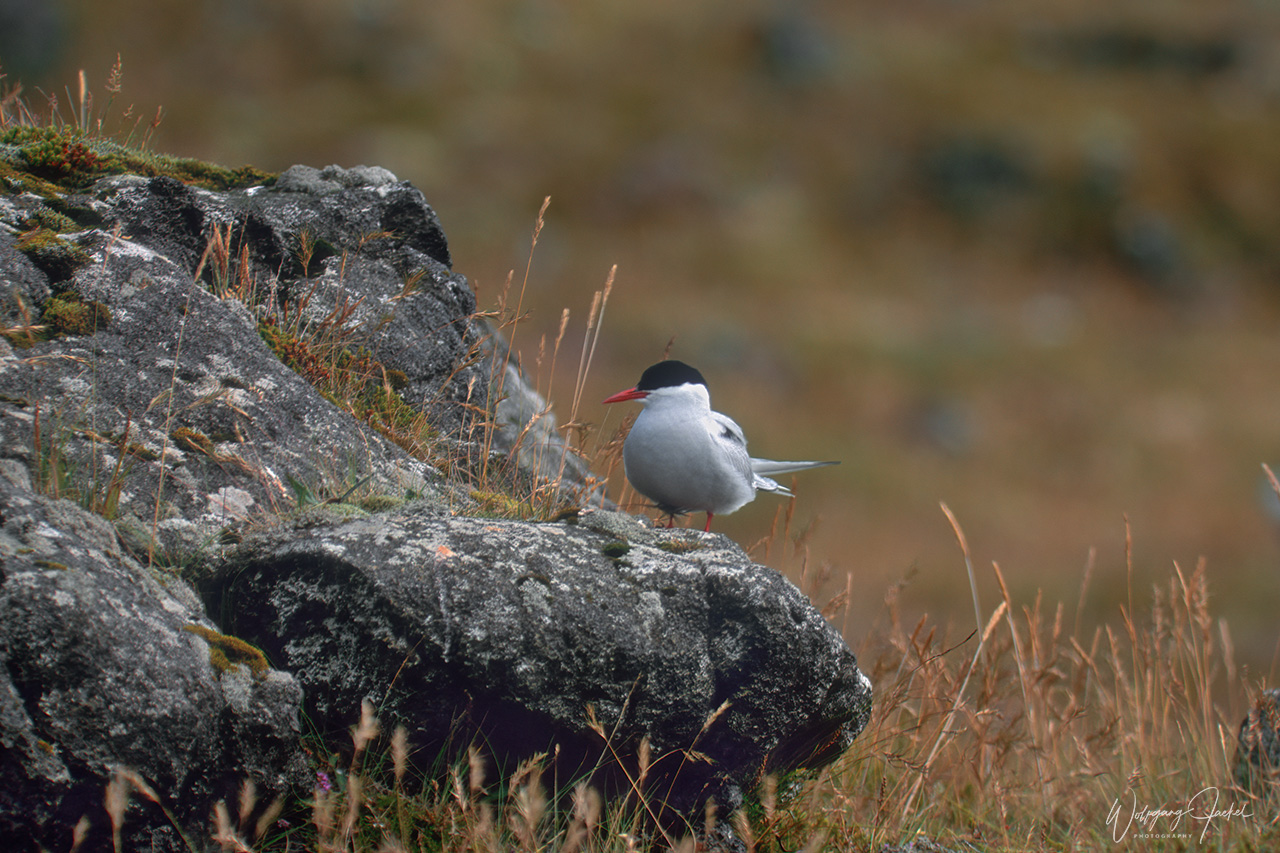
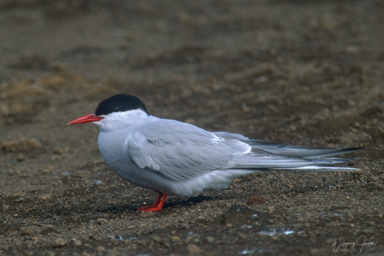
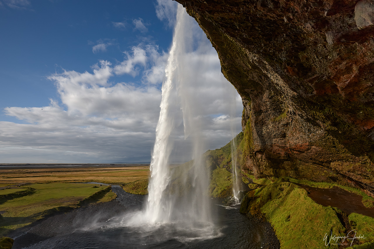
Driving from Reykjavik southeast along the Ring Road you reach the famous and photogenic Seljalandsfoss and Skógafoss waterfalls. After passing the glaciers Mýrdalsjökull and Eyjafjallajökull with volcanoes beneath them, the dramatic cliffs of the Dyrhólaey rock arch are the next attraction. This promontory, which is a former island, can be reached via a short detour from Route 1 to the coast. During the nesting season of puffins, arctic terns, fulmars and other seabirds, Dyrhólaey has limited access, though. On top of the higher area there’s a breathtaking view to all directions: – on the huge black arch of lava reaching out into the sea in front, the endless black coastline to the west and the Mýrdalsjökull glacier to the north. Specifically from the lower of the two viewpoints, there’s also a stunning view on the black sands of Reynisfjara Beach, and Arnardrangur rock to the east, with the black lava seastacks Reynisdrangar in the background. The name Arnardrangur rock (“Eagle Rock”), refers to the eagles formerly nesting in the rock but they haven’t nested there since 1850.
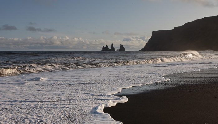
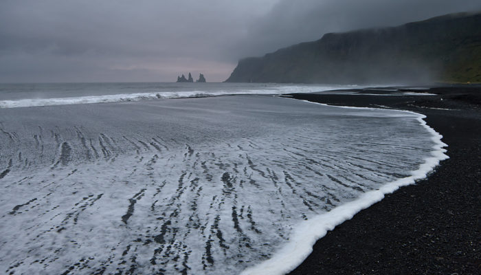
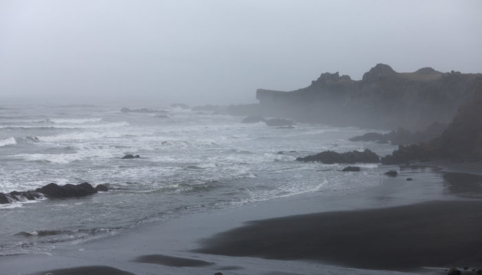
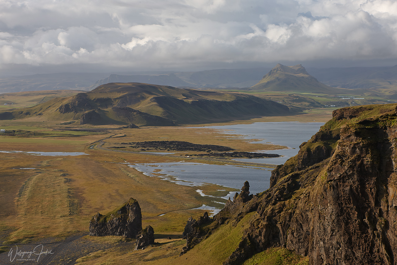
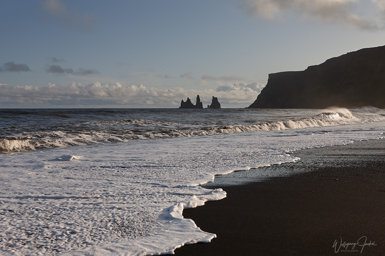
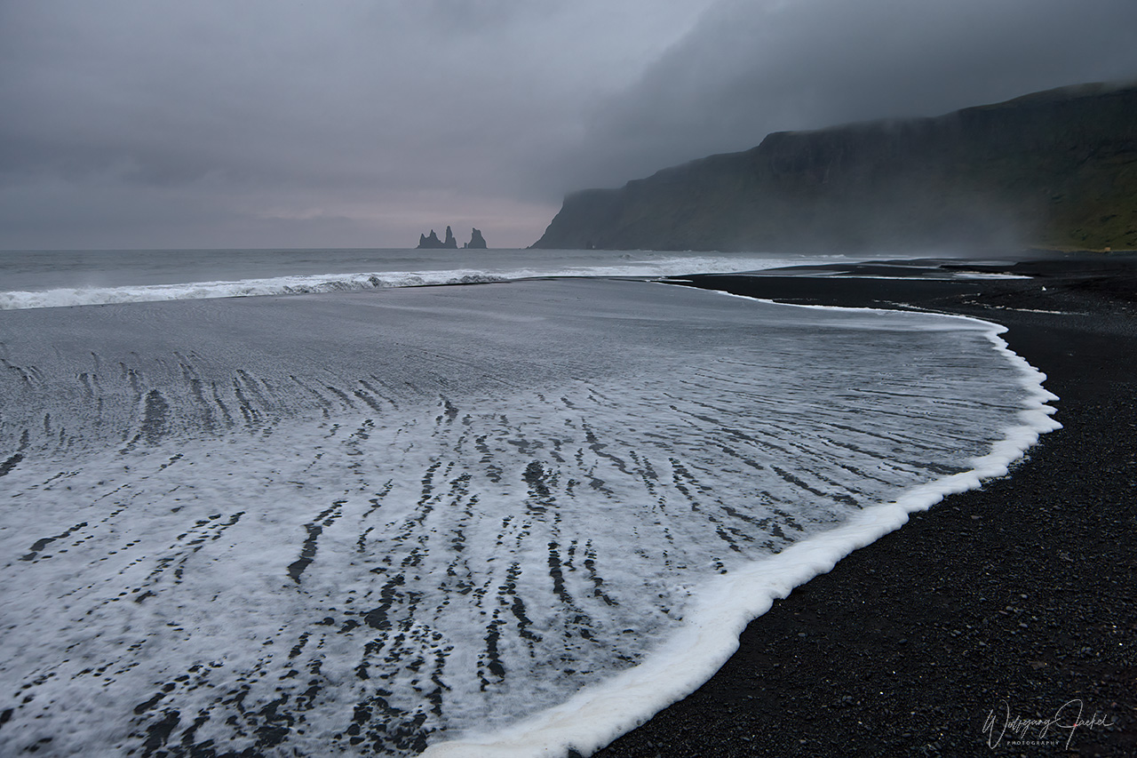
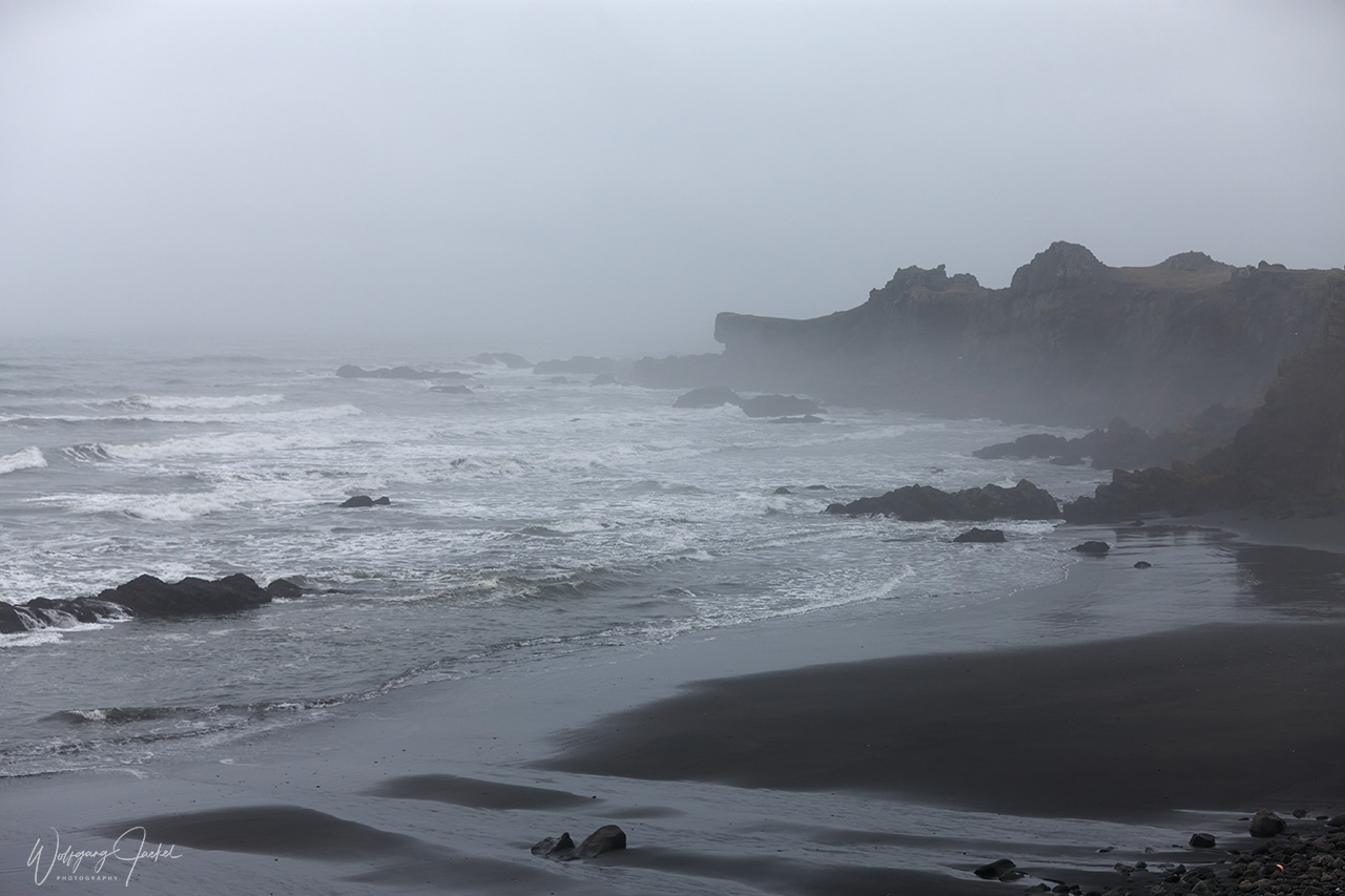
A few kilometres east of Dyrholaey on the main ring Road you reach Vík í Mýrdal, the southernmost sea front village where I could take nice pictures of the Black Sand Beach and the Reynisdrangar offshore rock formations.
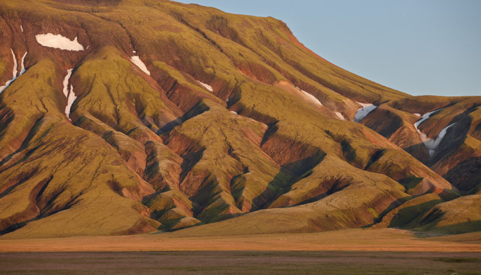
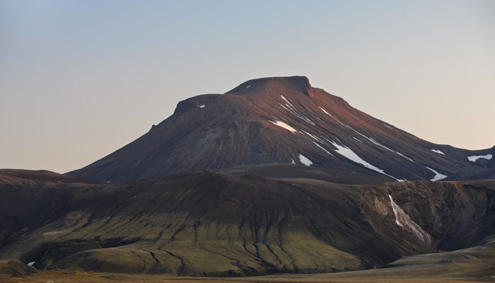
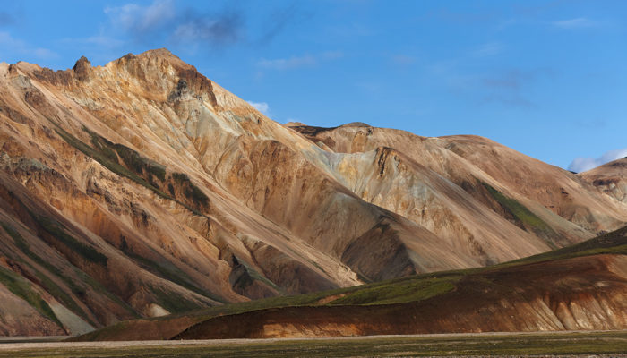
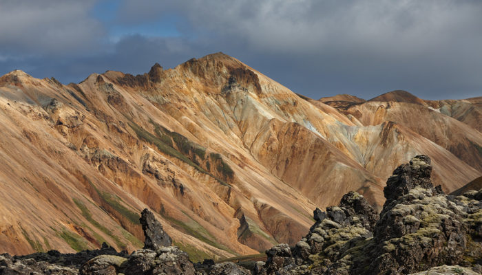
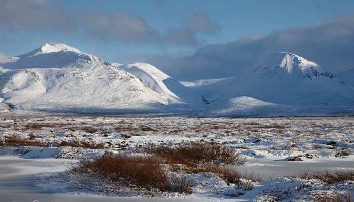
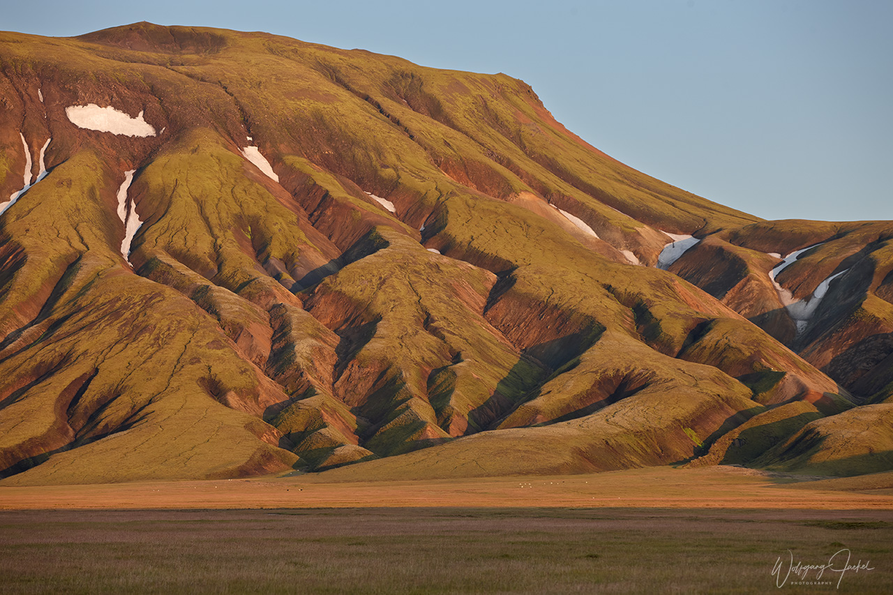
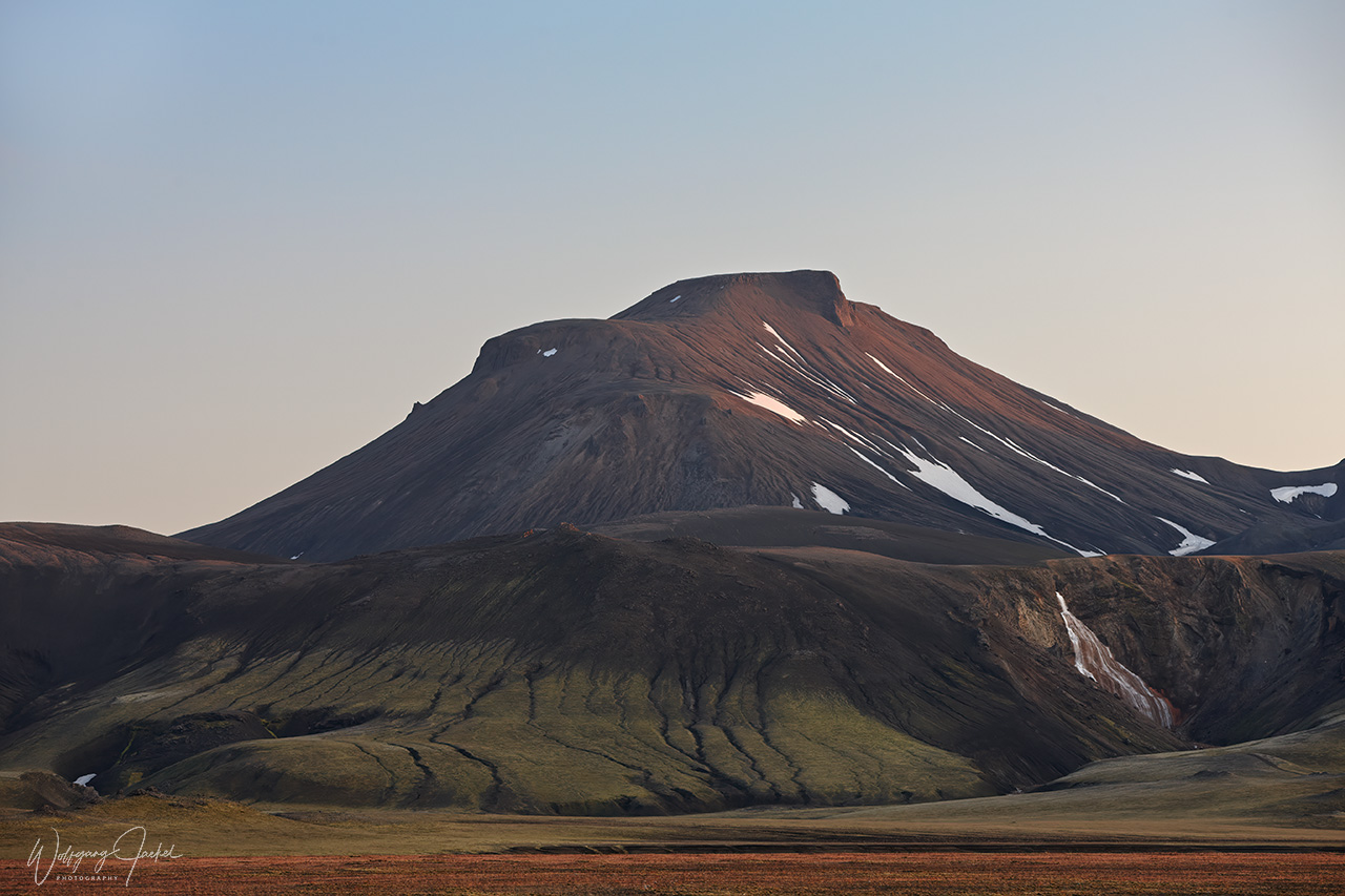
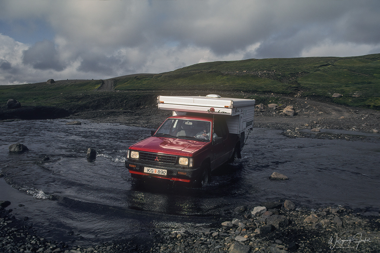
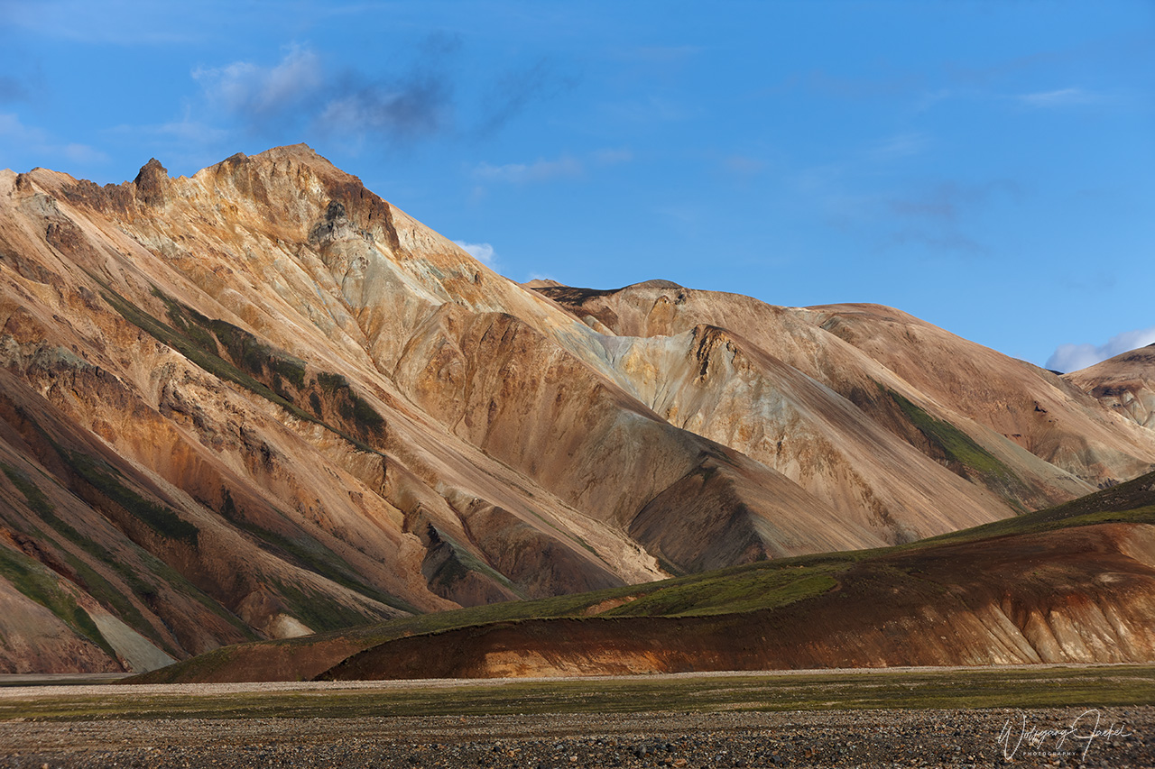
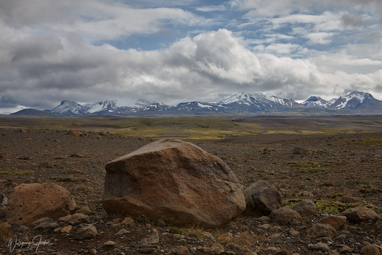
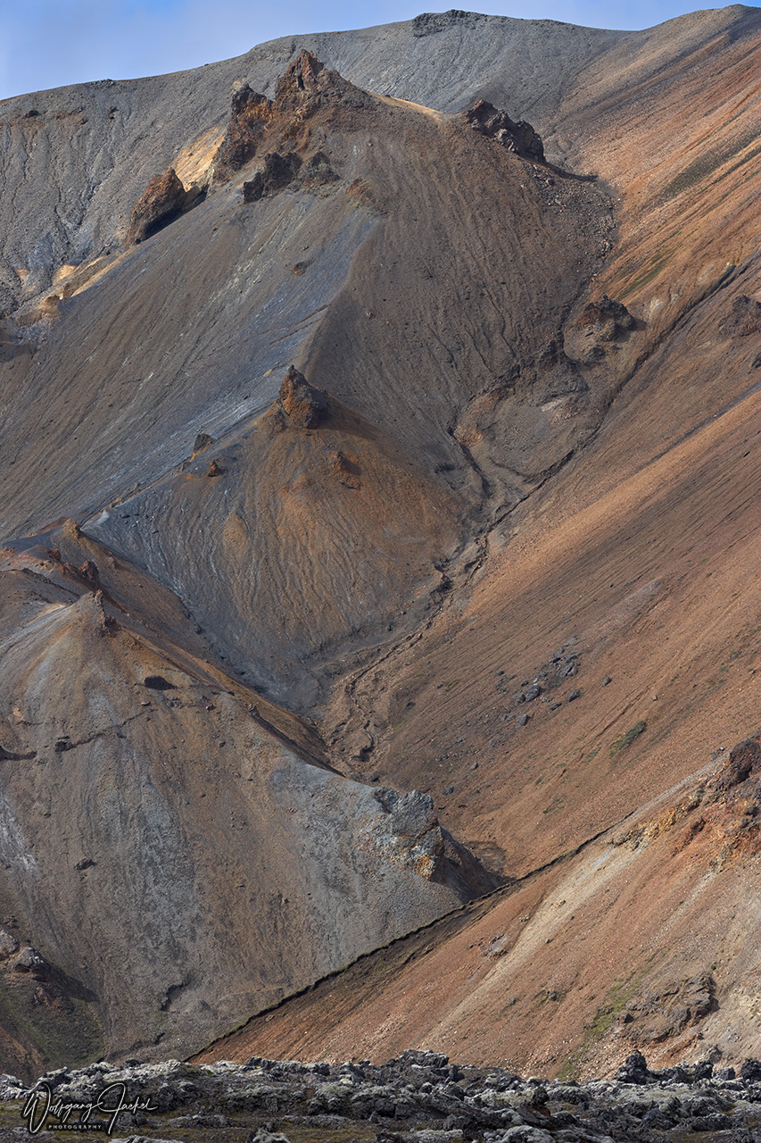
On one of the summer tours we made a 2days side trip inland to Landmannalaugar, located in the heart of the southern Highlands near the Hekla volcano.The road branching off east of Vik is mostly unpaved and bumpy with several river crossings required so that a suitable 4WD car is needed to get there. On the way you pass the impressive Eldgjá, or Fire Canyon, referring to a 40km long volcanic fissure, the longest in the world. However, by today the name usually refers to the 5km long and 600m wide middle part. Landmannalaugar is famous for its unique colorful rhyolite mountains flanking the geothermal area with natural baths, hence its name the “People’s Pools”. Many beautiful hikes offer stunning views of the rainbow-hued rocks and mountainous scenery of the South Highlands and make up for spectacular images.
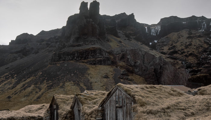
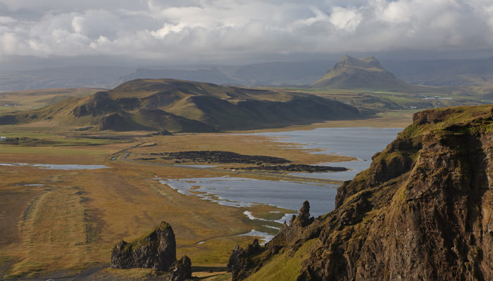
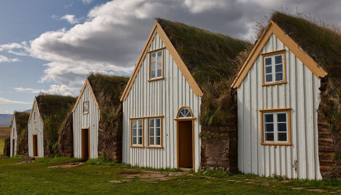
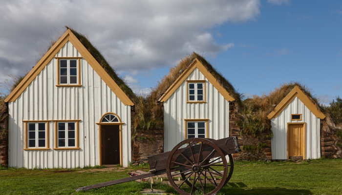
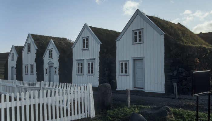
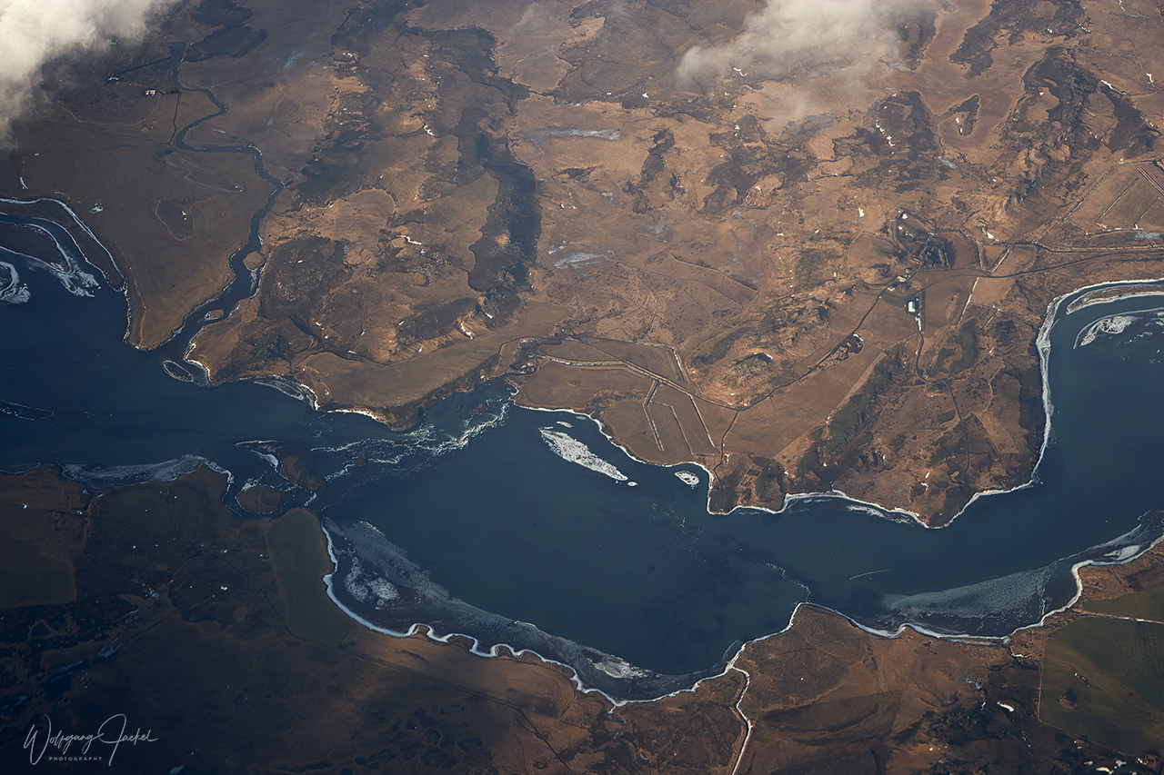
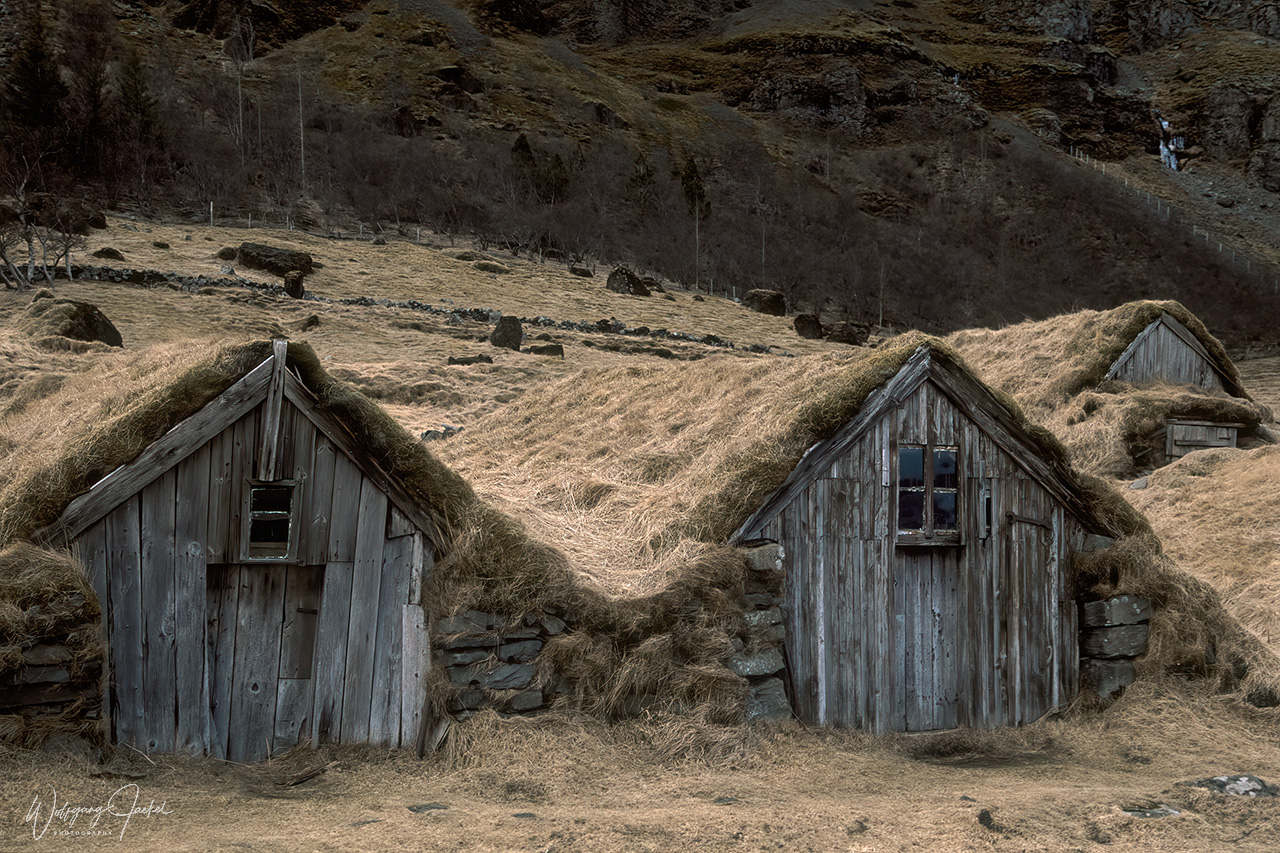
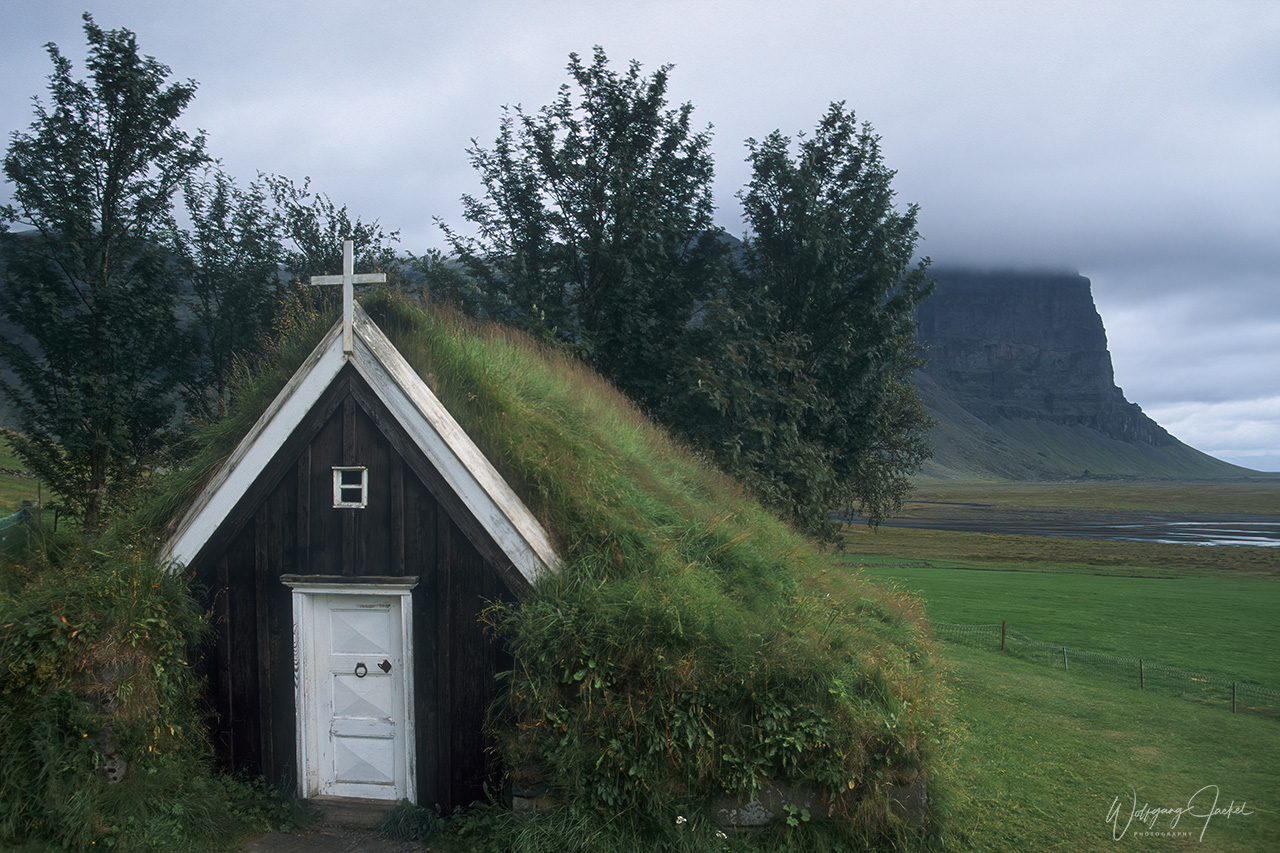
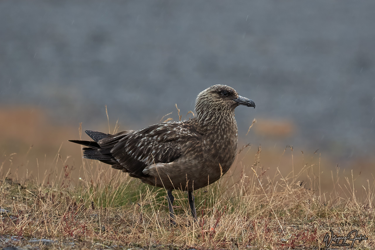
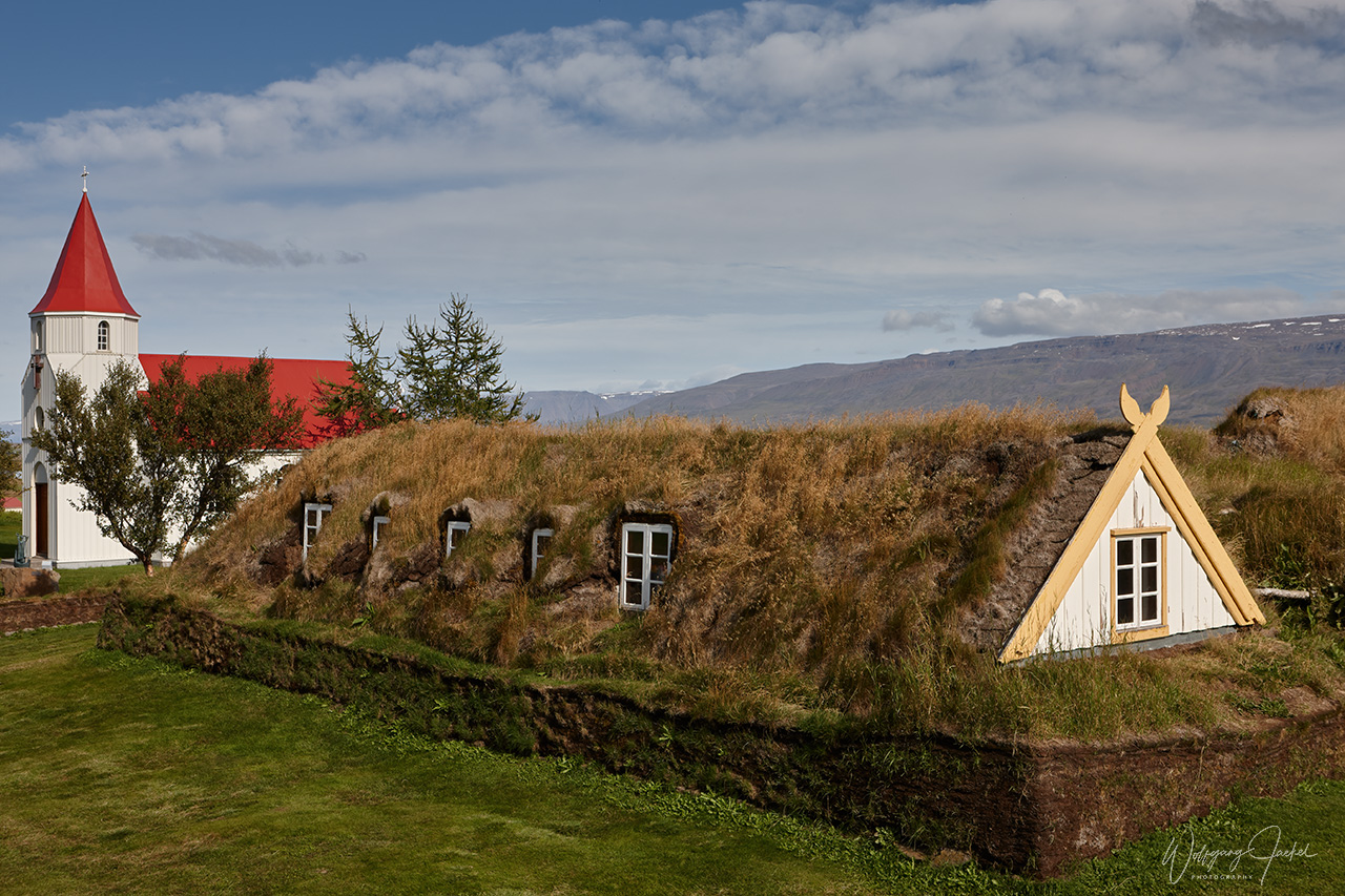
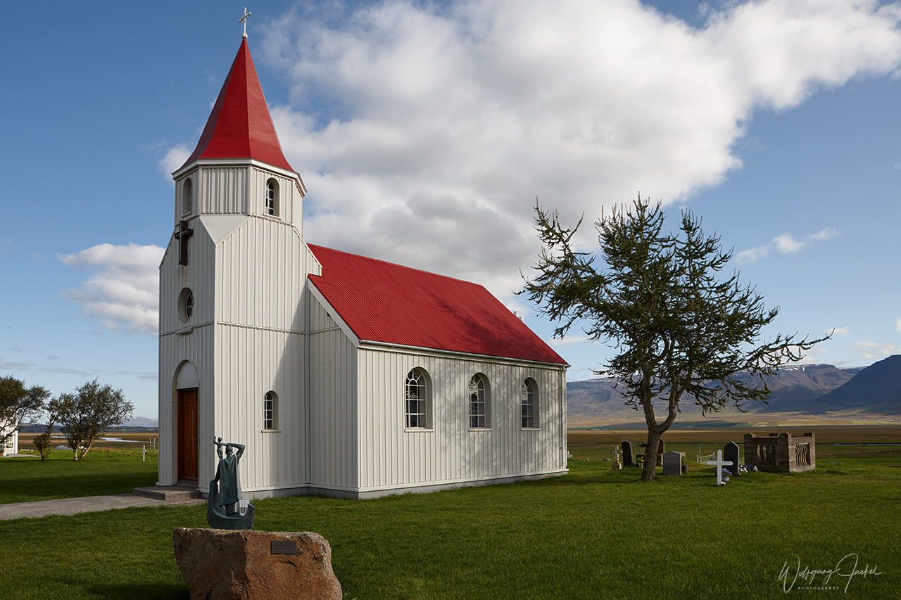
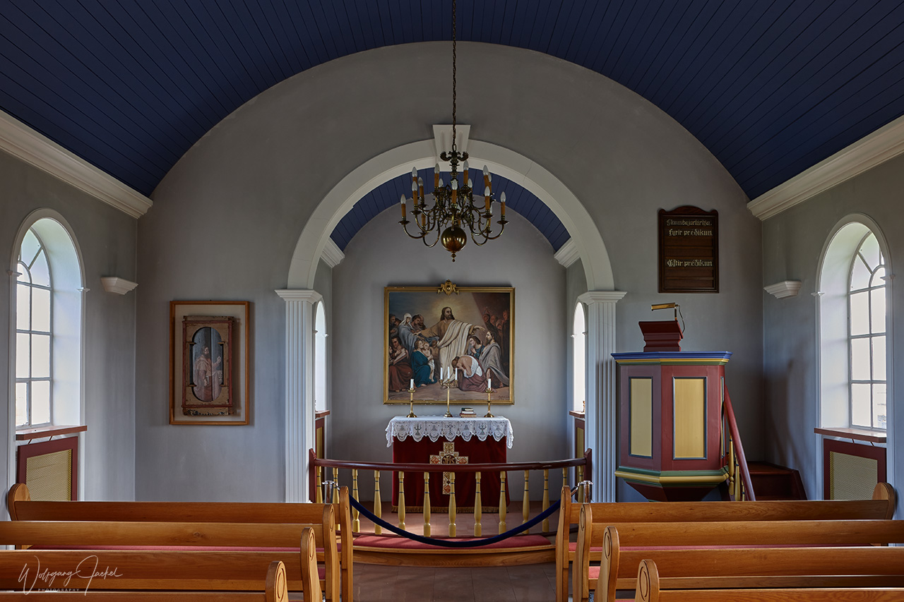
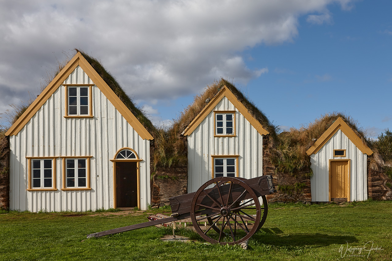
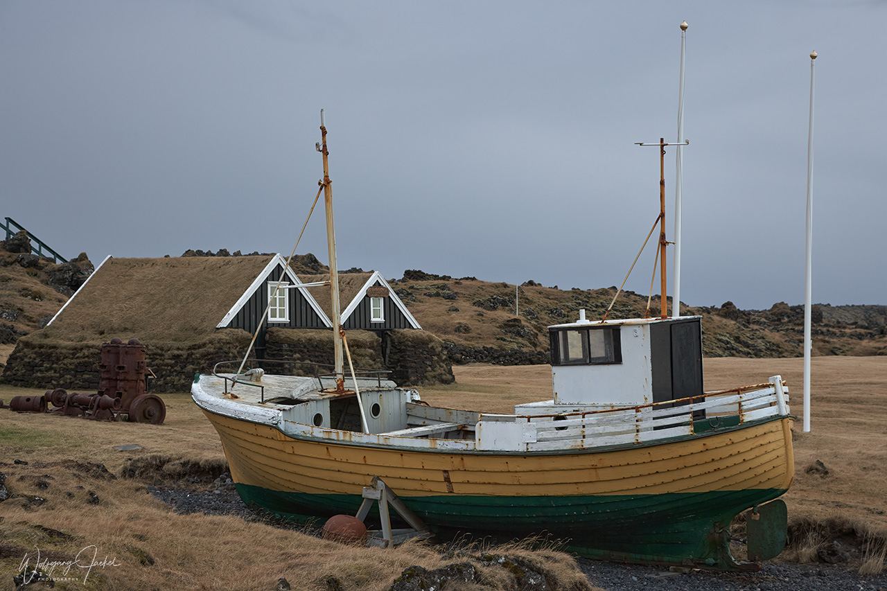
Following the ring road from Vik to the east you pass Skeiðarársandur, a vast sand plain, formed from alluvial deposits of gravel, sand and silt, that originate from several glacial bursts in consequence of eruptions under the Vatnajokull glacier 20-30km away, – with the latest outburst flood being in 2011. Sandur covers 1300 km² and a coastline of 56 km, making it the largest sand plain in the world. It’s also one of the largest nesting places for the Great Skua. On our first trip in 2000, we had also stopped west of Skeiðarársandur at Núpsstaður for a short view of the known turf church Núpsstaðakirkja that was built around 1650 and is closed to the public for preservation puposes now. In the proximity I photographed the historic turf houses of the old farm. Grass-roofed houses are part of Iceland’s heritage and had been used throughout 11 hundred years up to the 19th century.
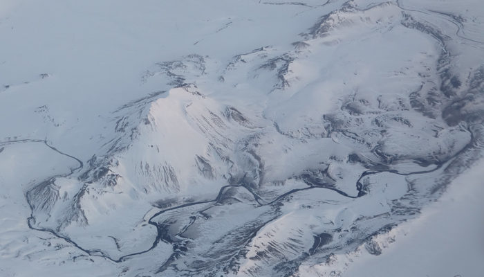
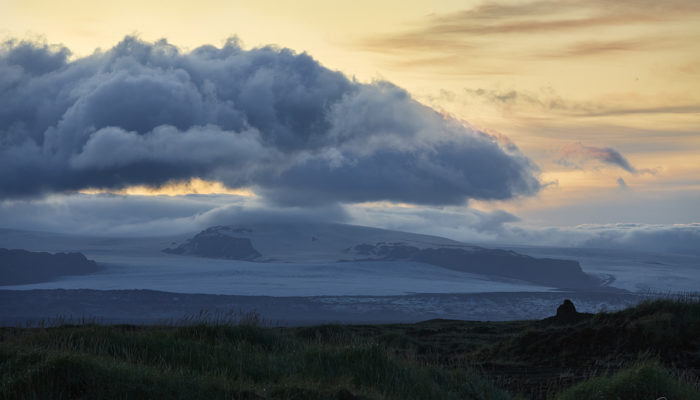
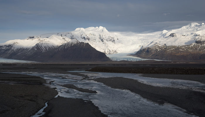
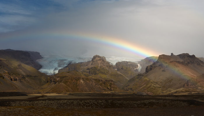
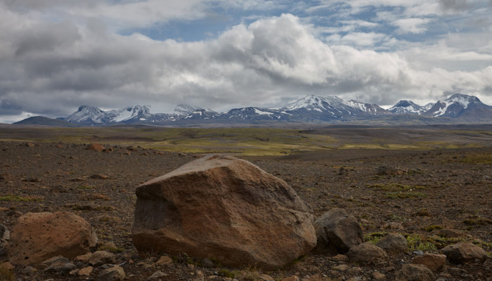
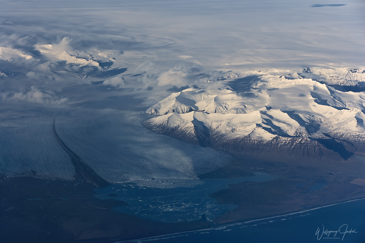
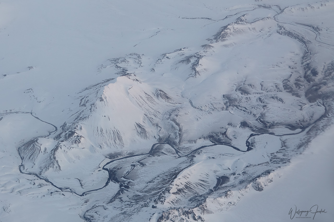
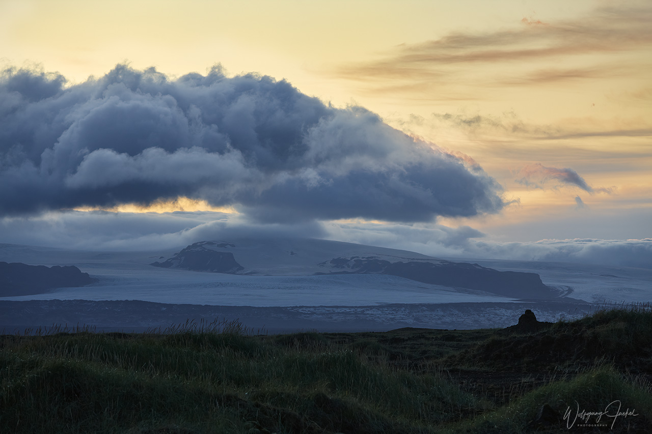
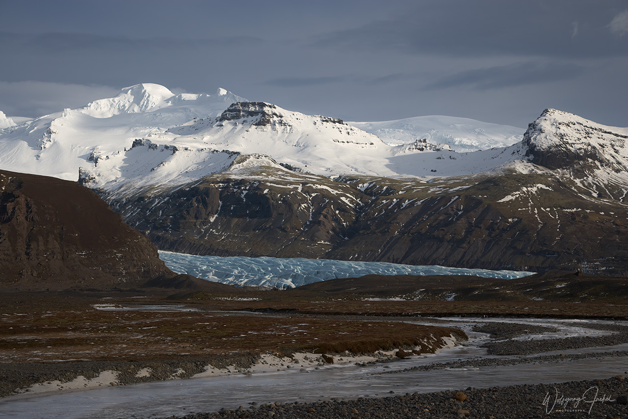
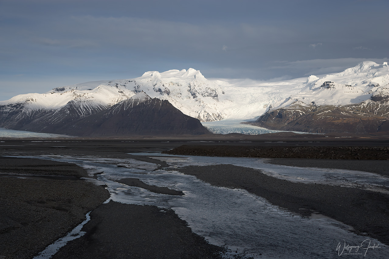
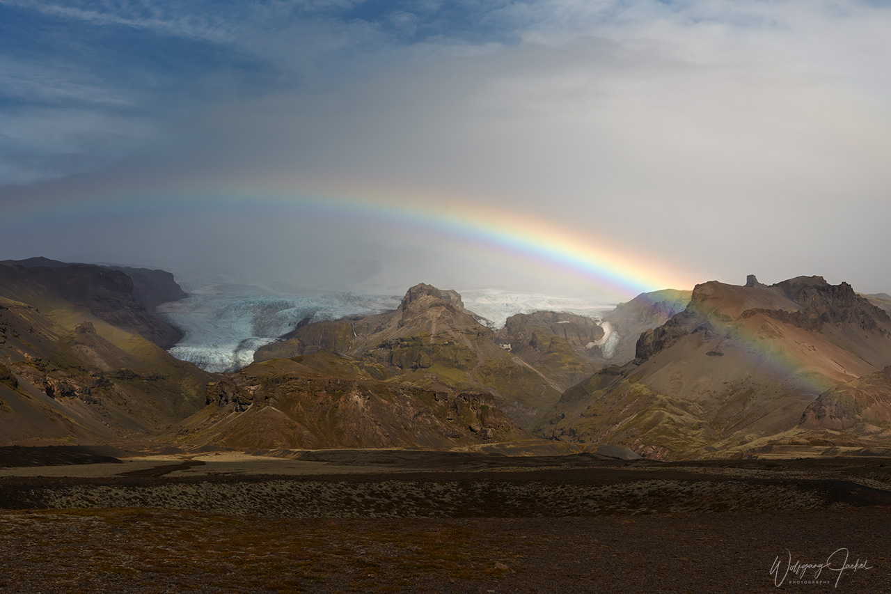
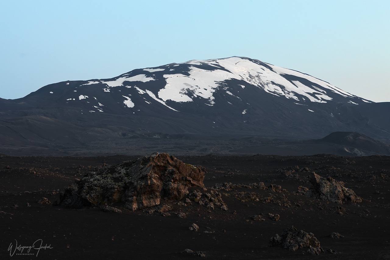
East of Sandur you reach the Skaftafell Reserve, a previous National Park which now is integrated into the much the larger Vatnajökull National Park, that was established in 2008.The landscape of Skaftafell reminds the High Alps with various glacial tongues that are flanked by jagged mountains. It is a known “hiker’s paradise”, offering lots of scenic trails, dramatic landmarks and outlet glaciers of Vatnajökull, Europe’s largest glacier outside the arctic. Its surface area amounts to 7900 sq.km covering 8% of Iceland. On average ice thickness measures 400–600m and at the most 950m (all data as of 2016). However, the Vatnajökull ice cap thins and retreats as almost all glaciers on the planet due to the climate change. There are several volcanoes under the ice cap with Bárðarbunga being the largest one, that had erupted in 2014.
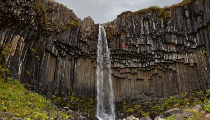
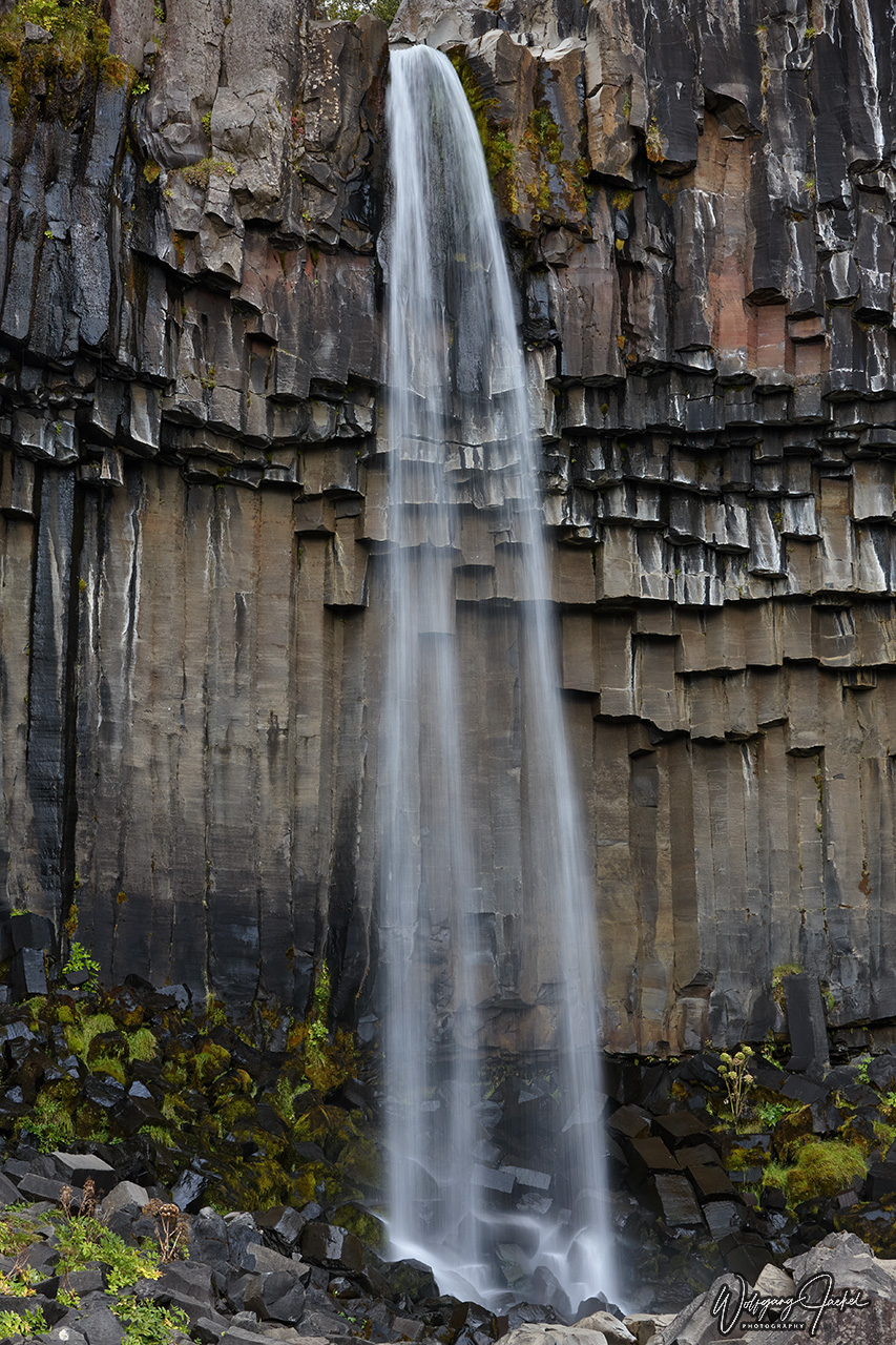
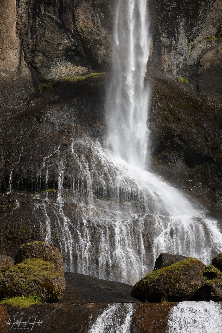
We didn’t hike in the Skaftafell area except to the photogenic Svartifoss waterfall. Though there’s just a small stream of water coming down, the unique array of black volcanic basalt columns inspired the design for the Hallgrimskirkja church in Reykjavík.
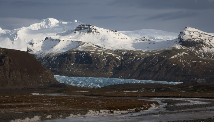
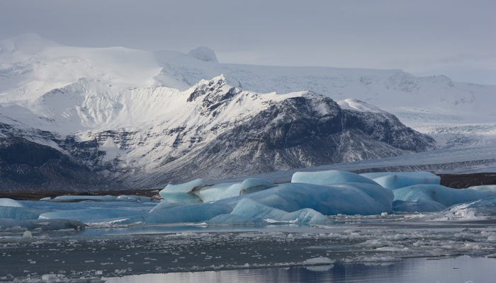
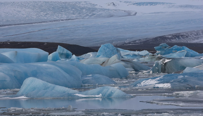
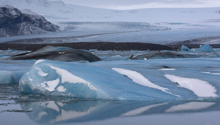
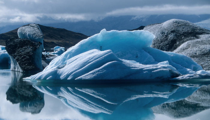
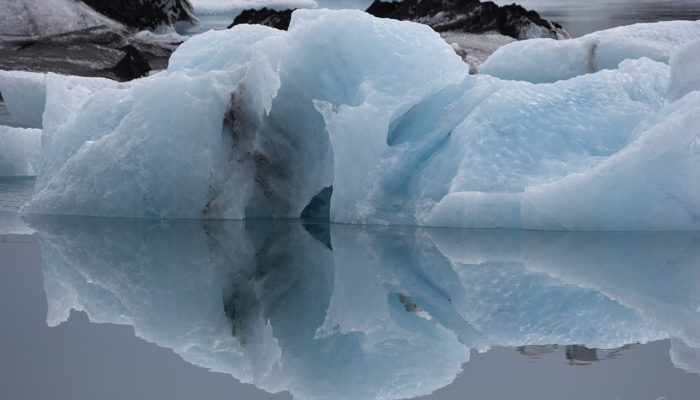
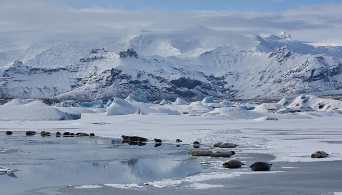
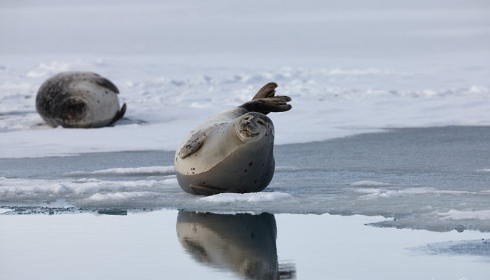
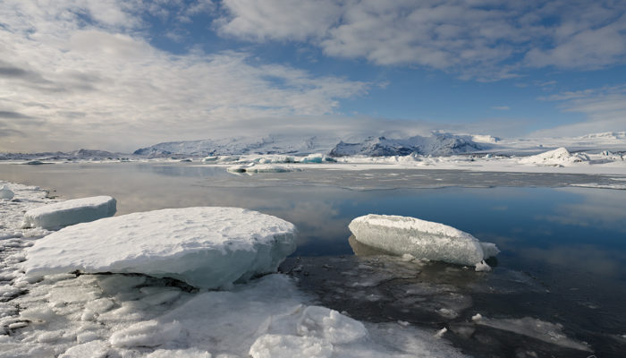
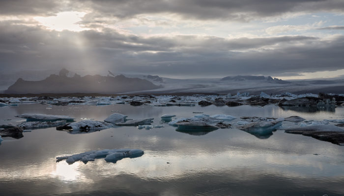
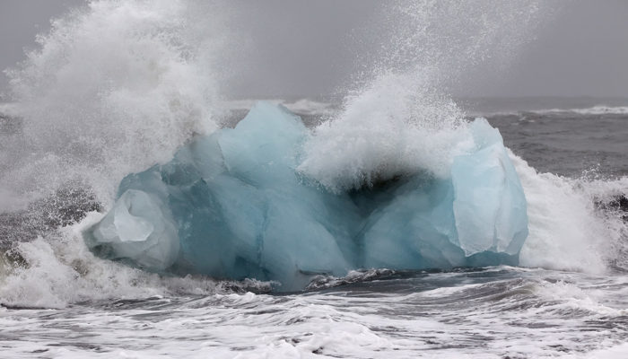
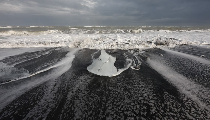
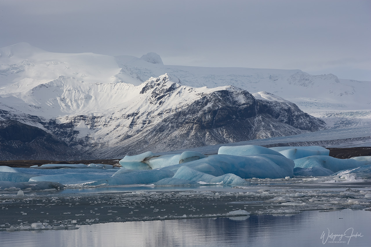
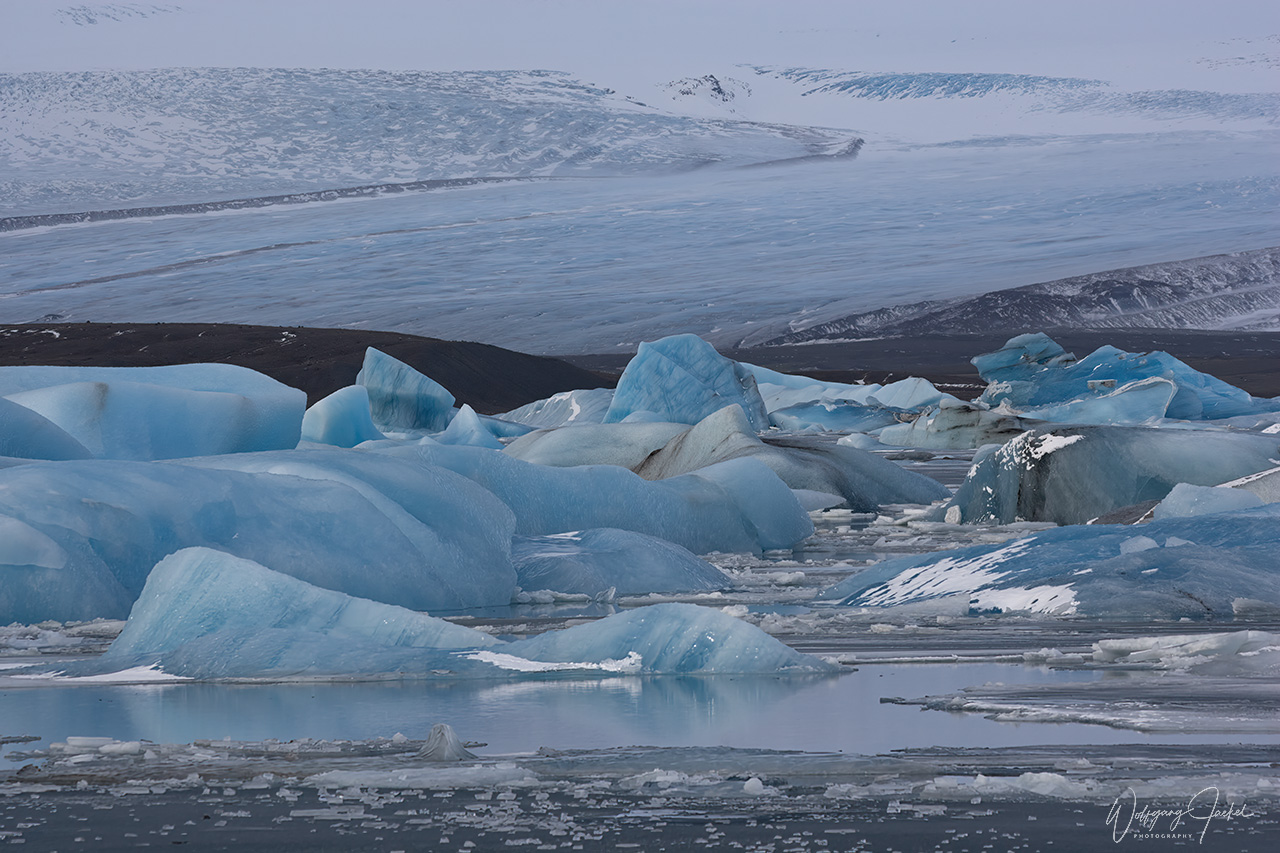
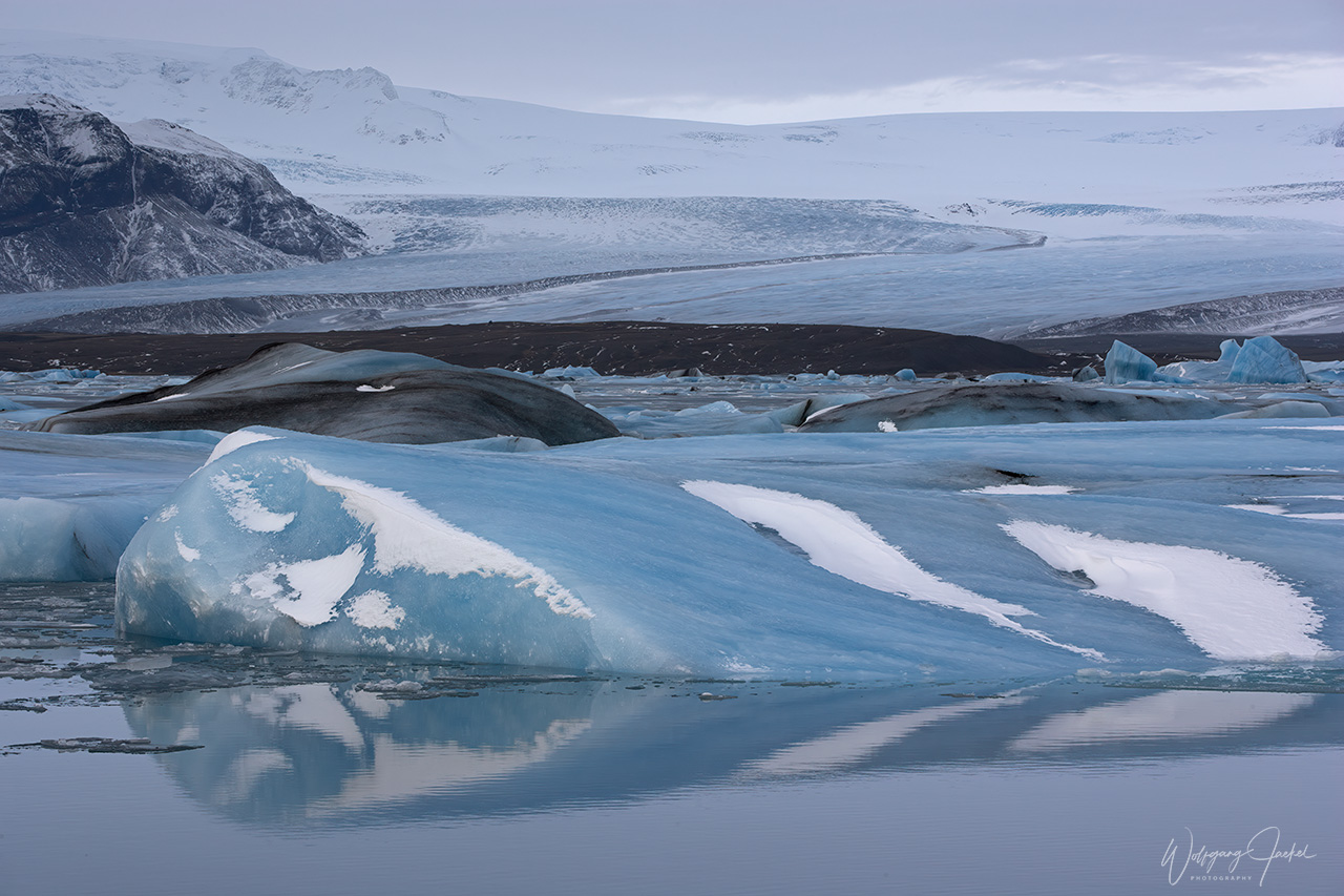
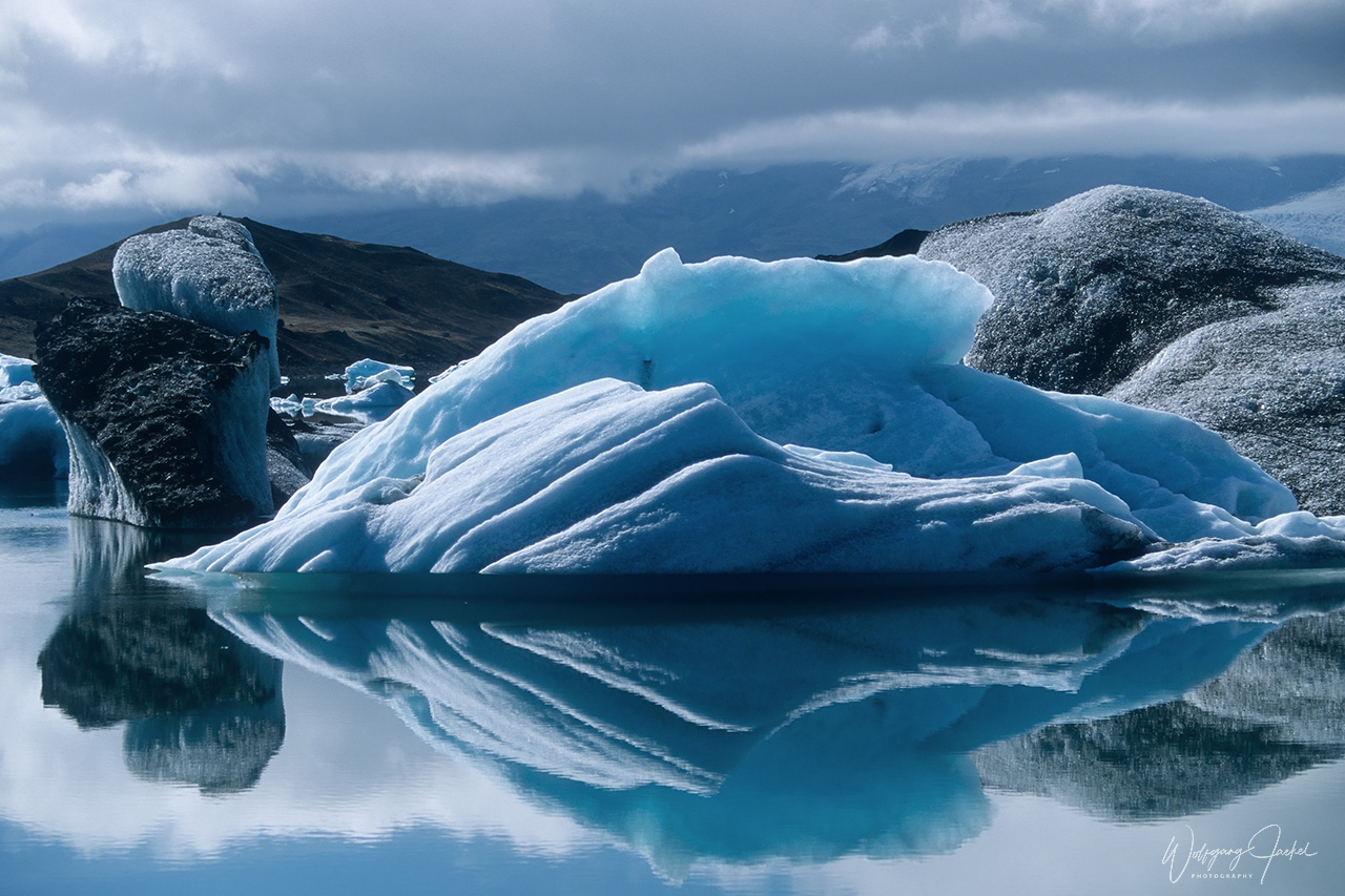
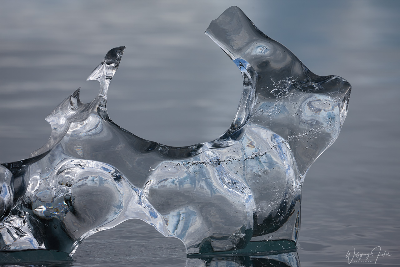
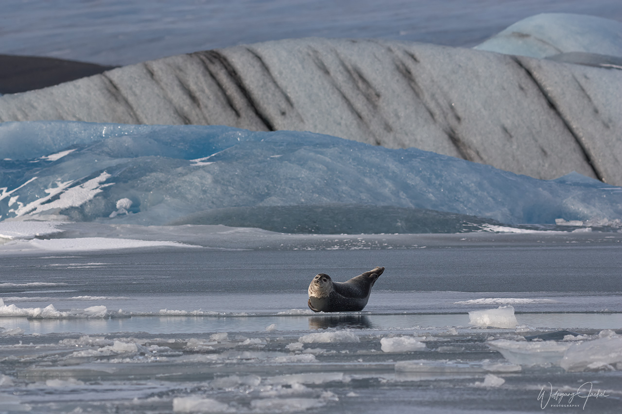
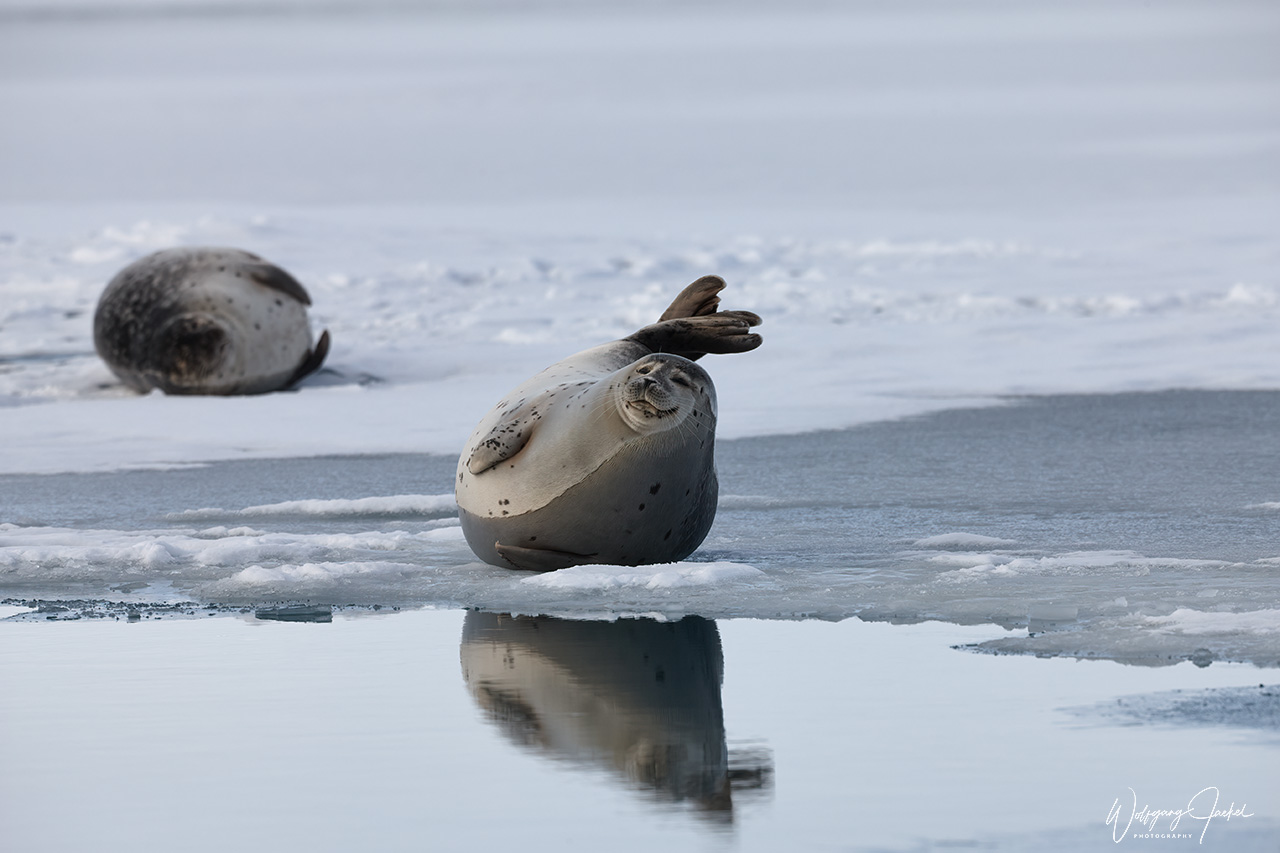
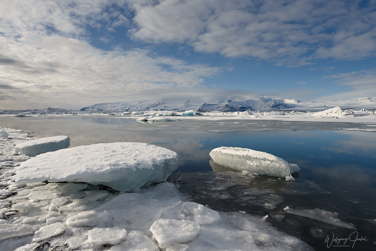
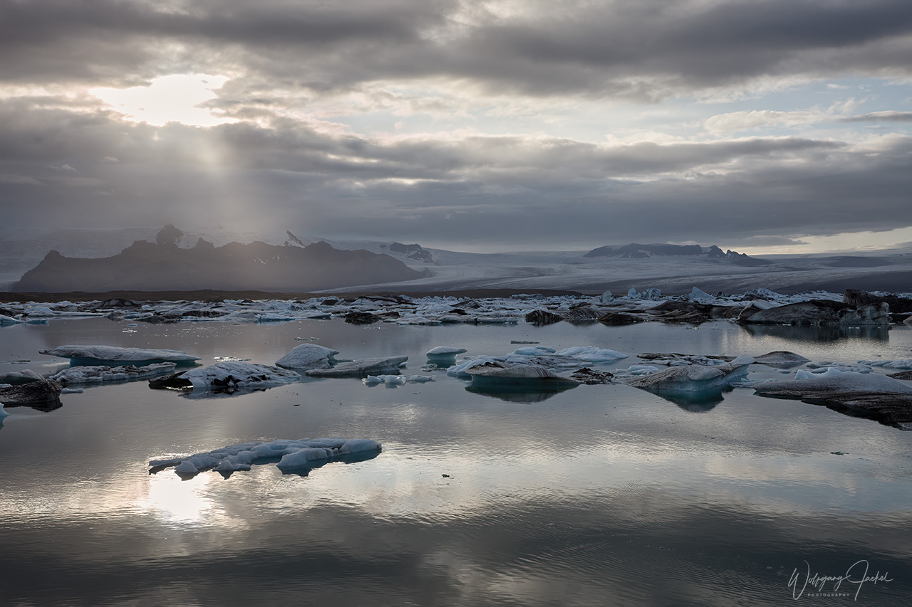
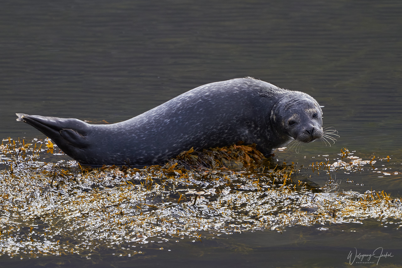
The main attraction and absolute highlight of the southeast coast, though, is the Jökulsárlón glacier lagoon, located around 58km east of the Skaftafell Visitor Center. The large blue lake is filled with gleaming icebergs of different shapes and sizes, which have broken off and drifted from the far off tongue of an outlet glacier of Vatnajökull. Some of the icebergs have black streaks of ash from eruptions centuries past. Especially in winter, we could watch groups of harbor seals resting on frozen parts of the lake. In recent years, Jökulsárlón has attracted lots of visitors including bus tourists from Rejkjavik, of course and there are boat tours offered on the glacier lake,too.
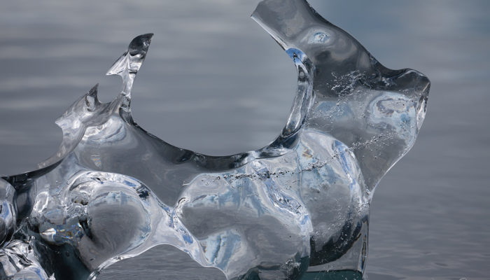
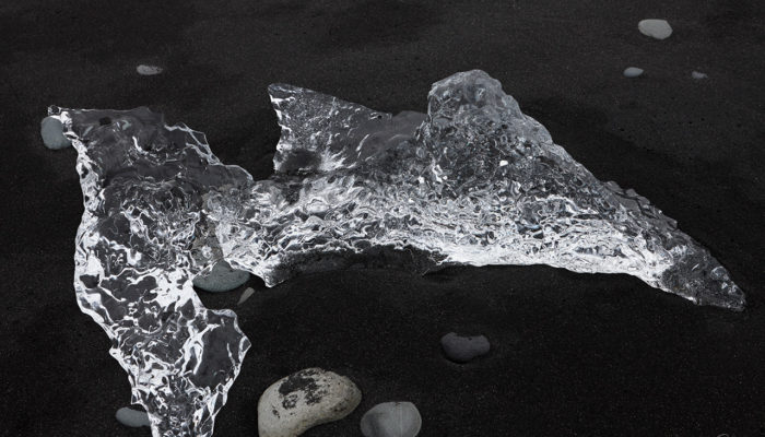
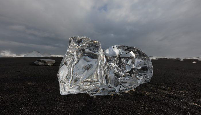
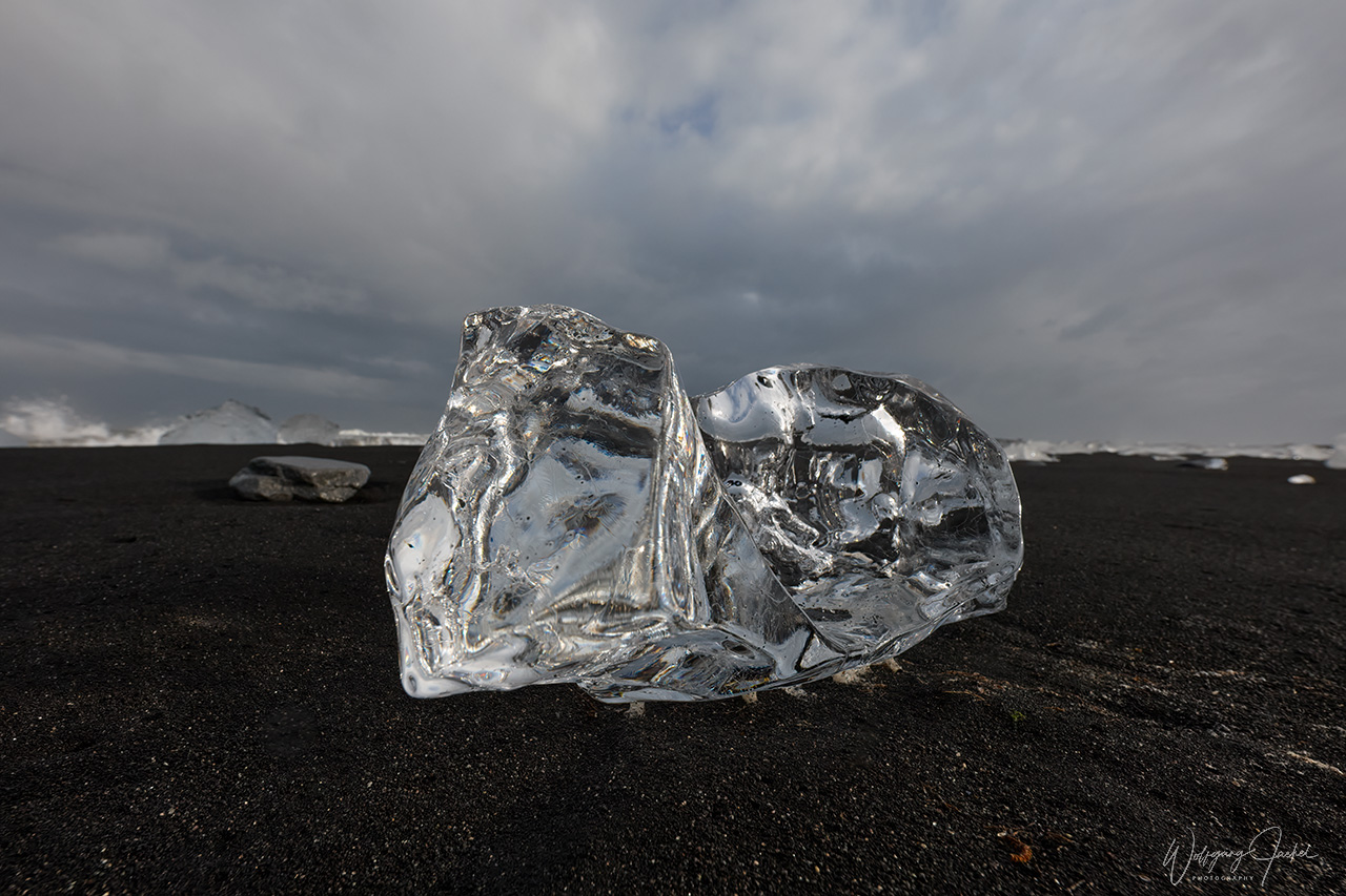
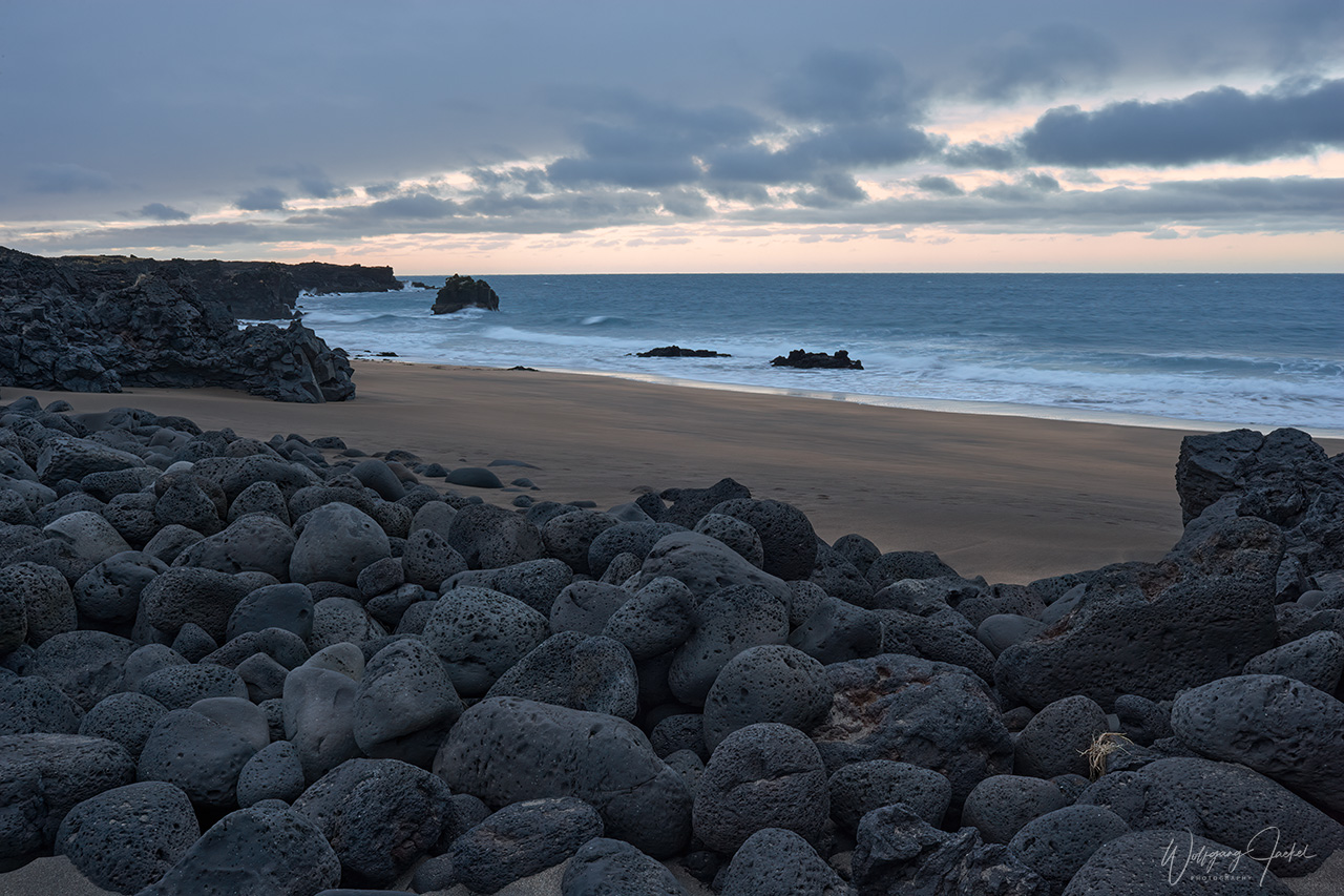
At the outflow of the lagoon towards the open sea, there’s a stretch of a black-sand-coastline called ‘the Diamond Beach’, as it is here that the floating icebergs are washed upon the shore.The contrast of their gleaming colors with the dark sands, the white surf and different lighting conditions make up for breathtaking images and compositions and has inspired many photographers, me included.
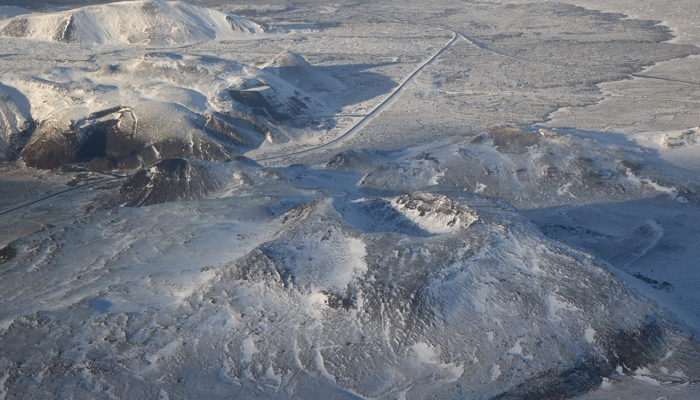
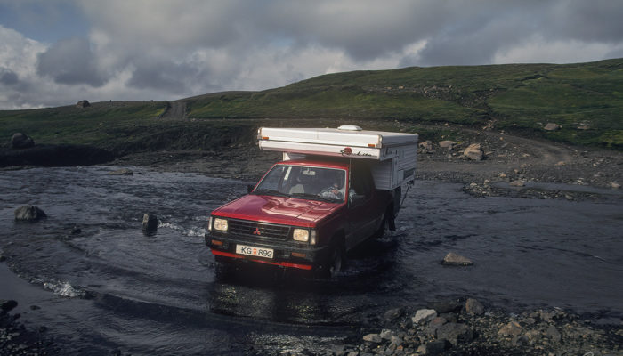
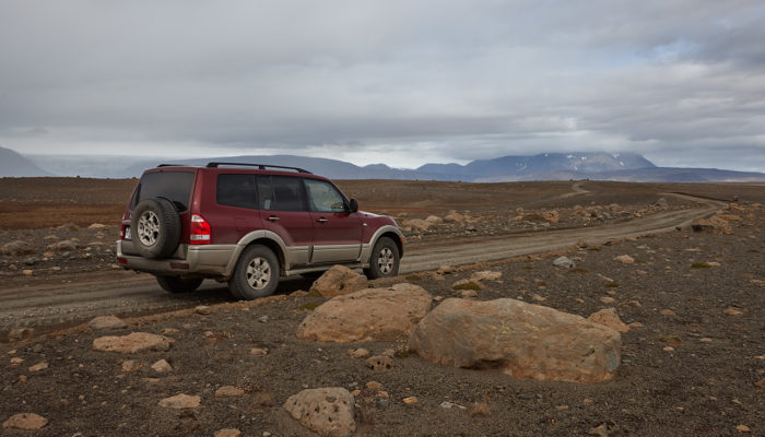
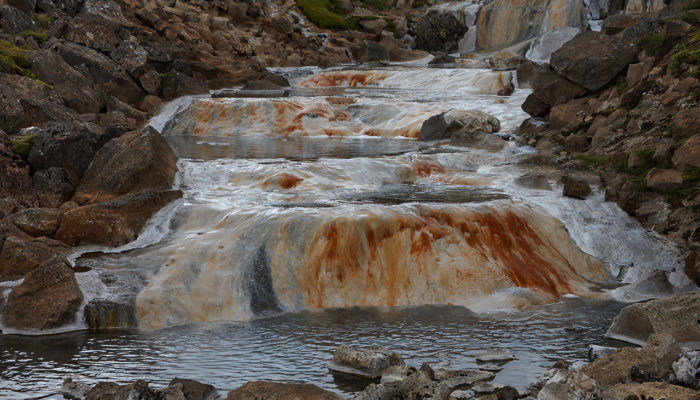
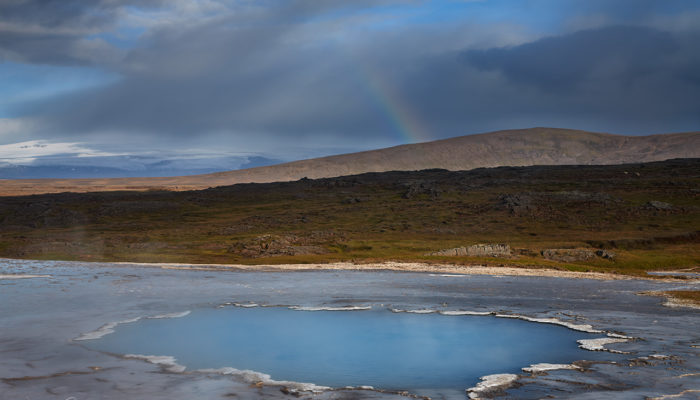
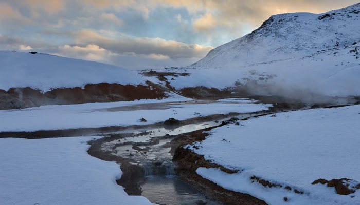
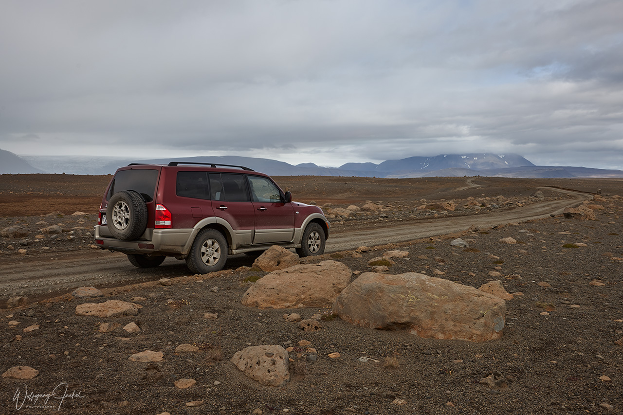
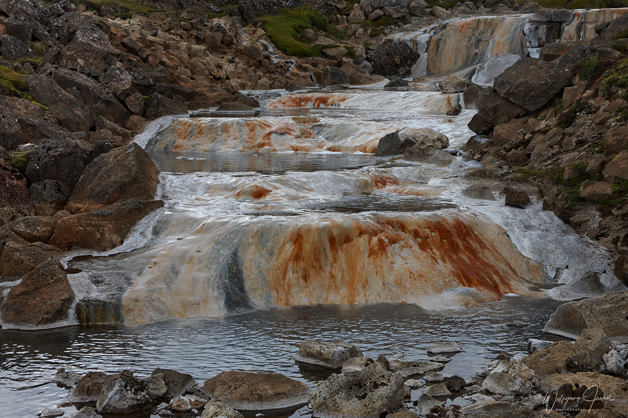
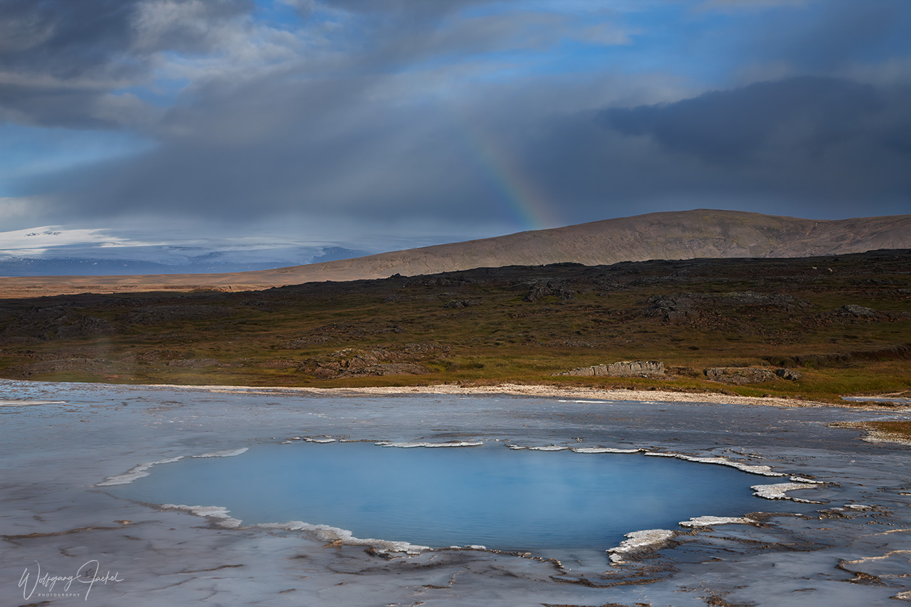
After our multiple visits to the lagoon over the years, we had not continued on the Ring Road to the northeast but returned to our accommodations in the southwest or near the Geyser area. Instead, we decided to cross the interior of the island to explore the north. We took the Kjolur (Kjölur) Route which is one of the 3 main highland routes in Iceland – and easiest of them to drive: Because there are no river crossings, it’s possible to drive the Kjolur Route with a normal car, road conditions and weather permitting. On both of our traverses we had opted for a 4×4 vehicle, though, which is the better choice for the 5 hours drive. Only open in summer, the 200km long highland gravel road traverses the remote, desert-like backcountry between the two icecaps Langjokull and Hofsjokull. It connects the south near Gullfoss to the ring road in the north of Iceland between Blönduós and Varmahlíð. Half way, on a short detour from the road is Hveravellir, one of Iceland’s most beautiful geothermal areas. It‘s a nature reserve and kind of an oasis in the vast wilderness of the central Highland with multi-colored boiling mud pools, puffing fumaroles and a geothermal river, in which one can bathe.
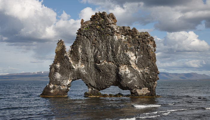
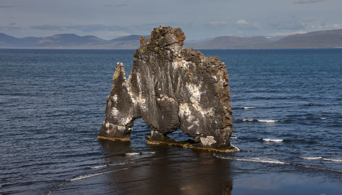
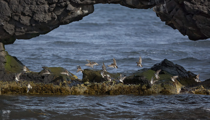
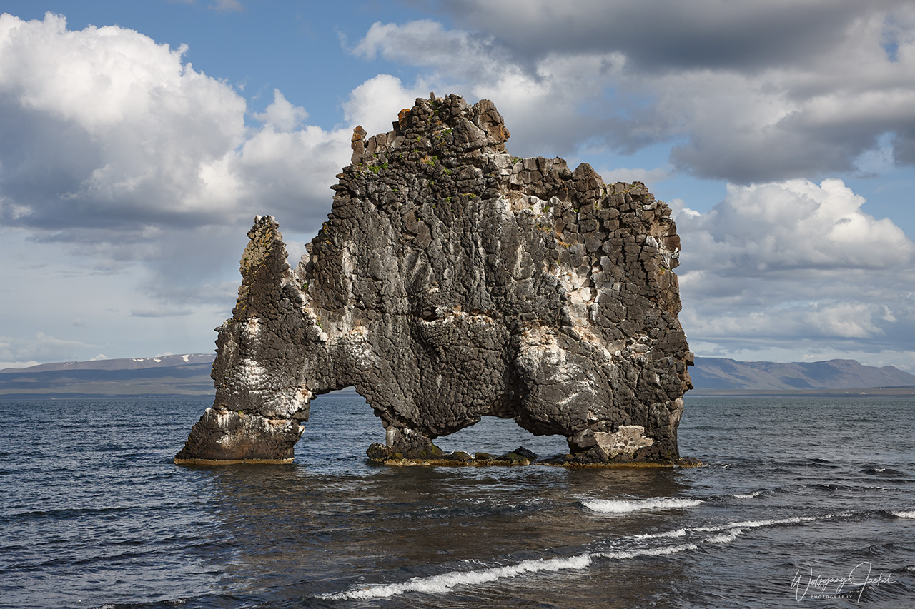
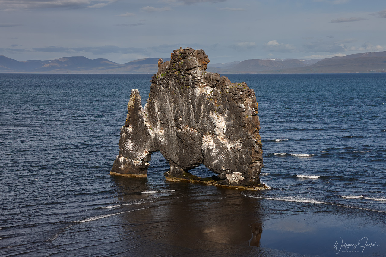
After one of the 2 crossings of the interior we turned west on the northern Ring Road towards the Vatnsnes Peninsula for photographing the scenic Hvítserkur basalt rock protruding from the flat waters at Húnaflói Bay also called the Troll of the North. Erosion from the cascading sea water has carved three large holes through the basalt rock, sculpting and shaping it into what appears as some petrified, mythological animal. The rock is also an important nesting site for seabirds. We were all alone at this beautiful sight that has become very popular over the years.since our visit. From Hverikur we followed the Ring Road to the west and back to the south again including several stops for photography.
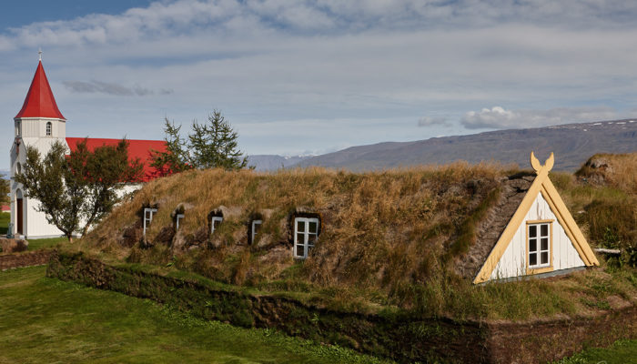
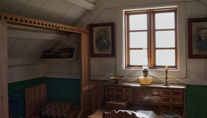
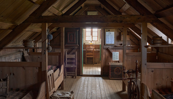
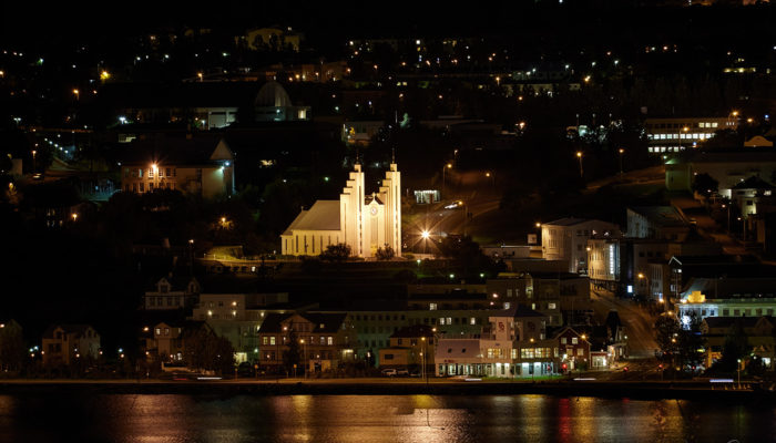
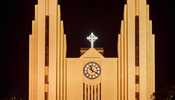
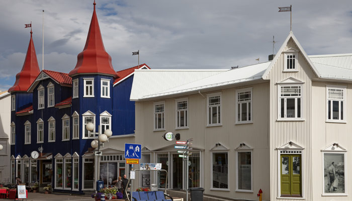
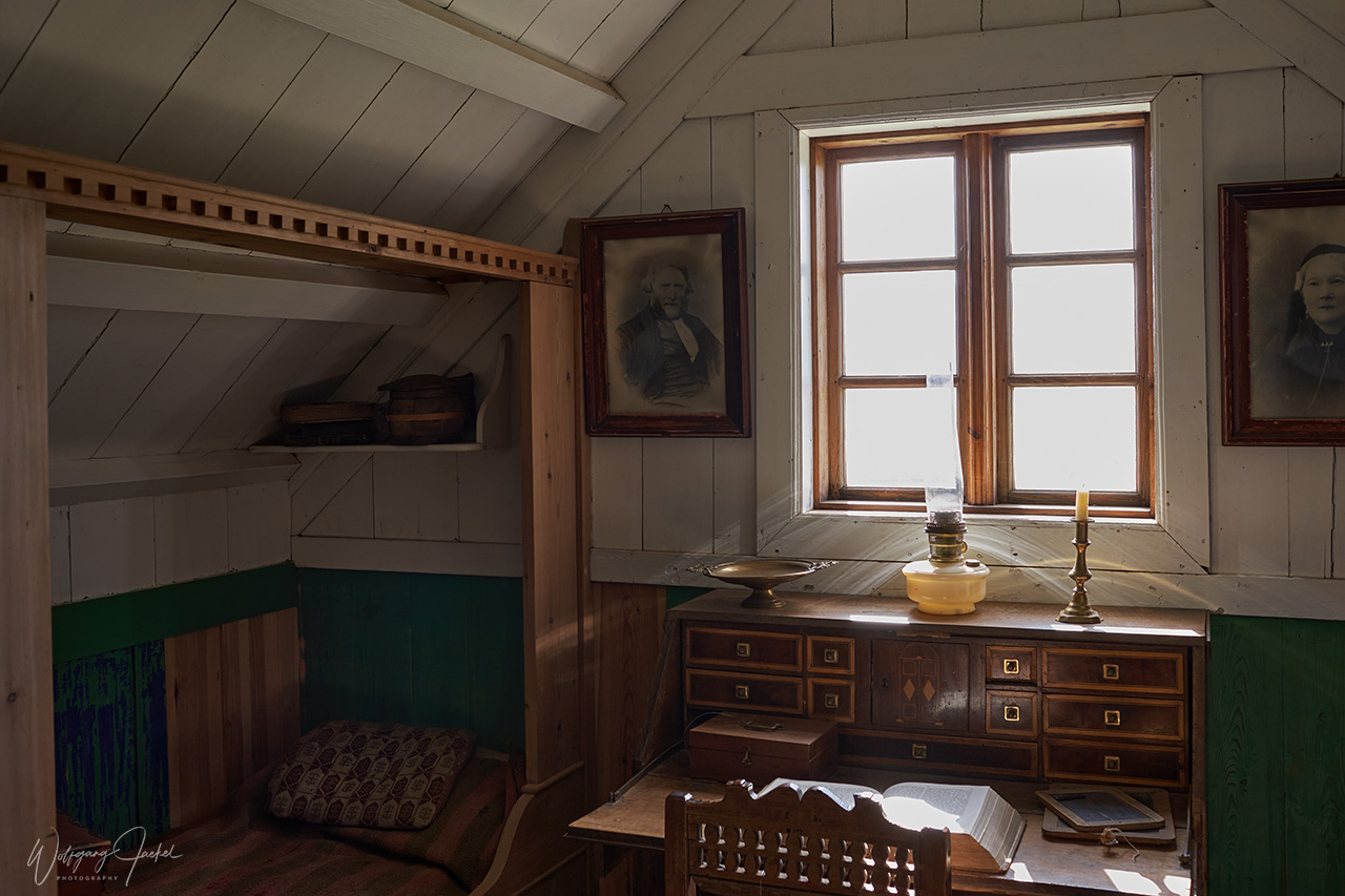
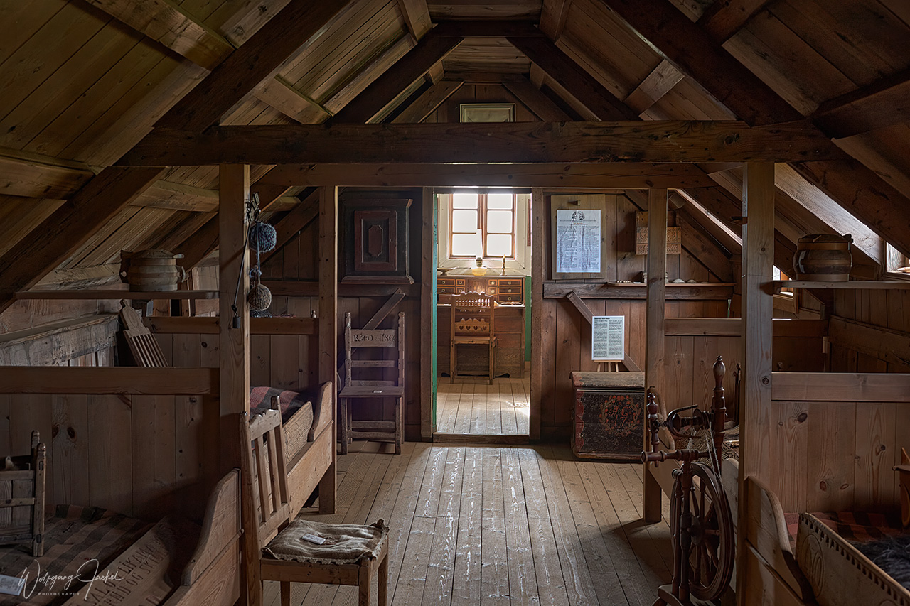
After the second traverse we turned east on the Ring Road and visited the historical Glaumbær Turf Houses north of Varmahlíð, which are part of an open air museum and give an impression how life in Iceland was back in the 18th and 19th century. People lived in Glaumbær turf houses until 1947. Further east fröm Varmahlíð along the Ring Road we reached Akureyri, the second largest city in Iceland nicknamed capitol of the North though less than 20000 people live there. Southeast and northeast of Akureyri, the most popular and known attractions of North Iceland are located in pretty close proximity to each other: They are part of the Diamond Circle, a famed 260 kilometers sightseeing route in the northeast of Iceland and is considered an analogue to the popular Golden Circle in the southwest.
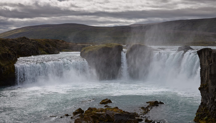
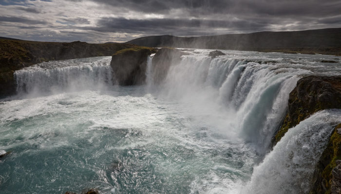
Around 35 km from Akureyri on R1, the Goðafoss waterfall is one of the most spectacular waterfalls in Iceland. It is 30 m wide and 9 -17 m high. The waters of the river originate in Vatnajökull glacier in the Highland. In contrary to the time I was there, myriads of tourists come here in summertime when the cruise ships dock in Akureyri:
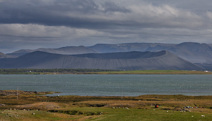
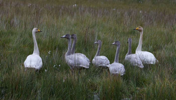
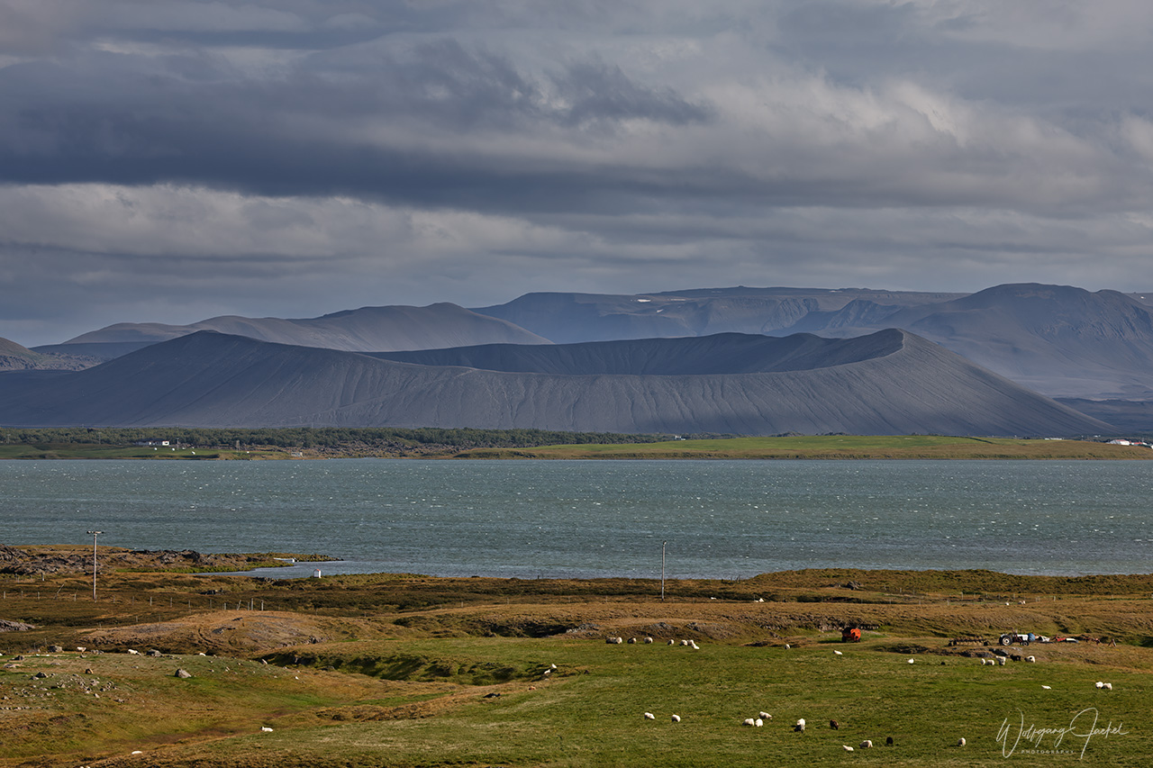
Another 45 km from Goðafoss on R1 (or 79 km from Akureyri) you approach Mývatn, a swallow lake that covers an area of 36,5 square kilometres and is world known for its rich flora and fauna. It’s a favorite location for birdwatchers in particular. The birdlife at Mývatn is characterized especially by ducks with 14 variations but in fact 58 species of birds frequent the area – migrants not included. Mývatn and Laxá River are on the UNESCO World Heritage Tentative List. The name Mývatn translates to “Midges Lake” and refers to its billions of midges in summer. Those are not mosquitos, though, so the translation “mosquito lake” isn’t correct. There are 2 species of midges, – non biting ones (Chironomids) and biting gnats (Simulium vittatum) – both tiring, though.
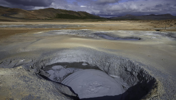
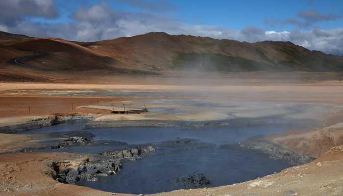
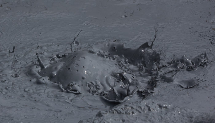
We also visited the impressive Námaskarð geothermal area, located nearby lake Mývatn about 5 km east of Reykjahlíð, with its numerous powerful hot springs, fumaroles, clay pots, rhyolite rocks and hillsides in pink, bright yellow, gray-blue and green scattering the surreal landscape in a kaleidoscope of colors.The constant emission of volcanic fumes has made the ground extremely sterile and acidic, thus impossible for any plant growth.
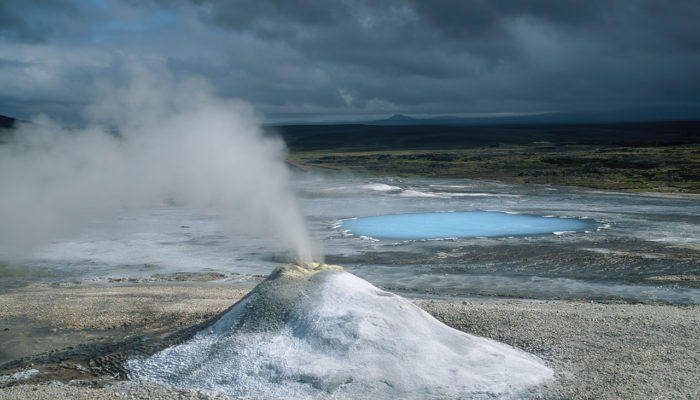
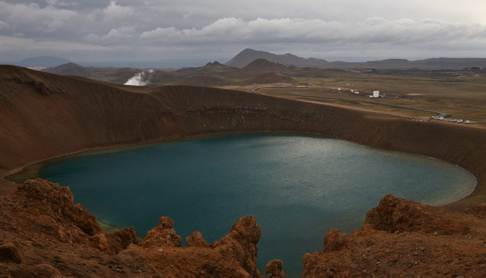
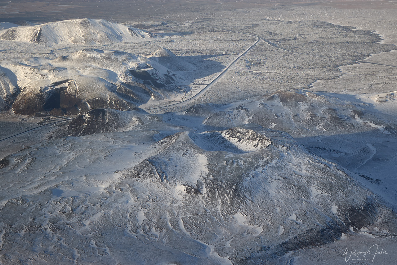
Another attraction, located a short distance north of Námaskarð is the Viti (“Hell”) Crater in Krafla volcano, approximately 300m in diameter.The crater which is accessible by a short hike to the top and a rim walk contains cold water in stunning blue or turquoise color and was formed during a 5-year long explosive eruption of the Krafla volcano system beginning with the Mývatn Fires in 1724. Krafla is one of the notorious and explosive volcanoes in Iceland. It is considered being unpredictable and dangerous.There have been 29 eruptions in Krafla recorded in history with the last one ending in 1984, after 9 eruptions ongoing since 1975. Krafla’s caldera is about 10 km wide with a 90 km long fissure zone, situated on the Iceland hotspot atop the Mid-Atlantic Ridge.The Viti crater is located in that fissure zone. Nearby the Viti crater there’s a large power station to utilize Krafla’s geothermal potential and provide the north with green energy.
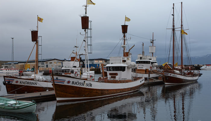
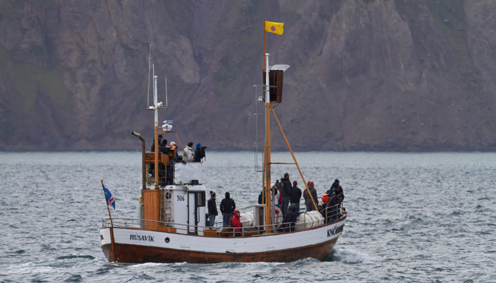
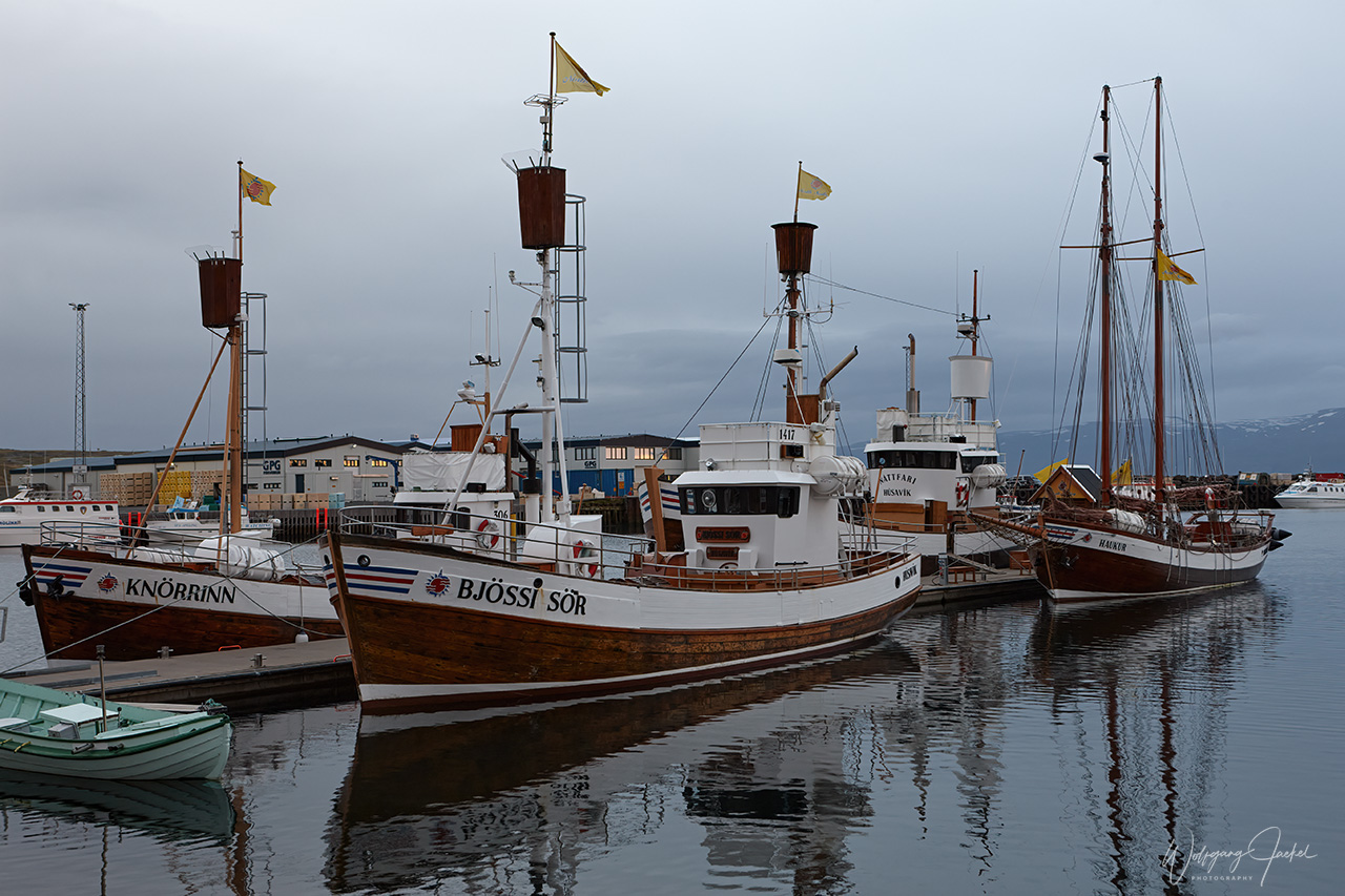
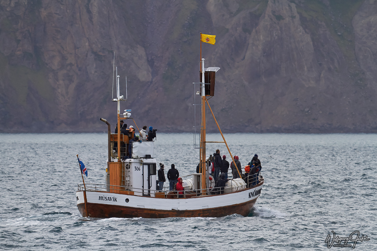
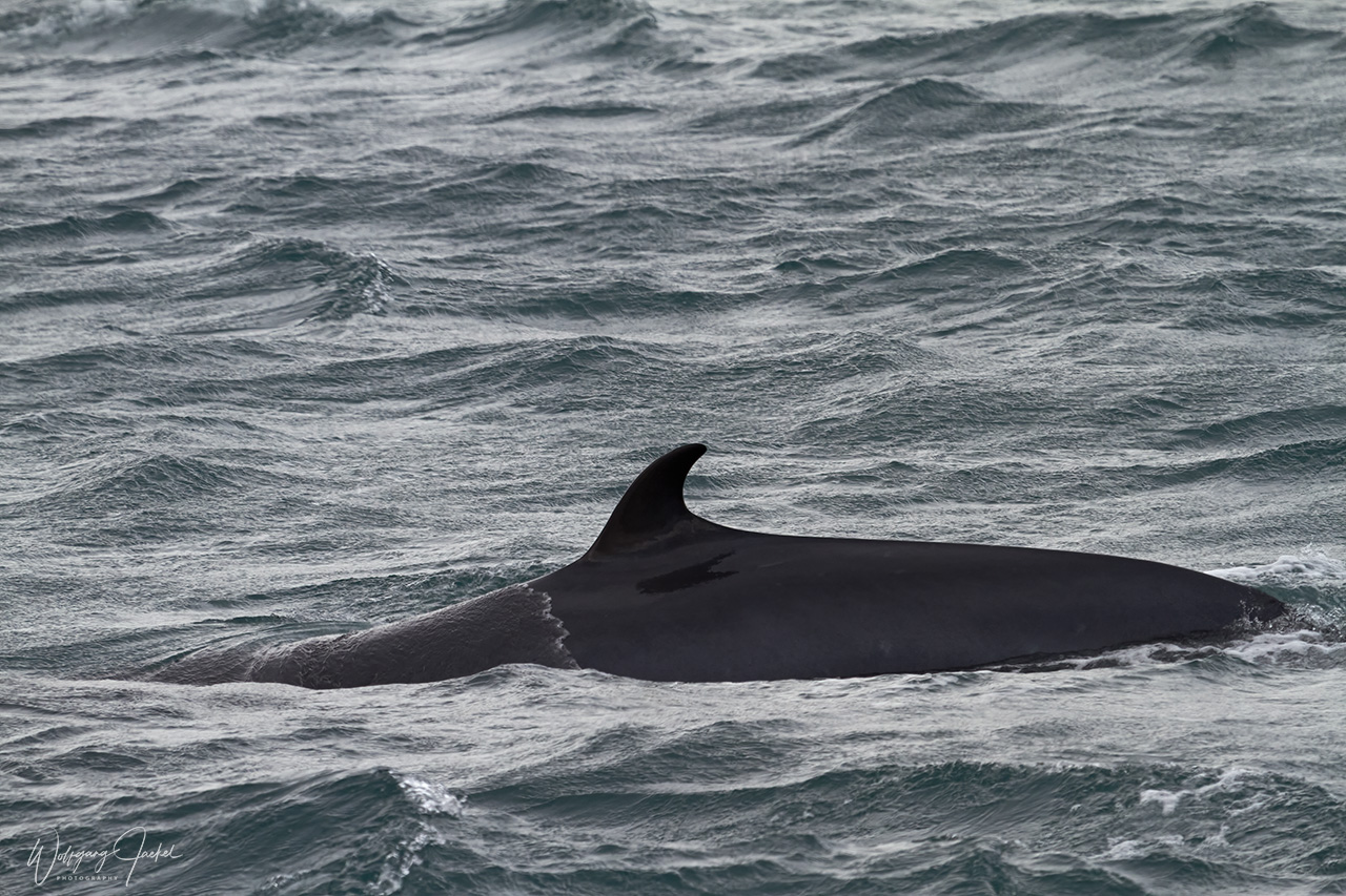
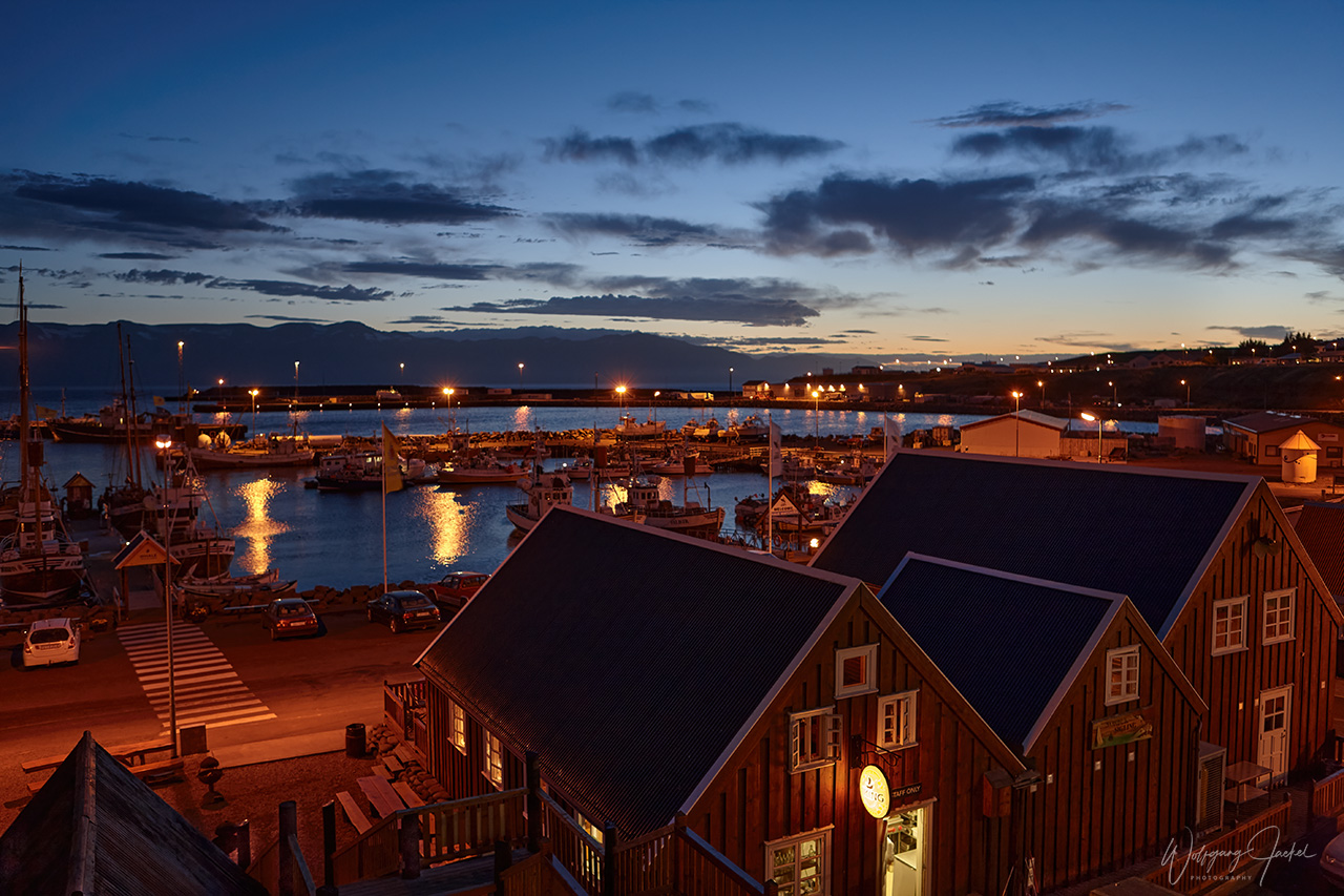
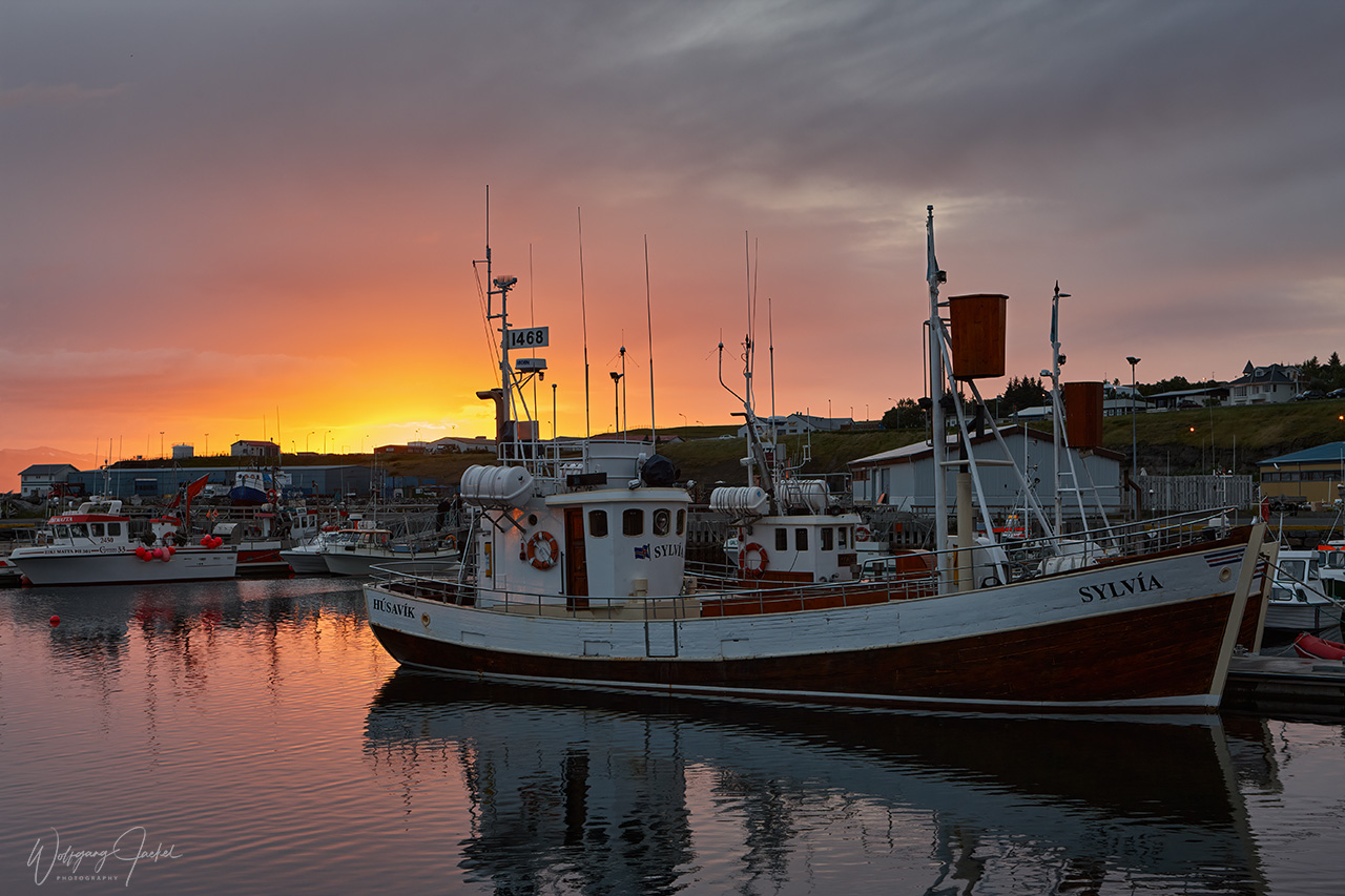
Around 56 km from the Mývatn area (76 km from Akureyri) the picturesque and colorful little coastal town of Húsavík has become a major tourist destination because it is considered to be one of the best places in Europe for whale watching in summer.Tour operators boast with 100% sighting rates.There are several species of whales around with the Humpback Whales being the most frequent. Since we have seen them pretty often on other trips around the world, we had joined a whale watching tour from Husavik just one time in late August. We didn’t see Humpbacks but only Minky whales.
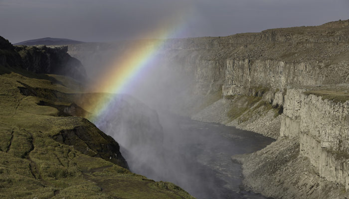
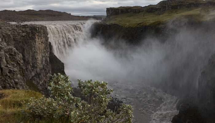
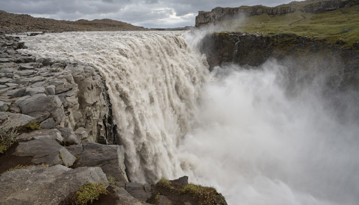
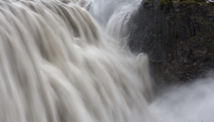
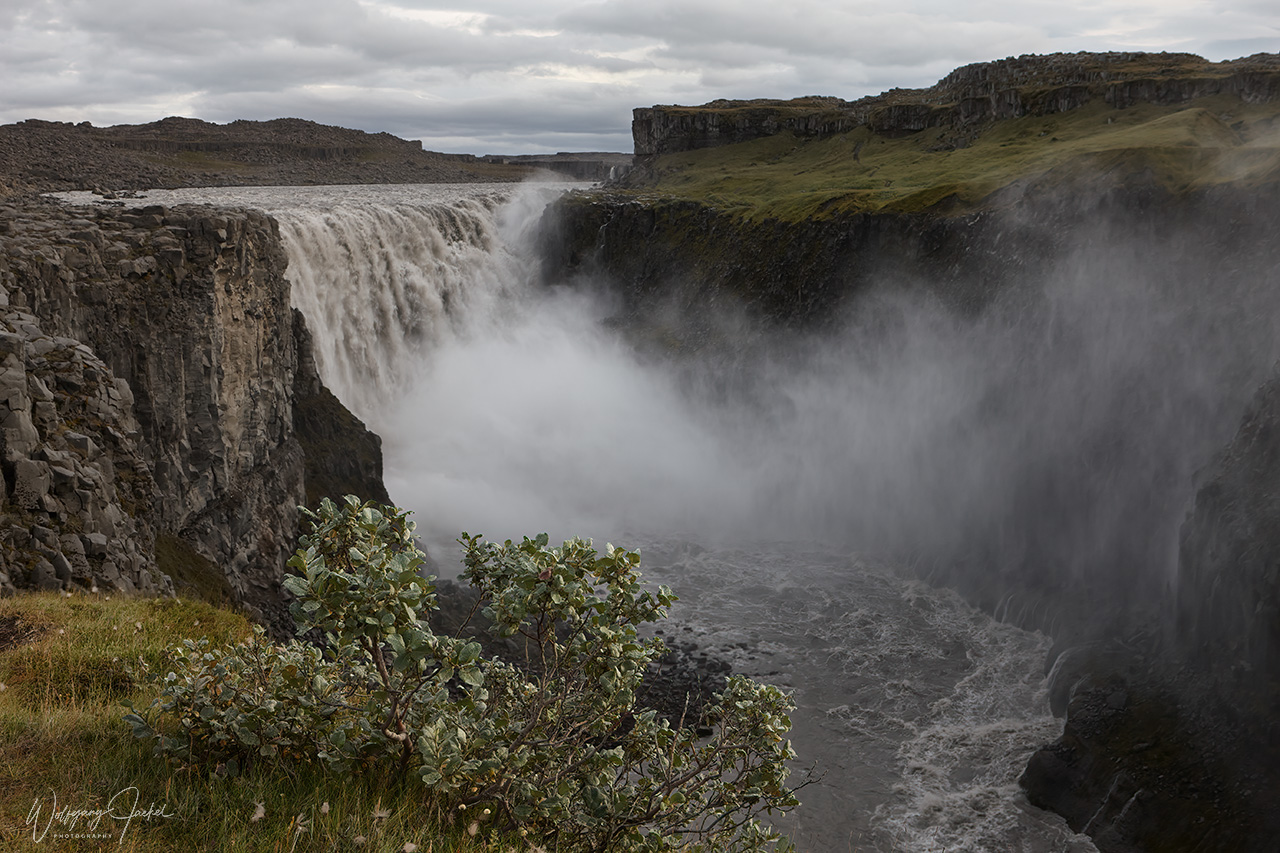
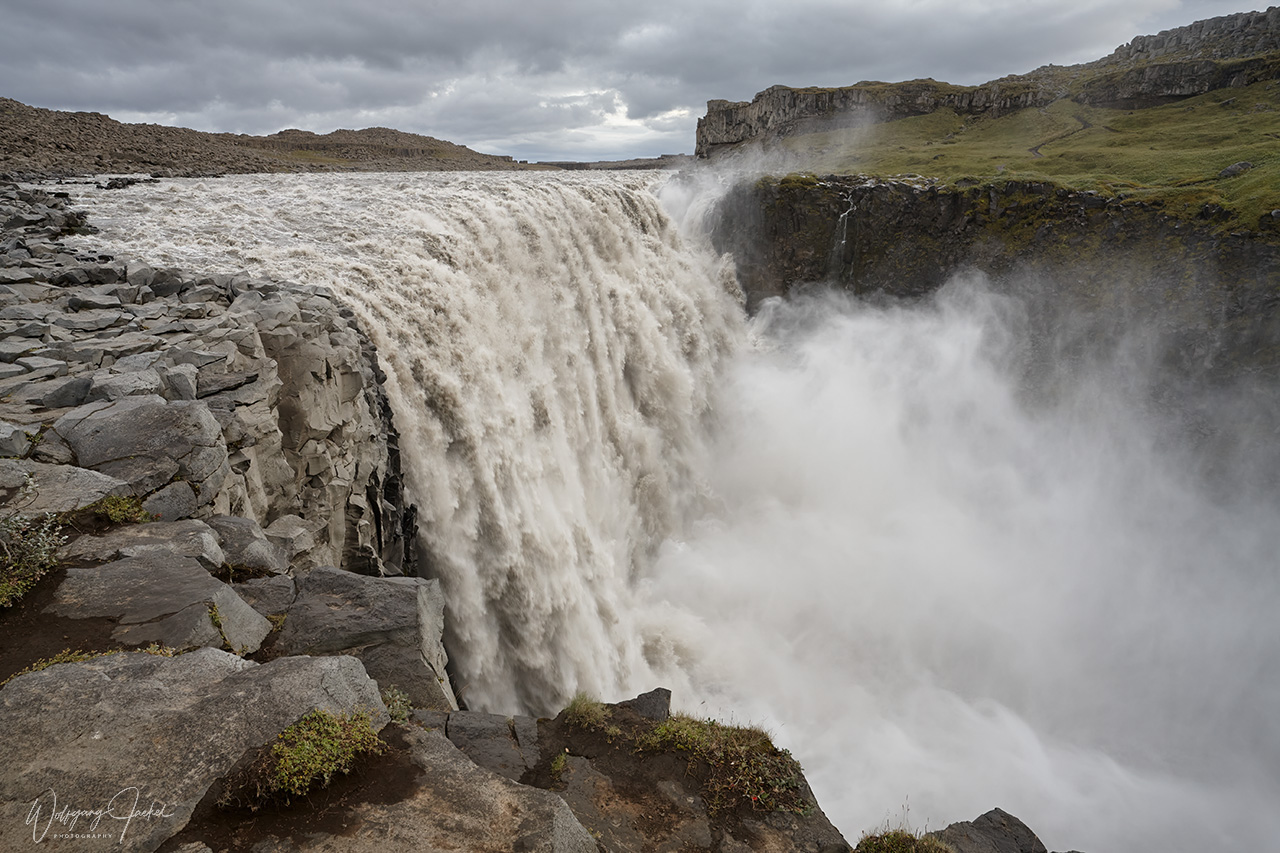
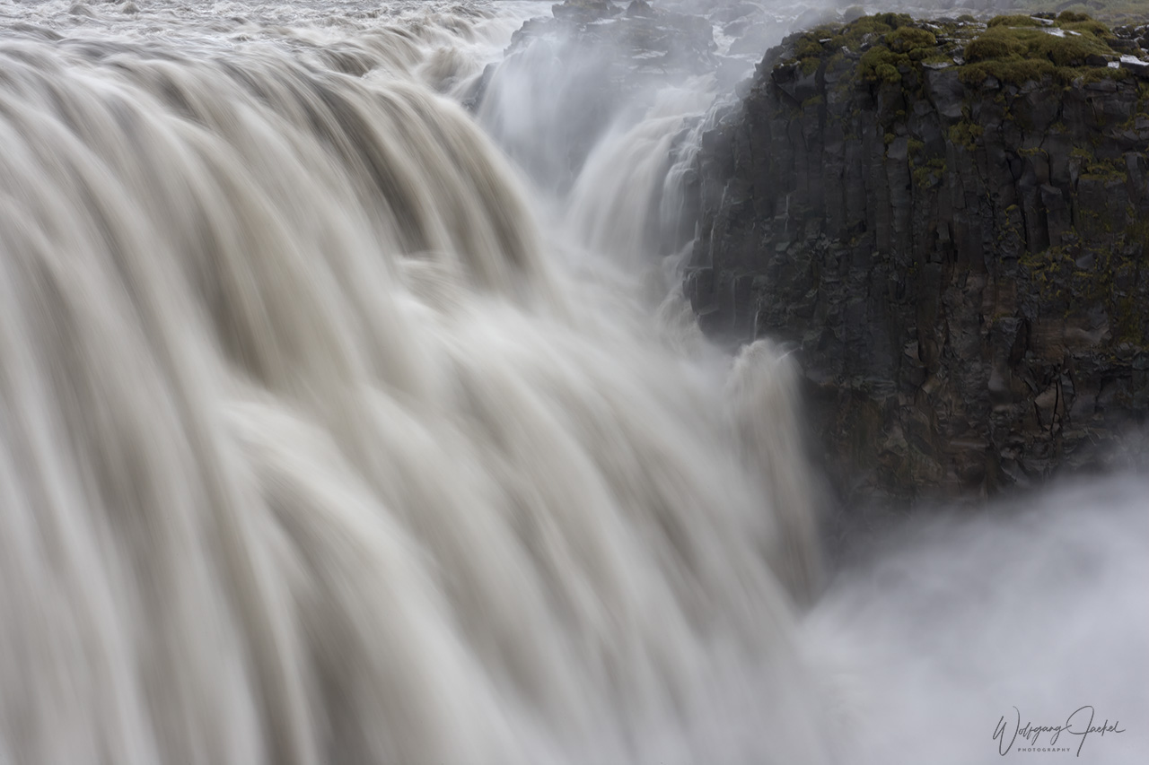
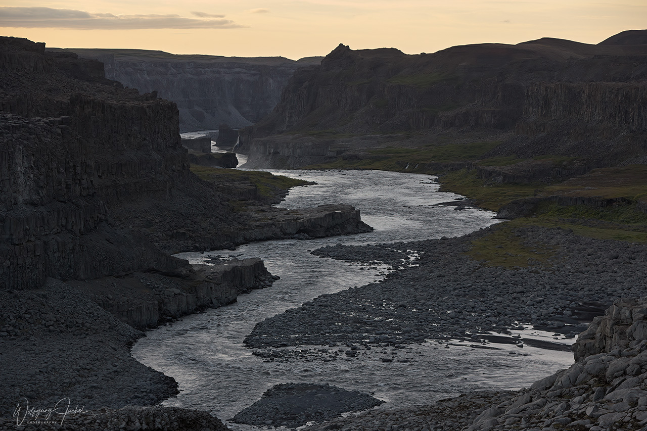
89 km southeast from Húsavík and 150 km east of Akureyri directly via R1 (or 78 km from Lake Mývatn), the epic 100m wide Dettifoss is a famous attraction and part of the Diamond Circle in the North. It is one of three waterfalls in the Selfoss/Jökulsá a Fjöllum River and considered the most powerful waterfall in Europe though some sources rate it second behind the Rhine Falls. Dettifoss has a height of 44m with an average water flow of 193 cubic metres per second making is also the largest European waterfall. We had visited this impressive and photogenic cascade from both sides of the river requiring an 1hour drive to get around.
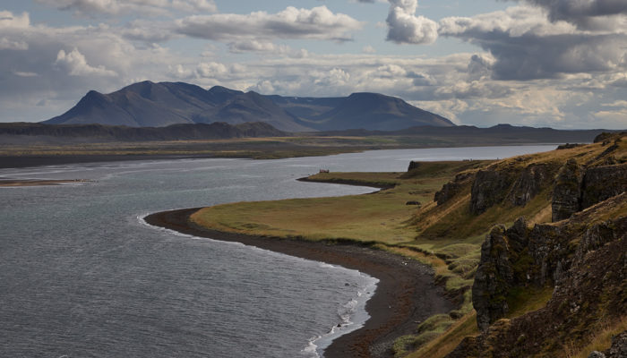
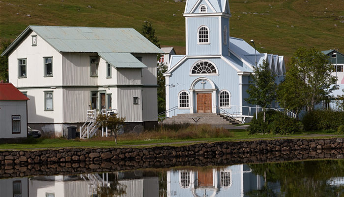
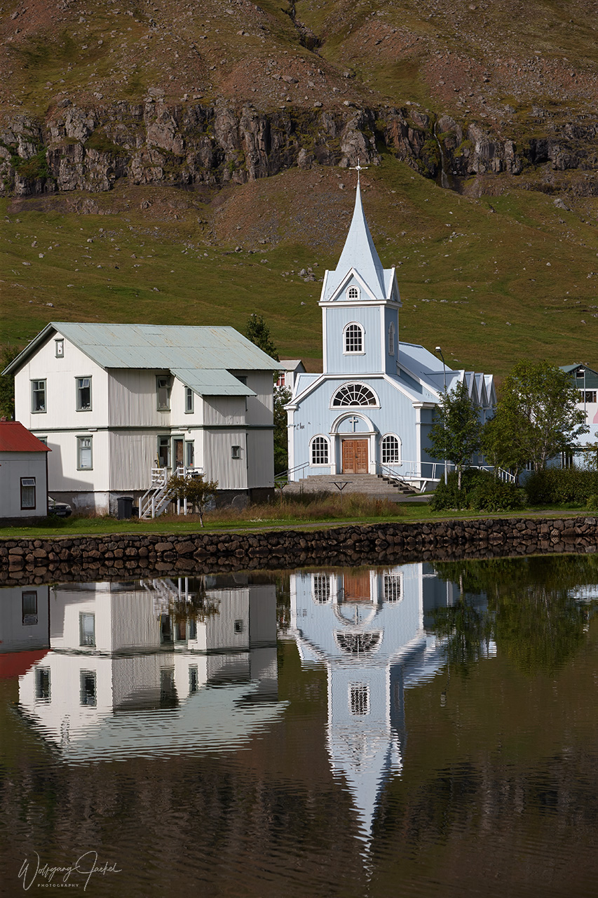
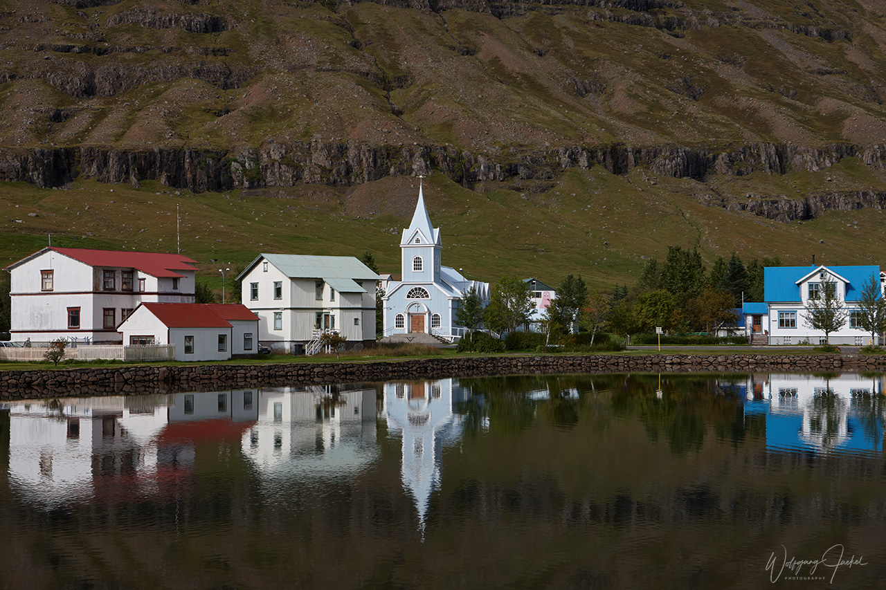
After our visit of the Dettifoss area we followed the Ring Road southeast for 186 km via the mountainous pass near Egilsstadir to Seyðisfjörður in East Iceland.The picturesque little town with 700 inhabitants is located inside of a fjord of the same name and is surrounded by high snow-capped mountains. The scenic place feels quite remote the more as the turnoff of R1 ends here.However, here’s also the terminal for car ferries, operating once a week from/to Hirtshals or Hanstholm in Denmark and the Faroer Islands in particular.
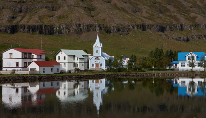
On the next day we continued the route southbound along the East Fjords with a short sidetrip to the small coastal town of Djúpivogur. Further on this roundtrip the weather in the east wasn’t cooperative, so we drove on the Ring road straight back to the southwest.
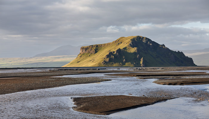
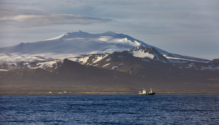
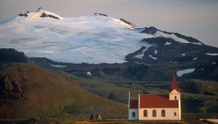
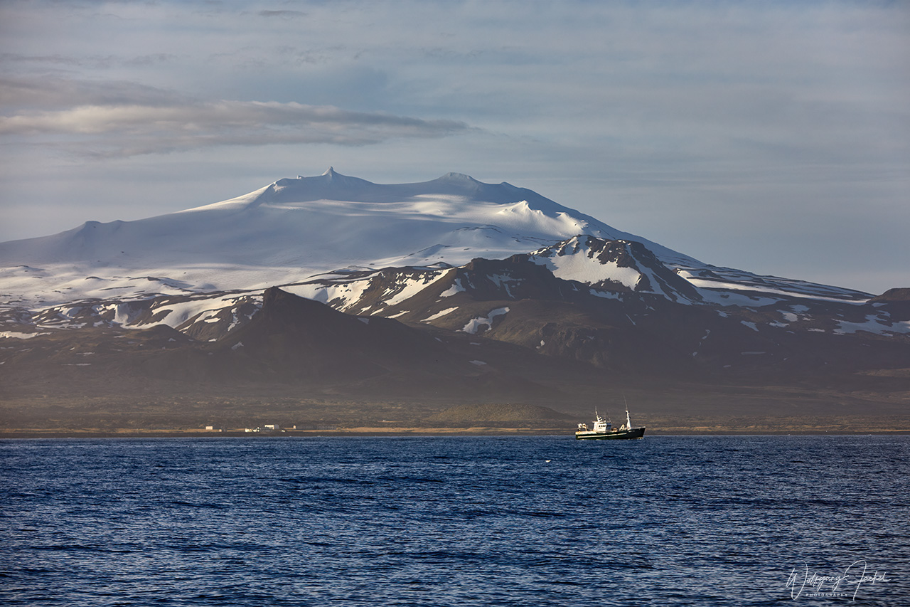
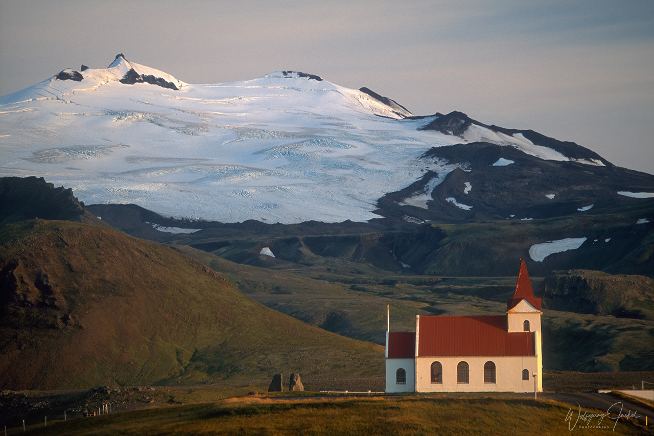
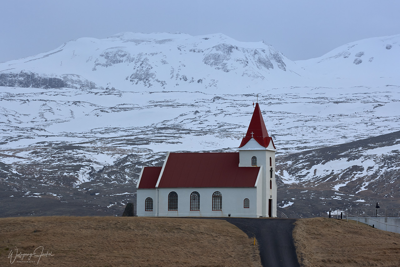
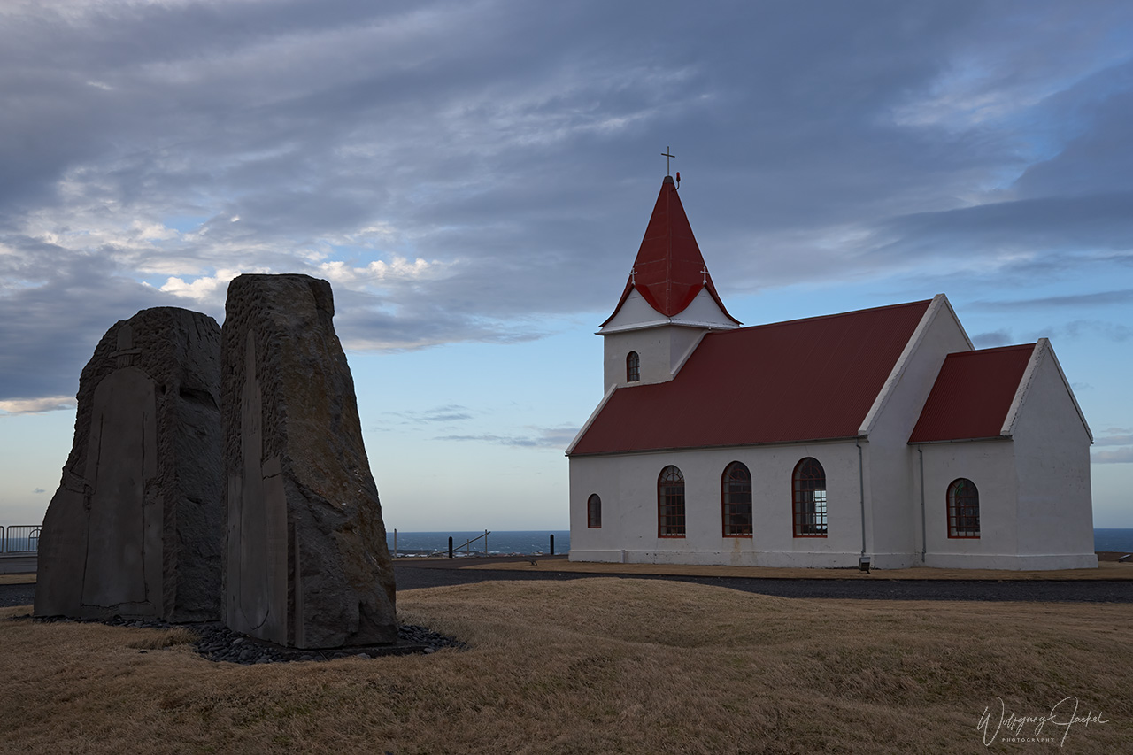
During 3 of our stays on Iceland, we had also visited the 100 km long Snæfellsnes Peninsula which is located north of Reykjavik and dominated by the (yet) glacier- capped stratovolcano Snæfellsjökull (1445m) in the most western part.The previously majestic glacier that was made famous by Jules Vernes’ fictional entrance to the center of the earth, measured 22,7 sq.km back in 1890 but had almost halved in size in 2000 when we first had visited the peninsula In the summer of 2012 the summit was ice-free for the first time in recorded history. Sadly, the magical glacier is shrinking faster than predicted and is expected to disappear entirely by the end of the century. The Snæfellsjökull volcano /glacier is surrounded by one of the 3 Nationalparks in Iceland with an area of 170 sq.km. The peninsula often is considered a compressed version of Iceland’s dramatic landscapes and natural wonders, nicknamed “Iceland in Miniature”. In fact, it’s packed with waterfalls, lava fields, craters, fjords, white and black beaches along the coastline, rugged rocks and cliffs, small villages and towns – in addition to the volcano and glacier. We couldn’t visit all of the sights, though, because we just did day tours from our accommodations in the south and the distance to get all around the peninsula is about 165 km.
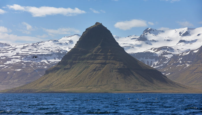
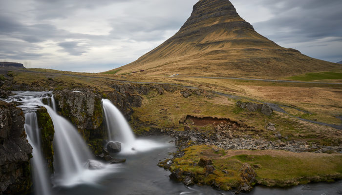
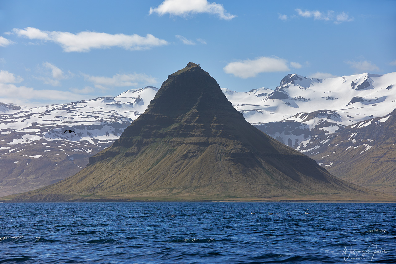
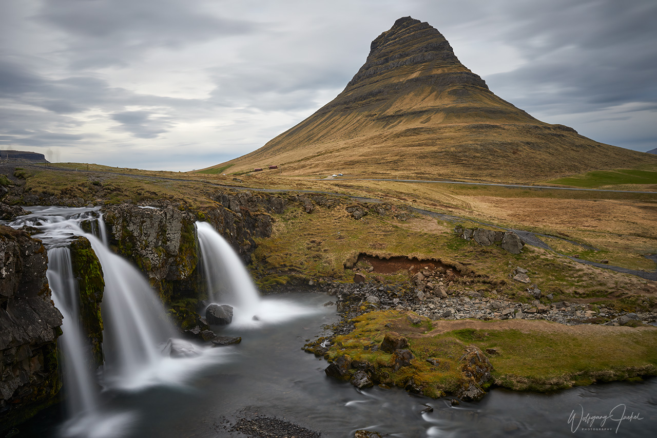
One of the most famous spots in Iceland is Kirkjufell (463m) and Kirkjufellsfoss, located nearby Grundarfjörður in the middle of the northern coast of the peninsula.The Kirkjufell mountain the “Games of Thrones” TV series was referred to is spectacular by itself. But the composition with the waterfall Kirkjufellsfoss has inspired thousands of photographers and is probably one of the most known motifs of Iceland..
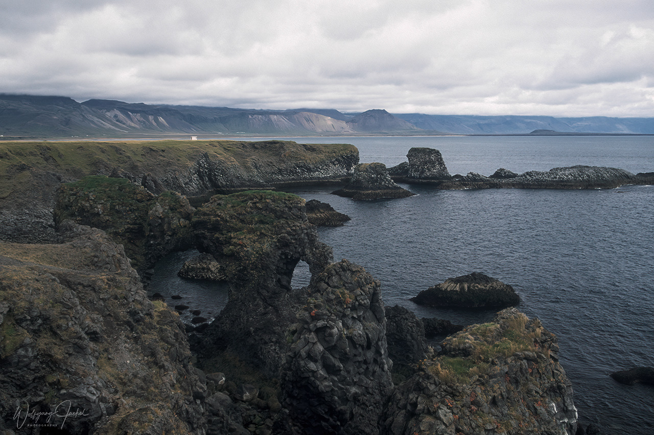
We also made a short photo stop at the small maritime museum in Hellisandur, one of the oldest fishing villages in Iceland which is located on the north western tip of the Snæfellsnes peninsula. Only 3 km away, close to the village Rif, the remote Ingjaldscholskirkja church makes up for a beautiful postcard motif against the backdrop of the snow-capped Snaefellsnesjökull. A few kilometers south on the road, we visited the nice Skarðsvík Beach with large black lava balls that stood out against the golden sand.The beach is framed by huge basaltic rock formations from eroded lava. While this place is among the less crowded spots in Iceland, Djúpalónssandur (Black Lava Pearl Beach) further to the southwest is a major attraction. We didn’t visit that place, though.The rugged south coast of the peninsula near Arnastapi offers a stunning view of (and through) the Gatklettur Arch Rock featuring a stone bridge over a circular opening created by the sea.
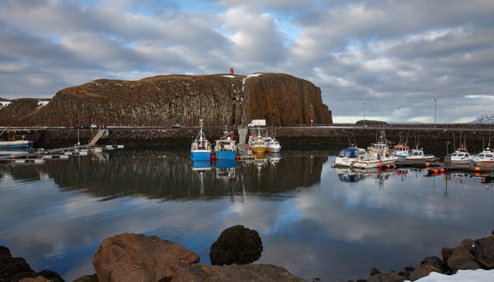
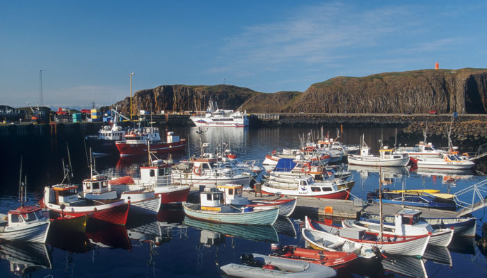
Stykkishólmur on the north coast is the largest town on the Snæfellsnes peninsula. It’s a fishing town of about 1100 people built around a picturesque natural harbor surrounded by basalt formations from which you can see Westfjords. It is also the gateway to Flatey. On our first trip in 2000 we had planned to take the ferry that operates from Stykkishólmur across the Breiðafjörður fjord to the Westfjords. Unfortunately the passage was cancelled due to technical problems. Therefore, we had to skip the visit of that part of Iceland which still is on the schedule for a future trip.
Concluding remarks:
Without doubt Iceland is an amazing place to visit and in some regard photographer’s paradise because of the uniqueness and diversity of landscapes, their forms, shapes and colors combined with the ever changing light and weather. It is a country of extremes, contrasts and spectacular phenomena.
All of our 7 trips and stop overs between 2000 and 2017 were fascinating and gave the opportunity to enshrine wonderful memories of the country’s beauty in the images.
However, as mentioned before, a lot has changed over time. The situation and experience at the locations had been very different one or two decades ago when many of my images were taken.That makes those captures and related memories very precious and special for me. In the last few years the tourist boom has become a major problem, not only frustrating for serious photographers and visitors looking for pure nature and coming all that way to admire it but also affecting the fragile environment and contributing to its ecological damage. In 2010, there were about 460,000 international tourists in Iceland; by 2018, that number had increased to 2.3 million. This trend surely has been accelerated by the masses invading the small country from numerous cruise ships anchoring at Iceland nowadays and by the flood of inspiring images, selfies and blogs in social media, too. As for photography, it’s also part of the truth, though, that a continuous stream of amateur and professional photographers has been coming to Iceland in the last few years and the number of workshops and photo tours has rapidly increased. So by no means you can argue that Iceland is undiscovered by photographers. To the contrary, at least all the famous attractions meanwhile are documented in countless publications and images from whatever perspective.
On the other hand, the multiple existence of similar or even identical photographs and perspectives hasn’t changed the beauty and fascination of the sights for me and neither the continuing wish to capture the natural wonders by myself. Especially in the interior, Iceland still has many places off the beaten tourist track that are worth to explore. I also haven’t been in the Westfjords yet.
So Iceland has been and will remain one of my favorite places to visit and I definitely will return, but maybe pass by the overcrowded main points now.
Information for Photographers:
Over the years different cameras and lenses were used. Prior to the switch to digital Photography in 2003/04 and thus for the first trip in 2000, the Canon EOS 1V/EOS-3 cameras were my main camera bodies. I used the Canon EF 28-80mm L USM/f2.8-4.0 and 80-200mm L/f 2.8mm lenses for most motifs by mainly shooting Fuji Velvia 50 and Kodachrome 64 film for archival purposes. Occasionally, I tried Fuji Provia 100 F/400F and Kodak Eite EBX 100 film, too. For scanning and post processing the slides, please refer to the informations provided in the description of the trip to the Seychelles.
On later trips, most photographs were captured with the EOS 1Ds II/III and EOS 1-D-Mark IV cameras with the Canon 24-70mm L USM /f.8, Canon 24-105mm L IS USM/f 4.0, 16-35mm L USM/f 2.8 and 70-200mm L IS USM/f 2.8 zoom lenses. On the last trip in 2017, the Canon EOS 7D Mark II with the 100-400mm L IS USM/f 4.0-5.6 was used, too – preferably for shooting birds. As usual, I always shoot Raw, with the files postprocessed with CaptureOne and tweaked with Photoshop CS6 , NiK and Topaz Plugins if necessary.


